
Dar es Salaam is the largest city and financial hub of Tanzania. It is also the capital of the Dar es Salaam Region. With a population of over eight million people, Dar es Salaam is the largest city in East Africa and the sixth-largest in Africa. Located on the Swahili coast, Dar es Salaam is an important economic center and one of the fastest-growing cities in the world.

Dar es Salaam Region is one of Tanzania's 31 administrative regions and is located in the east coast of the country. The region covers an area of 1,393 km2 (538 sq mi). The region is comparable in size to the combined land and water areas of the nation state of Mauritius Dar es Salaam Region is bordered to the east by Indian Ocean and it is entirely surrounded by Pwani Region. The Pwani districts that border Dar es Salaam region are Bagamoyo District to the north, Kibaha Urban District to the west, Kisarawe District to the south west and Mkuranga District to the south of the region. The region's seat (capital) is located inside the ward of Ilala. The region is named after the city of Dar es Salaam itself. The region is home to Tanzania's major finance, administration and industries, thus the making it the country's richest region. The region also has the second highest Human Development Index in the country after Mjini Magharibi. According to the 2022 census, the region has a total population of 5,383,728 and national census of 2012 had 4,364,541. The region has the highest population in Tanzania followed by Mwanza Region.

Temeke District, officially the Temeke Municipal Council is one of five districts of the Dar es Salaam Region of Tanzania. Temeke is bordered to the south by the Mkuranga District of the Pwani Region, to the north by the Indian Ocean, and to the northwest by the Ilala District. Temeke's eastern boundary is shared by Kigamboni District. The district covers an area of 150.4 km2 (58.1 sq mi). The district is comparable in size to the land area of Cook Islands. The administrative seat is Miburani. The district is home to the University of Dar es Salaam's School of Education, the National Stadium, the largest stadium in the country, Port of Dar es Salaam the largest port in the country, and The Chamazi Stadium the largest privately owned stadium. The 2012 National Tanzania Census states the population of the district as 1,205,949.

Ilala District, officially the Ilala Municipal Council is one of five districts of the Dar es Salaam Region of Tanzania. The district is bordered to the north and northeast by Kinondoni District and Ubungo District, to the east by the Zanzibar Channel, the west by Pwani Region, and to the south by the Temeke District. It covers an area of 364.9 km2 (140.9 sq mi). The district is comparable in size to the land area of U.S Virgin Islands. The administrative seat is Mchafukoge. The 2012 National Tanzania Census states the population for Ilala as 1,220,611.

Kivukoni is an administrative ward of the Ilala Municipical Council of the Dar es Salaam Region in Tanzania. Kivikoni's name come from the Swahili word meaning "a crossing place". The ward is bordered by Upanga East ward to the west, Kisutu ward to the southwest, and Kigamboni ward across the Kivukoni channel. The ward covers an area of 2.387 km2 (0.922 sq mi). Kivukoni ward is one of the most important wards in the country, as it is home to the Ikulu, which is the home of the president of Tanzania. Kivukoni ward is also home to the National Museum of Tanzania. According to the 2012 census, the ward had a total population of 6,742.
Mwalimu Nyerere Memorial Academy (MNMA) is an undergraduate university dating back to the dawn of Tanzania's independence in 1961. It is located in Kigamboni District of Dar es Salaam Region, Tanzania. It took over the assets and functions of the former Kivukoni Academy of Social Sciences.

Mchafukoge is an administrative ward and district capital of the Ilala district in the Dar es Salaam Region of Tanzania. Kisutu and Kivukoni wards form the ward's northern boundary. The Dar es Salaam Harbor forms its eastern border. The Temeke District wards of Kurasini and Keko border it on the south. Kariakoo and Jangwani wards border the ward to the west. The ward is home to the Uhuru Monument, the Central Railway Station, and the headquarters for Tanzania Revenue Authority at Mapato House. In 2016 the Tanzania National Bureau of Statistics reported there were 13,384 people in the ward, from 10,688 in 2012.

Kigamboni District, officially known as The Kigamboni Municipal Council is one of five districts of the Dar es Salaam Region of Tanzania. The district is bordered to the north by Ilala District, to the east by the Indian Ocean, the west by Temeke District, and to the south by the Mkuranga District of Pwani Region. It covers an area of 578.3 km2 (223.3 sq mi), making it the largest district the region by area. The district is comparable in size to the land area of Micronesia. The administrative seat is Somangila. The district is home to the headquarters of the Tanzanian Navy, The Kigamboni Naval Base. Also the district is home to the prestigious Mwalimu Nyerere Memorial Academy. In addition the district is one of two districts in Dar es Salaam that has a National Historic Site, with Kigamboni hosting the most, namely the Kimbiji Ruins, Mbutu Bandarini and Mbuamaji historic sites. The 2012 National Tanzania Census states the population for Kigamboni as 162,932.

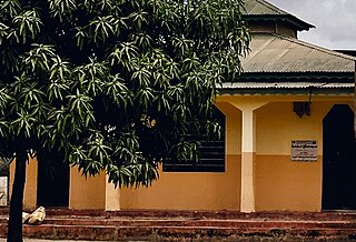
Kibada is an administrative ward in the Kigamboni district of the Dar es Salaam Region of Tanzania. The Temeke District's Kijichi and Toangoma wards border the ward on the south and west, and Mjimwema and Kisarawe II wards border it on the east. The ward is bordered to the north by Vijibweni. The ward is famous for its mango production.
Kisarawe II or unofficially East Kisarawe is an administrative ward in the Kigamboni district of the Dar es Salaam Region of Tanzania. The Kibada and Mjimwema form the ward's northern border. East is Somangila. Pembamnazi borders it to the south. Toangoma in the Temeke District, as well as Vianzi and Vikindu in the Pwani Region's Mkuranga District, border the west. Since Kisarawe II is the district's top agricultural producer, it is known as Kigamboni's "ricebowl" and "food basket". In 2016 the Tanzania National Bureau of Statistics report there were 10,401 people in the ward, from 8,306 in 2012.

Kurasini is an administrative ward in the Temeke district of the Dar es Salaam Region of Tanzania. Home of The Dar es Salaam Port, It is the location of the Port of Dar es Salaam; the fourth-largest port in Africa on the Indian Ocean, The National Police College, the Mgulani Police Barracks, Tanzania Immigration Headquarters, Diplomacy College and the Dar es Salaam International Trade Fair Grounds. Kurasini, under the British occupation of Tanganyika was built before 1940 for European port officials only. According to the 2012 census, the ward has a total population of 26,193.

Mtoni is an administrative ward in the Temeke district of the Dar es Salaam Region of Tanzania. Kurasini forms the ward's northern boundary. The Kigamboni MC's east by Vijibweni. The ward is bordered by Miburani and Azimio to the west. The ward is bordered with Kijichi to the south. According to the 2012 census, the ward has a total population of 59,378.
Vijibweni is an administrative ward in the Kigamboni district of the Dar es Salaam Region of Tanzania. The Tungi and Mjimwema form the ward's northern and eastern borders, respectively. In the Temeke District, it is bordered to the south by Kibada and to the west by Kijichi, Mtoni, and Kurasini. Kurasini is connected to Vijibweni by the iconic Nyerere Bridge. With seven major firms situated there, Vijibweni is home to the largest manufacturing industries in the entire District. In 2016 the Tanzania National Bureau of Statistics report there were 36,327 people in the ward, from 29,010 in 2012.

Tanzania Ports Authority (TPA) is a parastatal public corporation acting under the aegis of the Ministry of Infrastructure Development, that has the responsibility "to manage and operate" the ocean ports and lake ports of the country of Tanzania. The Tanzania Ports Authrorty headquarters are located in Mchafukoge ward of Ilala District in Dar es Salaam Region. It is a member of the Port Management Association of Eastern and Southern Africa.

Keko is an administrative ward in the Temeke district of the Dar es Salaam Region of Tanzania. Mchafukoge, Gerezani, and Ilala of the Ilala MC's border the ward on its northern side. Kurasini Ward is to the east of the ward. Miburani ward is in the south. Chang'ombe is the west. Keko also hosts the largest Vocational Education and Training Authority (VETA) in Temeke District. According to the 2012 census, the ward has a total population of 35,163.

Dar es Salaam Rapid Transit also known as UDART is a bus rapid transit system that began operations on 10 May 2016 in Dar es Salaam, Tanzania.

The National Social Security Fund (NSSF) is the government agency of Tanzania responsible for the collection, safekeeping, responsible investment, and distribution of retirement funds of all employees in all sectors of the Tanzania economy that do not fall under the governmental pension schemes. The headquartersare located in Kivukoni ward of Ilala District of Dar es Salaam Region. There are one other pension fund organizations in the country; the Public Services Social Security(PSSSF). Fund for all employees working directly under the government and for all employees working under governmental Parastatal organization

Yetu Microfinance Bank Plc. (YETU) is a microfinance bank in Tanzania. It is the first microfinance institution to be listed in the Dar es Salaam Stock Exchange. Yetu is a Swahili word meaning Ours.

Isaya Mwita Charles is a Tanzanian politician who has been serving as the 17th and current Mayor of Dar es Salaam since March 21, 2016. Prior to his appointment as mayor, he served at the Temeke Municipal Council as a cashier before contesting the general election for the Vijibweni Ward representative as councilor at Kigamboni District in Dar es Salaam.

Kigamboni is an administrative ward of Kigamboni District in the Dar es Salaam Region of Tanzania. The Indian Ocean borders the ward to the east, Tungi borders it to the south, and Dar es Salaam harbor borders it to the west. The Kivukoni Ward in Ilala District, which is across the harbor mouth, borders the ward to the north. According to the 2012 census, the ward has a total population of 30,496.

