Dar es Salaam is the largest city and financial hub of Tanzania. It is also the capital of Dar es Salaam Region. With a population of over six million people, Dar is the largest city in East Africa and the sixth-largest in Africa. Located on the Swahili coast, Dar es Salaam is an important economic centre and is one of the fastest-growing cities in the world.

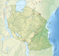
Dar es Salaam Region is one of Tanzania's 31 administrative regions and is located in the east coast of the country. The region covers an area of 1,393 km2 (538 sq mi). The region is comparable in size to the combined land and water areas of the nation state of Mauritius Dar es Salaam Region is bordered to the east by Indian Ocean and it is entirely surrounded by Pwani Region. The Pwani districts that border Dar es Salaam region are Bagamoyo District to the north, Kibaha Urban District to the west, Kisarawe District to the south west and Mkuranga District to the south of the region. The region's seat (capital) is located inside the ward of Ilala. The region is named after the city of Dar es Salaam itself. The region is home to Tanzania's major finance, administration and industries, thus the making it the country's richest region. According to the 2022 census, the region has a total population of 5,383,728 and national census of 2012 had 4,364,541. The region has the highest population in Tanzania followed by Mwanza Region.

Kinondoni District, officially the Kinondoni Municipal Council is one of five districts of the Dar es Salaam Region of Tanzania. The district is bordered to the north by Bagamoyo District and Kibaha of Pwani Region, to the east by the Indian Ocean, the west by Ubungo District, and to the south by the Ilala District. The district covers an area of 269.5 km2 (104.1 sq mi). The district is comparable in size to the land area of Malta. The administrative seat is Ndugumbi. The district is home to one of the best preserved Medieval Swahili settlements, Kunduchi Ruins, headquarters for the National Muslim Council of Tanzania (BAKWATA) and Makumbusho Village Museum. Considered the cultural center of Dar es Salaam, Kinondoni District is also regarded the birthplace of the musical genre of Singeli. In addition the district is one of two districts in Dar es Salaam that has a National Historic Site, namely the Kunduchi Ruins.The 2012 National Tanzania Census states the population for Kinondoni as 1,775,049.
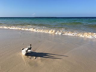
Bongoyo Island is a protected, uninhabited island under the Dar es Salaam Marine Reserve with the IUCN category II located within Kinondoni District of Dar es Salaam Region in Tanzania. The island situated 2.5 km north of the country's largest city, Dar es Salaam in the Sea of Zanj. It is the most frequently visited of the four islands of the Dar es Salaam Marine Reserve System (DMRS) and a popular daytrip for both tourists and Tanzanian residents alike for snorkelling and sunbathing. North of the island is Mbudya Island and to the west is Pangavini Island.
Mbudya Island is a protected, uninhabited island under the Dar es Salaam Marine Reserve with the IUCN category II located within Kinondoni District of Dar es Salaam Region in Tanzania. The island reserve measures around 14.2 km2. Fungu Yasin is to the north of the island, and Bongoyo Island is to the south. The island of Pangavini is to the west.
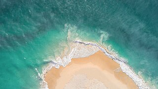
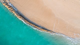
The Dar es Salaam Marine Reserve System or DMRS is a group of marine reserves in Tanzania, with the IUCN category II located within Dar es Salaam Region of Tanzania. The reserve system consists of nine uninhabited islands, four located north of Dar es Salaam's Kinondoni District; and four south of the city Makatumbi Islands, Kimbubu Island, Sinda Island and Kendwa Island in Kigamboni District. It provides protection for several important tropical ecosystems; coral reefs, mangroves and seagrass beds.

Pangavini Island is a protected, uninhabited island under the Dar es Salaam Marine Reserve with the IUCN category II located within Kinondoni District of Dar es Salaam Region in Tanzania. The island reserve measures around 2.13km2. Pangavini is the smallest island in the group, only about 250 m long; it has a rocky coastline without beaches. To the west of the island is Kunduchi ward and to the north is Mbudya Island. To the south of the island is Bongoyo Island.
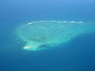
Fungu Yasini Island is a protected, uninhabited island under the Dar es Salaam Marine Reserve (DMRS) with the IUCN category II located within Kinondoni District of Dar es Salaam Region in Tanzania. The island reserve measures around 22.90km2 with most it underwater as a reef. South of the island is Mbudya Island.

Kigamboni District, officially known as The Kigamboni Municipal Council is one of five districts of the Dar es Salaam Region of Tanzania. The district is bordered to the north by Ilala District, to the east by the Indian Ocean, the west by Temeke District, and to the south by the Mkuranga District of Pwani Region. It covers an area of 578.3 km2 (223.3 sq mi), making it the largest district the region by area. The district is comparable in size to the land area of Micronesia. The administrative seat is Somangila. The district is home to the headquarters of the Tanzanian Navy, The Kigamboni Naval Base. Also the district is home to the prestigious Mwalimu Nyerere Memorial Academy. In addition the district is one of two districts in Dar es Salaam that has a National Historic Site, with Kigamboni hosting the most, namely the Kimbiji Ruins, Mbutu Bandarini and Mbuamaji historic sites. The 2012 National Tanzania Census states the population for Kigamboni as 162,932.

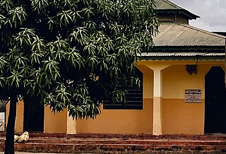
Kibada is an administrative ward in the Kigamboni district of the Dar es Salaam Region of Tanzania. The Temeke District's Kijichi and Toangoma wards border the ward on the south and west, and Mjimwema and Kisarawe II wards border it on the east. The ward is bordered to the north by Vijibweni. The ward is famous for its mango production.
Kisarawe II or unofficially East Kisarawe is an administrative ward in the Kigamboni district of the Dar es Salaam Region of Tanzania. The Kibada and Mjimwema form the ward's northern border. East is Somangila. Pembamnazi borders it to the south. Toangoma in the Temeke District, as well as Vianzi and Vikindu in the Pwani Region's Mkuranga District, border the west. Since Kisarawe II is the district's top agricultural producer, it is known as Kigamboni's "ricebowl" and "food basket". In 2016 the Tanzania National Bureau of Statistics report there were 10,401 people in the ward, from 8,306 in 2012.

Tanzania Ports Authority (TPA) is a parastatal public corporation acting under the aegis of the Ministry of Infrastructure Development, that has the responsibility "to manage and operate" the ocean ports and lake ports of the country of Tanzania. The Tanzania Ports Authrorty headquarters are located in Mchafukoge ward of Ilala District in Dar es Salaam Region. It is a member of the Port Management Association of Eastern and Southern Africa.

Nyerere Bridge also unofficially known as Kigamboni Bridge is a 680-meter-long bridge located in the Dar es Salaam Region of Tanzania that connects the Temeke District's ward of Kurasini from the east to the west of Kigamboni District's Vijibweni ward across the Kurasini estuary. Construction work began in February 2012 and completed in April 2016.
Dar es Salaam Zoo is a zoological park in Dar es Salaam, Tanzania. The zoo is located in the Kigamboni-district in the eastern part of the city, 37 km (23 mi) from Downtown Dar es Salaam.

The United African University of Tanzania (UAUT) is a private Christian university located in Vijibweni ward of Kigamboni District in Dar es Salaam Region of Tanzania. It was founded by the Korea Church Mission and is located in Dar es Salaam.
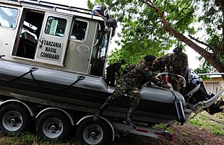
The Tanzania Naval Command is the naval military branch of the Tanzania People's Defence Force (TPDF). It was established in 1971 with assistance from China.

The Marine Park and Reserves Unit of Tanzania was formed in 1994 under the Marine Parks and Reserve Act No 29, of 1994. The headquarters are located in Upanga West ward of Ilala District in Dar es Salaam Region. Previously all marine life and biodiversity was under the Ministry of Livestock and Fisheries. The population along the 1400 km Tanzanian coastline has reached to over 10 million and the increase in number of people whose livelihood depends on the marine resource has also increased. The increase in population has caused various threats to the marine life due to over fishing, coral mining and unplanned increase in settlements. To protect the marine biodiversity the Government of Tanzania established the Marine Park and Reserves unit in 1994 with Mafia Island Marine Park as the first marine park.
Makatumbi Islands or Makatumbe Islands are a protected, uninhabited islands in the Sea of Zanj under the Dar es Salaam Marine Reserve (DMRS) with the IUCN category II located within Kigamboni District of Dar es Salaam Region in Tanzania. The islands reserve measures around 7.8km2 consisting of inner and outer Makatumbi Island. South of the island is Kimbumbu Island and north is the Dar es Salaam harbor mouth. The island is under threat from Marine pollution as elevated cadmium readings offshore for a core found east of Makatumbe Island near the entrance to the Dar es Salaam harbour.

Sinda Island is a protected, uninhabited island in the Sea of Zanj under the Dar es Salaam Marine Reserve (DMRS) with the IUCN category II located within Kigamboni District of Dar es Salaam Region in Tanzania. The islands reserve measures around 4.6km2 consisting of inner and outer Sinder Island. South of the island is Kikwero reef and west is the Somangila ward of Kigamboni.
Kendwa Island is a protected, uninhabited island in the Sea of Zanj under the Dar es Salaam Marine Reserve (DMRS) with the IUCN category II located within Kigamboni District of Dar es Salaam Region in Tanzania. The islands reserve measures around 5.30km2. The Sinda Island is to the east of the island, the Makatumbi Islands are to the north, and the Kigamboni ward of Kigamboni is to the west.