A suspension bridge is a type of bridge in which the deck is hung below suspension cables on vertical suspenders. The first modern examples of this type of bridge were built in the early 1800s. Simple suspension bridges, which lack vertical suspenders, have a long history in many mountainous parts of the world.

Hammersmith Bridge is a suspension bridge that crosses the River Thames in west London. It links the southern part of Hammersmith in the London Borough of Hammersmith and Fulham, on the north side of the river, and Barnes in the London Borough of Richmond upon Thames, on the south side of the river. The current bridge, which is Grade II* listed and was designed by civil engineer Sir Joseph Bazalgette, is the second permanent bridge on the site, and has been attacked three times by Irish republicans. It was closed indefinitely to all motor traffic in April 2019 after cracks were discovered in the bridge's pedestals. The closure was extended to pedestrians and cyclists between August 2020 and July 2021 when limited use resumed.

The Hungerford Bridge crosses the River Thames in London, and lies between Waterloo Bridge and Westminster Bridge. Owned by Network Rail Infrastructure Ltd it is a steel truss railway bridge flanked by two more recent, cable-stayed, pedestrian bridges that share the railway bridge's foundation piers, and which are named the Golden Jubilee Bridges.

The High Level Bridge is a road and railway bridge spanning the River Tyne between Newcastle upon Tyne and Gateshead in North East England. It is considered the most notable historical engineering work in the city. It was built by the Hawks family from 5,050 tons of iron. George Hawks, Mayor of Gateshead, drove in the last key of the structure on 7 June 1849, and the bridge was officially opened by Queen Victoria later that year.

The Oregon City Bridge, also known as the Arch Bridge, is a steel through arch bridge spanning the Willamette River between Oregon City and West Linn, Oregon, United States. Completed in 1922, it is listed on the National Register of Historic Places. It was built and is owned by the Oregon Department of Transportation (ODOT) as part of Oregon Route 43 and is the third-southernmost Willamette bridge in the Portland metropolitan area, after the Boone Bridge in Wilsonville and the Oregon 219 bridge near Newberg.
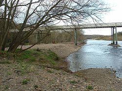
Richmond Lock and Footbridge is a lock, rising and falling low-tide barrage integrating controlled sluices and pair of pedestrian bridges on the River Thames in south west London, England and is a Grade II* listed structure. It is the furthest downstream of the forty-five Thames locks and the only one owned and operated by the Port of London Authority. It was opened in 1894 and is north-west of the centre of Richmond in a semi-urban part of south-west London. Downstream are Syon Park and Kew Gardens on opposite banks. It connects the promenade at Richmond with the neighbouring district of St. Margarets on the west bank during the day and is closed at night to pedestrians – after 19:30 GMT or after 21:30 when BST is in use. At high tide the sluice gates are raised and partly hidden behind metal arches forming twin footbridges.

Albert Bridge is a road bridge over the River Thames connecting Chelsea in Central London on the north bank to Battersea on the south. Designed and built by Rowland Mason Ordish in 1873 as an Ordish–Lefeuvre system modified cable-stayed bridge, it proved to be structurally unsound, so between 1884 and 1887 Sir Joseph Bazalgette incorporated some of the design elements of a suspension bridge. In 1973 the Greater London Council added two concrete piers, which transformed the central span into a simple beam bridge. As a result, today the bridge is an unusual hybrid of three different design styles. It is an English Heritage Grade II* listed building.

Whitchurch Bridge is a toll bridge that carries the B471 road over the River Thames in England. It links the villages of Pangbourne in Berkshire, and Whitchurch-on-Thames in Oxfordshire – crossing the river just downstream of Whitchurch Lock. It is one of two remaining private toll bridges across the Thames, the other being Swinford Toll Bridge. The bridge has a weight limit of 7.5 tonnes and is a Grade II listed structure. Its 1792-built, now unrelated, residential toll house is also listed.

The Bandra–Worli Sea Link is a 5.6 km long, 8-lane wide bridge that links Bandra in the Western Suburbs of Mumbai with Worli in South Mumbai. It is the 4th longest bridge in India after Bhupen Hazarika Setu, Dibang River Bridge and Mahatma Gandhi Setu. It is a cable-stayed bridge with pre-stressed concrete-steel viaducts on either side. It was planned as a part of the proposed Western Freeway that would link the Western Suburbs to Nariman Point in Mumbai's main business district, but is now planned to become part of the Coastal Road to Kandivali.
The Portland–Columbia Pedestrian Bridge is a footbridge that crosses the Delaware River, at Portland, Pennsylvania, connecting to Columbia, in Knowlton Township, New Jersey, United States. The bridge is owned and operated by the Delaware River Joint Toll Bridge Commission.

Fullers Bridge, officially called the Fullers Creek Bridge, is a road bridge that carries Delhi Road to Millwood Avenue across the Lane Cove River, in Chatswood West, Sydney, New South Wales, Australia. The concrete beam bridge is located 9 kilometres (5.6 mi) northwest of the Sydney central business district and connects Chatswood to North Ryde as part of the A38.

The Schierstein Bridge is 1,282-meter (4,206 ft) long, four-lane highway bridge in Germany. It carries Bundesautobahn 643 over the Rhine River between Mainz-Mombach, Rhineland-Palatinate and Wiesbaden-Schierstein, Hesse. Crossing two arms of the Rhine and the intervening island of Rettbergsaue, the bridge is made of six individual structures, including 100 m (330 ft) from prestressed concrete. It was built between 1959 and 1962.

The Infinity Bridge is a public pedestrian and cycle footbridge across the River Tees in the borough of Stockton-on-Tees in northern England. The bridge is situated one kilometre downriver of Stockton town centre, between the Princess of Wales Bridge and the Tees Barrage. It connects the Teesdale Business Park and the University of Durham's Queen's Campus in Thornaby-on-Tees on the south bank of the Tees with the Tees Valley Regeneration's £320 million North Shore development on the north bank.

Wilford Toll Bridge, locally referred to as the 'Halfpenny Bridge', is a tram, pedestrian and cycle bridge in Nottingham, England. It crosses the River Trent between the Meadows and Wilford. It originally opened as a toll bridge for general traffic in 1870, but was closed when declared unsafe in 1974. Following demolition of the central span, a narrower footbridge and cycleway was opened in 1980. The bridge was once again widened to accommodate an extension of the Nottingham Express Transit network in 2015.

The San Mateo–Hayward Bridge is a bridge crossing the American state of California's San Francisco Bay, linking the San Francisco Peninsula with the East Bay. The bridge's western end is in Foster City, a suburb on the eastern edge of San Mateo. The eastern end of the bridge is in Hayward. It is the longest bridge in California and the 25th longest in the world by length. The bridge is owned by the state of California, and is maintained by California Department of Transportation (Caltrans), the state highway agency. Further oversight is provided by the Bay Area Toll Authority (BATA).

The Stone kerbing, channels and footbridges of Charters Towers is a heritage-listed group of water infrastructure at various locations in Charters Towers City, Millchester, Queenton, and Richmond Hill throughout Charters Towers, Charters Towers Region, Queensland, Australia. It was built from c. 1884 to 1930s. It was added to the Queensland Heritage Register on 7 February 2005.

The Surtees Rail Bridge is a rail bridge on the Tees Valley Line over the River Tees in the Borough of Stockton-on-Tees. The bridge is south of Stockton-on-Tees town centre and just north of the adjacent Surtees Bridge which carries the A66 road. The bridge is built on the site of a series of Tees Bridges alternating between two adjacent crossing sites.

The State Street Bridge, also known as the Fort Road Bridge or the Bridgeport Bridge, is a bridge carrying State Street over the Cass River in Bridgeport, Michigan, United States. It was listed on the National Register of Historic Places in 1995.

St Peter's Bridge carries the A5189 road across the River Trent in Burton upon Trent, Staffordshire, England. Opened in 1985, the 800-metre (2,600 ft) long reinforced concrete bridge is the most recent road crossing of the Trent. It was closed for more than two months in 2017 for major repair works.
Dukes Meadows Footbridge is a pedestrian bridge under construction in Chiswick, London that will allow the Thames Path on the north bank at Dukes Meadows to follow the river without diversion.