Healy is a census-designated place (CDP) and the borough seat of Denali Borough in the U.S. state of Alaska. The population was 966 at the time of the 2020 census, down from 1,021 in 2010.
Tolsona is a census-designated place (CDP) in Copper River Census Area, Alaska, United States. The population was 12 at the 2020 census, down from 30 in 2010.

Molino is a census-designated place (CDP) in Escambia County, Florida, United States. The population was 1,296 at the 2020 census, up from 1,277 at the 2010 census. It is part of the Pensacola–Ferry Pass–Brent, Florida Metropolitan Statistical Area.
Fox Lake Hills is an unincorporated community and census-designated place (CDP) in Lake Villa Township, Lake County, Illinois, United States. Per the 2020 census, the population was 2,684.

South Paris is a census-designated place (CDP) located within the town of Paris in Oxford County, Maine, United States. South Paris is included in the Lewiston-Auburn, Maine metropolitan New England city and town area.The population was 2,237 at the 2000 census. While the CDP refers only to the densely settled area in the southern part of the town of Paris, the entire town, outside of Paris Hill, is located within the South Paris ZIP code, resulting in many residents referring to the entire town as South Paris.

East Falmouth is a census-designated place (CDP) in the town of Falmouth in Barnstable County, Massachusetts, United States. It is located at the base of Massachusetts' "fishhook" peninsula. The population was 6,038 at the 2010 census, making East Falmouth the most populous of the six CDPs in Falmouth.

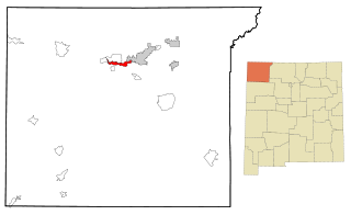
Upper Fruitland is a census-designated place (CDP) in San Juan County, New Mexico, United States. The population was 1,664 at the 2000 census. It is part of the Farmington Metropolitan Statistical Area.

Northampton is a hamlet and census-designated place (CDP) in Suffolk County, New York, United States on Long Island. The CDP population was 570 at the 2010 census.

McLeansville is an unincorporated community and census-designated place (CDP) in Guilford County, North Carolina, United States. The population was 1,021 at the 2010 census.

Rowley is a census-designated place (CDP) in the town of Rowley in Essex County, Massachusetts, United States. The population was 1,416 at the 2010 census.

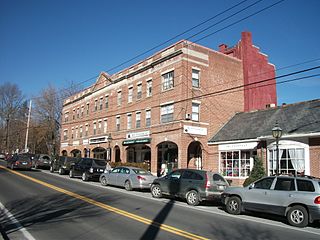
Bedford is a hamlet and census-designated place (CDP) located in the town of Bedford in Westchester County, New York, United States. The population was 1,834 at the 2010 census.

Livermore Falls is a census-designated place (CDP) in the town of Livermore Falls in Androscoggin County, Maine, United States. The population of the CDP was 1,594 at the 2010 census, out of a population of 3,187 within the full town.

Bridgton is a census-designated place (CDP) in the town of Bridgton in Cumberland County, Maine, United States. The CDP comprises the villages of Bridgton and North Bridgton within the town. The population of the CDP was 2,071 at the 2010 census. It is part of the Portland–South Portland–Biddeford, Maine Metropolitan Statistical Area.

Yarmouth is a census-designated place (CDP) in the town of Yarmouth in Cumberland County, Maine, United States. The population was 6,125 at the 2020 census. It is part of the Portland–South Portland–Biddeford, Maine Metropolitan Statistical Area.

Dixfield is a census-designated place (CDP) in the town of Dixfield in Oxford County, Maine, United States. The population was 1,323 at the 2020 census.
Fryeburg is a census-designated place (CDP) in the town of Fryeburg in Oxford County, Maine, United States. The population was 1,444 at the 2020 census.
Mexico is a census-designated place (CDP) in the town of Mexico in Oxford County, Maine, United States. The population was 1,946 at the 2000 census.
Norway is a census-designated place (CDP) in the town of Norway in Oxford County, Maine, United States. The population was 2,623 at the 2000 census.

Oxford is a town in Oxford County, Maine, United States. Oxford is included in the Lewiston-Auburn, Maine metropolitan New England city and town area. The population was 4,229 at the 2020 census. Oxford is home to the Oxford Plains Speedway, Kamp Kohut, the annual Oxford County Fair, and Oxford Casino. The town includes the village of Welchville.
Rumford is a census-designated place (CDP) in the town of Rumford in Oxford County, Maine, United States. The population was 4,795 at the 2000 census.


