Paragon Estates, Colorado

Last updated

Paragon Estates, Colorado
Boulder County Colorado Incorporated and Unincorporated areas Paragon Estates Highlighted 0857445.svg
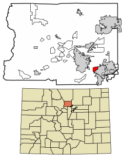
Location of the Paragon Estates CDP in Boulder County, Colorado
Usa edcp location map.svg
Red pog.svg
Paragon Estates
Location of the Paragon Estates CDP in the United States
Coordinates: 39°58′49″N105°10′53″W / 39.98028°N 105.18139°W / 39.98028; -105.18139 (Paragon Estates CDP, Colorado) [1]
Country Flag of the United States.svg  United States
State Flag of Colorado.svg  Colorado
County Boulder County
Government
[1]
  Type unincorporated community
Area
[2]
  Total4.361 km2 (1.684 sq mi)
  Land4.341 km2 (1.676 sq mi)
  Water0.020 km2 (0.008 sq mi)
Elevation
[1]
1,660 m (5,440 ft)
Population
 (2020) [3]
  Total975
  Density220/km2 (580/sq mi)
Time zone UTC-7 (MST)
  Summer (DST) UTC-6 (MDT)
ZIP Code [4]
Boulder 80303
Area codes 303 & 720
GNIS feature ID 2583275 [1]

Paragon Estates is an unincorporated community and a census-designated place (CDP) located in and governed by Boulder County, Colorado, United States. The CDP is a part of the Boulder, CO Metropolitan Statistical Area. The population of the Paragon Estates CDP was 975 at the United States Census 2020. [3] The Boulder post office (Zip Code 80303) serves the area. [4]

Contents

Geography

Paragon Estates is located in southeastern Boulder County on the northwest edge of Louisville and 6 miles (10 km) southeast of Boulder. U.S. Highway 36, the Denver–Boulder Turnpike, forms the southwest edge of the CDP.

The Paragon Estates CDP has an area of 1,078 acres (4.361 km2), including 4.9 acres (0.020 km2) of water. [2]

Demographics

The United States Census Bureau initially defined the Paragon Estates CDP for the United States Census 2010.

Paragon Estates CDP, Colorado
YearPop.±%
2010 928    
2020 975+5.1%
Source: United States Census Bureau

See also

Related Research Articles

<span class="mw-page-title-main">Louviers, Colorado</span> Census Designated Place in Colorado, United States

Louviers is an unincorporated town, a post office, and a census-designated place (CDP) located in and governed by Douglas County, Colorado, United States. The CDP is a part of the Denver–Aurora–Lakewood, CO Metropolitan Statistical Area. The Louviers post office has the ZIP Code 80131. At the United States Census 2020, the population of the Louviers CDP was 293.

<span class="mw-page-title-main">Stonegate, Colorado</span> Census Designated Place in Colorado, United States

Stonegate is an unincorporated community and a census-designated place (CDP) located in and governed by Douglas County, Colorado, United States. The CDP is a part of the Denver–Aurora–Lakewood, CO Metropolitan Statistical Area. The population of the Stonegate CDP was 9,072 at the United States Census 2020. The Stonegate Village Metropolitan District provides services to the community, which lies in ZIP Code 80134.

<span class="mw-page-title-main">Aristocrat Ranchettes, Colorado</span> Census Designated Place in Colorado, United States

Aristocrat Ranchettes is an unincorporated community and a census-designated place (CDP) located in and governed by Weld County, Colorado, United States. The population of the Aristocrat Ranchettes CDP was 1,715 at the United States Census 2020. The Fort Lupton post office (Zip Code 80621) serves the area. The CDP is a part of the Greeley, CO Metropolitan Statistical Area.

<span class="mw-page-title-main">Grand View Estates, Colorado</span> Census Designated Place in Colorado, United States

Grand View Estates is an unincorporated community and a census-designated place (CDP) located in and governed by Douglas County, Colorado, United States. The CDP is a part of the Denver–Aurora–Lakewood, CO Metropolitan Statistical Area. The population of the Grand View Estates CDP was 689 at the United States Census 2020. The area lies in ZIP code 80134.

<span class="mw-page-title-main">Altona, Colorado</span> Census Designated Place in Colorado, United States

Altona is an unincorporated community and a census-designated place (CDP) located in and governed by Boulder County, Colorado, United States. The CDP is a part of the Boulder, CO Metropolitan Statistical Area. The population of the Altona CDP was 512 at the United States Census 2020. The Boulder post office serves the area.

<span class="mw-page-title-main">Aetna Estates, Colorado</span> Census Designated Place in Colorado, United States

Aetna Estates is an unincorporated community and a census-designated place (CDP) located in and governed by Arapahoe County, Colorado, United States. The CDP is a part of the Denver–Aurora–Lakewood, CO Metropolitan Statistical Area. The population of the Aetna Estates CDP was 1,496 at the United States Census 2020. The unincorporated community is surrounded by Aurora and lies in ZIP Code 80018.

<span class="mw-page-title-main">Brick Center, Colorado</span> Census Designated Place in Colorado, United States

Brick Center is an unincorporated community and a census-designated place (CDP) located in and governed by Arapahoe County, Colorado, United States. The CDP is a part of the Denver–Aurora–Lakewood, CO Metropolitan Statistical Area. The population of the Brick Center CDP was 105 at the United States Census 2020. The Bennett post office serves the area.

<span class="mw-page-title-main">Comanche Creek, Colorado</span> Census Designated Place in Colorado, United States

Comanche Creek is an unincorporated community and a census-designated place (CDP) located in and governed by Arapahoe County, Colorado, United States. The CDP is a part of the Denver–Aurora–Lakewood, CO Metropolitan Statistical Area. The population of the Comanche Creek CDP was 442 at the United States Census 2020. The Strasburg post office serves the area.

<span class="mw-page-title-main">Bark Ranch, Colorado</span> Census Designated Place in Colorado, United States

Bark Ranch is an unincorporated community and a census-designated place (CDP) located in and governed by Boulder County, Colorado, United States. The Bark Ranch CDP encompasses the Bar-K Ranch housing community. The CDP is a part of the Boulder, CO Metropolitan Statistical Area. The population of the Bark Ranch CDP was 202 at the United States Census 2020. The Ward post office serves the area.

<span class="mw-page-title-main">Bonanza Mountain Estates, Colorado</span> Census Designated Place in Colorado, United States

Bonanza Mountain Estates is an unincorporated community and a census-designated place (CDP) located in and governed by Boulder County, Colorado, United States. The CDP is a part of the Boulder, CO Metropolitan Statistical Area. The population of the Bonanza Mountain Estates CDP was 127 at the United States Census 2020. The Nederland post office serves the area.

<span class="mw-page-title-main">Glendale, Boulder County, Colorado</span> Census Designated Place in Colorado, United States

Glendale is an unincorporated community and a census-designated place (CDP) located in and governed by Boulder County, Colorado, United States. The CDP is a part of the Boulder, CO Metropolitan Statistical Area. The population of the Glendale CDP was 64 at the United States Census 2020. The Jamestown post office serves the area.

<span class="mw-page-title-main">Hidden Lake, Colorado</span> Census Designated Place in Colorado, United States

Hidden Lake is an unincorporated community and a census-designated place (CDP) located in and governed by Boulder County, Colorado, United States. The CDP is a part of the Boulder, CO Metropolitan Statistical Area. The population of the Hidden Lake CDP was 24 at the United States Census 2020. The Ward post office serves the area.

<span class="mw-page-title-main">Lazy Acres, Colorado</span> Census Designated Place in Colorado, United States

Lazy Acres is an unincorporated community and a census-designated place (CDP) located in and governed by Boulder County, Colorado, United States. The CDP is a part of the Boulder, CO Metropolitan Statistical Area. The population of the Lazy Acres CDP was 957 at the United States Census 2020. The Boulder post office serves the area.

<span class="mw-page-title-main">Leyner, Colorado</span> Census Designated Place in Colorado, United States

Leyner is an unincorporated community and a census-designated place (CDP) located in and governed by Boulder County, Colorado, United States. The CDP is a part of the Boulder, CO Metropolitan Statistical Area. The population of the Leyner CDP was 40 at the United States Census 2020. The Lafayette post office serves the area.

<span class="mw-page-title-main">Mountain Meadows, Colorado</span> Census Designated Place in Colorado, United States

Mountain Meadows is an unincorporated community and a census-designated place (CDP) located in and governed by Boulder County, Colorado, United States. The CDP is a part of the Boulder, CO Metropolitan Statistical Area. The population of the Mountain Meadows CDP was 237 at the United States Census 2020. The Boulder post office serves the area.

<span class="mw-page-title-main">Pine Brook Hill, Colorado</span> Census Designated Place in Colorado, United States

Pine Brook Hill is an unincorporated community and a census-designated place (CDP) located in and governed by Boulder County, Colorado, United States. The CDP is a part of the Boulder, CO Metropolitan Statistical Area. The population of the Pine Brook Hill CDP was 975 at the United States Census 2020. The Boulder post office serves the area.

<span class="mw-page-title-main">St. Ann Highlands, Colorado</span> Census Designated Place in Colorado, United States

St. Ann Highlands or Saint Ann Highlands is an unincorporated community and a census-designated place (CDP) located in and governed by Boulder County, Colorado, United States. The CDP is a part of the Boulder, CO Metropolitan Statistical Area. The population of the St. Ann Highlands CDP was 325 at the United States Census 2020. The Nederland post office serves the area.

<span class="mw-page-title-main">Seven Hills, Colorado</span> Census Designated Place in Colorado, United States

Seven Hills is an unincorporated community and a census-designated place (CDP) located in and governed by Boulder County, Colorado, United States. The CDP is a part of the Boulder, CO Metropolitan Statistical Area. The population of the Seven Hills CDP was 129 at the United States Census 2020. The Boulder post office serves the area.

<span class="mw-page-title-main">Tall Timber, Colorado</span> Census Designated Place in Colorado, United States

Tall Timber is an unincorporated community and a census-designated place (CDP) located in and governed by Boulder County, Colorado, United States. The CDP is a part of the Boulder, CO Metropolitan Statistical Area. The population of the Tall Timber CDP was 185 at the United States Census 2020. The Boulder post office serves the area.

<span class="mw-page-title-main">Shaw Heights, Colorado</span> Census Designated Place in Colorado, United States

Shaw Heights is an unincorporated community and a census-designated place (CDP) located in and governed by Adams County, Colorado, United States. The CDP is part of the Denver–Aurora–Lakewood, CO Metropolitan Statistical Area. The population of the Shaw Heights CDP was 5,185 at the United States Census 2020. The Westminster post office serves the area.

References

  1. 1 2 3 4 U.S. Geological Survey Geographic Names Information System: Paragon Estates, Colorado
  2. 1 2 "State of Colorado Census Designated Places - BAS20 - Data as of January 1, 2020". United States Census Bureau . Retrieved December 12, 2020.
  3. 1 2 United States Census Bureau. "Paragon Estates CDP, Colorado" . Retrieved April 18, 2023.
  4. 1 2 "Zip Code 80303 Map and Profile". zipdatamaps.com. 2020. Retrieved December 20, 2020.