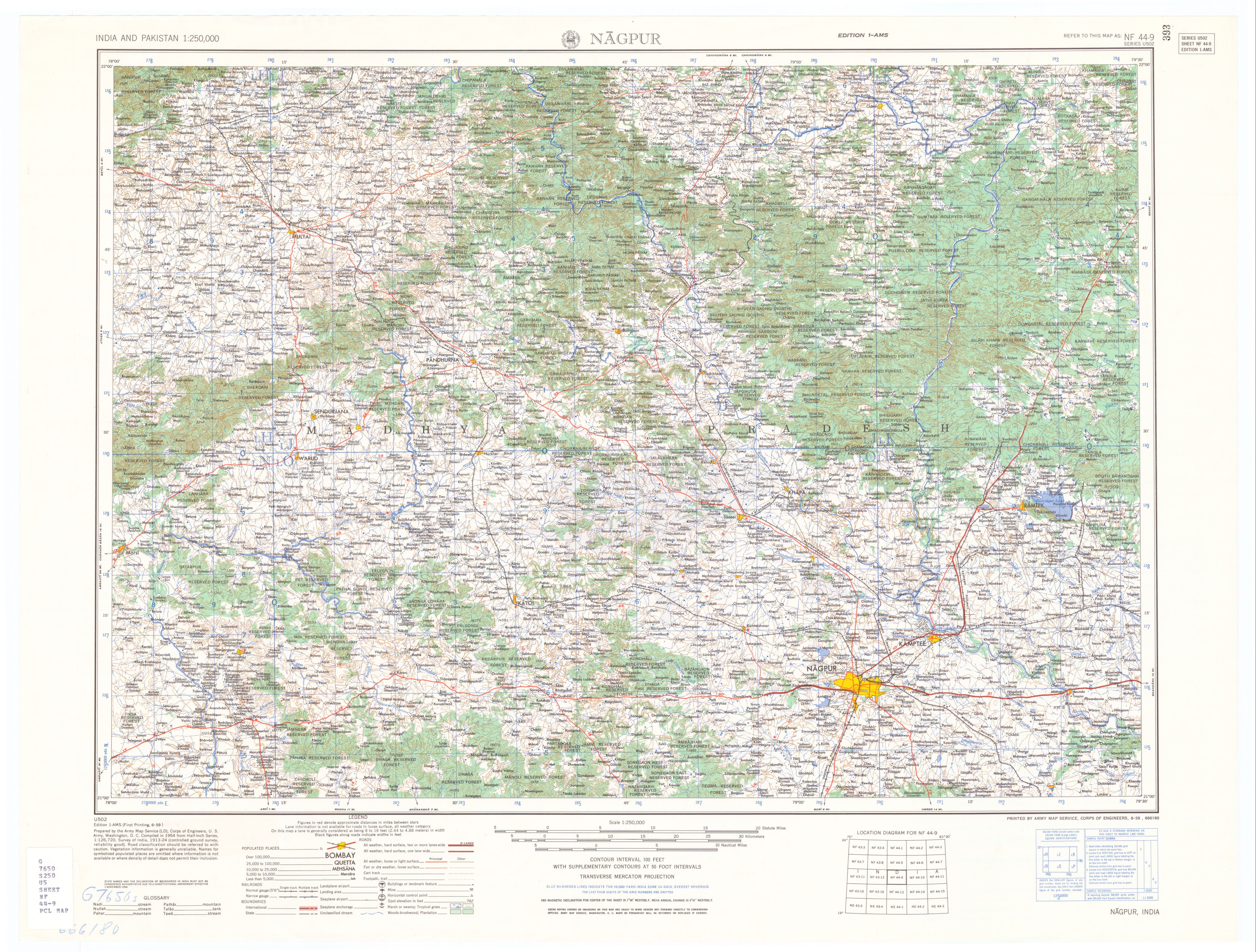
Patansavangi (Patansaongi,[1]Patansawagi) is a panchayat village[2] in Maharashtra State, India.[3][4] Administratively, Patansavangi is under the Saoner Taluk of Nagpur District in Maharashtra,[4] although earlier (1908) it had been part of the larger Ramtek taluka.[5] It lies on the left (east) bank of the Kolar River, just upstream from its confluence with the Chandrabhaga Nadi.[6] Patansavangi is 13km by road southeast of the town of Saoner (Savner) and 25km by road northwest of the town of Nagpur.
There are three villages in the Patansawagi gram panchayat: Patansavangi, Bidkawadas and Kawadas.[4]
Patansavangi is the site of a Gondi fort dating from the 16th century.[7] In 1742 there was a massacre at the fort of Gondi people who resisted Raghoji I Bhonsle, with a death toll of up to 12,000.[8]
↑ Central Provinces District Gazetteers, Volume 7, Nagpur District, Volume A, Descriptive. Bombay: Gazetteer Department, Government of Maharashtra. 1999. p.326. revision of 1908 edition
↑ Nagpur(topographic map, 1:250,000), series U502, sheet NF 44-09, United States Army Map Service, June 1959
Balaghat district is a district of Madhya Pradesh state in Central India.
Chhindwara district is one of the major districts of Madhya Pradesh state of India, and Chhindwara town is the district headquarters. Chhindwara was the largest district in Madhya Pradesh with an area of 10,293 square km before the bifurcation of Pandhurna district. The district is part of Jabalpur division.
Amravati Division, also known as Varhad, is an Indian one of the six administrative divisions of Maharashtra state in India. Amravati and Nagpur divisions constitute the ancient Vidarbha region. Amravati Division is bound by Madhya Pradesh state to the north, Nagpur Division to the east, Telangana state to the southeast, Marathwada region to the south and southwest, and Nashik Division to the west.
Nagpur district is a district in the Vidarbha region of Maharashtra state in central India. The city of Nagpur is the district administrative centre. The district is part of Nagpur Division.
Wasunde, is the only village in the Vasunde gram panchayat in the Parner Taluka of the Ahmednagar District, state of Maharashtra, India. The village is 4.8 km (3.0 mi) by road north of Takli Dhokeshwar on State Highway 50.
Chinchpada is a panchayat village located in Nashik division of the Kandesh region of Maharashtra state in India. The village used to be called Bodhgaon. Administratively, Chinchpada is under Navapur Taluka, Nandurbar District, Maharashtra. There is only the single village of Chinchpada in the Chinchpada gram panchayat. It is located on National Highway 6, running from Hazira in Gujarat to Kolkota, West Bengal. It is about 100 km from Dhule and about 120 km from Surat.
Vashi (Washi) is a panchayat village in Pen Taluka, Raigad District, Maharashtra, India, on a distributary of the Bhogeshwar River that flows into the Amba River. Vashi is 7.7 km by road northwest of the village of Pen.
Alur is a panchayat village in the state of Maharashtra, India. Administratively, Alur is under Deglur Taluka of Nanded District in Maharashtra. There is only the single village of Alur in the Alur gram panchayat. The village of Alur is 25 km by road northeast of the town of Deglur and 47 km by road south-southwest of the town of Dharmabad.
Sastur is a panchayat village in the state of Maharashtra, India. Administratively, Sastur is under Lohara Tehsil of Osmanabad District in Maharashtra. There is only the single village of Sastur in the Sastur gram panchayat. The village of Sastur is 20 km by road northwest of the village of Madaj and 22 km by road east of the village of Lohara Bk.
Chas is a panchayat village in the state of Maharashtra, India, on the left (east) bank of the Bhima River. Administratively, Chas is under Khed Taluka of Pune District in Maharashtra. There is only the single village of Chas in the Chas gram panchayat. The village of Chas is 16 km southeast of the Chas-Kaman Dam, and 14 km by road northwest of the town of Rajgurunagar (Khed).
Vitthalwadi is a panchayat village in the state of Maharashtra, India, on the left (north) bank of the Bhima River. Administratively, Vitthalwadi is under Shirur Taluka of Pune District in Maharashtra. There is only the single village of Vitthalwadi in the Vitthalwadi gram panchayat. The village of Vitthalwadi is 6 km by road south of the village of Talegaon Dhamdhere, and 18 km by road east of the town of Koregaon Bhima.
Talegaon Dhamdhere is a panchayat village in the state of Maharashtra, India, on the right (south) bank of the Vel River. Administratively, Talegaon Dhamdhere is under Shirur Taluka of Pune District in Maharashtra. There is only the single village of Talegaon Dhamdhere in the Talegaon Dhamdhere gram panchayat. The village of Talegaon Dhamdhere is 4 km by road southeast of the village of Shikrapur, and 6 km by road north of the village of Vittalwadi.
Ranjangaon Sandus is a panchayat village in the state of Maharashtra, India, on the left (east) bank of the Bhima River just above its intersection with the Mula-Mutha River. Administratively, Ranjangaon Sandas is under Shirur Taluka of Pune District in Maharashtra. The village of Ranjangaon Sandas is 5.5 km by road south of the village of Alegaon Paga, and 38 km by road south of the town of Shirur.
Alegaon Paga is a panchayat village in the state of Maharashtra, India. The village is 2.6 kilometres east of the Bhima River. Administratively, Alegaon Paga is under Shirur Taluka of Pune District in Maharashtra. The village of Alegaon Paga is 5.5 km by road north of the village of Ranjangaon Sandas, and 31 km by road south of the town of Shirur.
Parodi is a panchayat village in the state of Maharashtra, India, on the left (north) bank of the Bhima River. Administratively, Parodi is under Shirur Taluka of Pune District in Maharashtra. There is only the single village of Parodi in the Parodi gram panchayat. The village of Parodi is 12.5 km by road east of the village of Talegaon Dhamdhere, and 32 km by road southwest of the town of Shirur.
Siddhegavhan is a panchayat village in the state of Maharashtra, India, on the left (east) bank of the Bhima River. Administratively, Siddhegavhan is under Khed Taluka of Pune District in Maharashtra. There is only the single village of Siddhegavhan in the Shinde Gavhan gram panchayat. The village of Siddhegavhan is 10.5 km southeast by road of the village of Pimpalgaon Tarf Khed, and 21 km by road west of the town of Shikrapur.
Kashti is a panchayat village in the state of Maharashtra, India, on the left (east) bank of the Ghod River, across the river from the village of Tandali. Administratively, Kashti is under Shrigonda Taluka of Ahmadnagar District in Maharashtra. There is only the single village of Kasti in the Kashti gram panchayat. The railroad station is 5 km by road south of the village. Kasti is 16 km by road southwest of the town of Shrigonda, and 14 km by road north of the town of Daund.
Kashti is a panchayat village in the state of Maharashtra, India. Administratively, Kashti is under Malegaon Taluka of Nashik District in Maharashtra. Kashti is the only village in its gram panchayat. The village is located on the right (southwest) bank of the Mausam River, 29 km by road southeast of the village of Nampur, and 37 km by road north-northwest of the city of Malegaon.
Dhavali is a panchayat village in the state of Maharashtra, India. Administratively, Dhavali is in Walwa Taluka, in the Sangli District of Maharashtra. Dhavali is the only village in its gram panchayat. The village of Dhavali is 23 km by road south of the city of Uran Islampur and 9 km by road west of the city of Ashta. In 2011, the population was 2258 persons, consisting of 1176 males and 1082 females in 477 families. The literacy rate is 88.15%
Kashti is a panchayat village in the state of Maharashtra, India. Administratively, Kashti is under Malegaon Taluka of Nashik District in Maharashtra. Kashti is the only village in its gram panchayat. The village is on the southwest bank of the Mausam River, 29 km by road southeast of the village of Nampur, and 37 km by road north-northwest of the city of Malegaon.
This page is based on this Wikipedia article Text is available under the CC BY-SA 4.0 license; additional terms may apply. Images, videos and audio are available under their respective licenses.


