Paterson, Washington

Last updated

Paterson
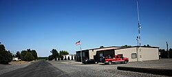
Paterson - rural fire department - July 2013.JPG
USA Washington location map.svg
Red pog.svg
Paterson
Location within the state of Washington
Coordinates: 45°56′13″N119°36′10″W / 45.93694°N 119.60278°W / 45.93694; -119.60278
Country United States
State Washington
County Benton
Elevation
[1]
384 ft (117 m)
Time zone UTC-8 (Pacific (PST))
  Summer (DST) UTC-7 (PDT)
ZIP code
99345 [2]
Area code 509
GNIS feature ID1511216 [1]

Paterson is an unincorporated community in Benton County, Washington, United States, located on the northern banks of the Columbia River at the junction of Washington State Route 14 and Washington State Route 221. [3] It was named for early settler Henry Paterson. [4]

Paterson residential area as seen in July 2013. Paterson Residential district - July 2013.JPG
Paterson residential area as seen in July 2013.

Climate

According to the Köppen Climate Classification system, Paterson has a semi-arid climate, abbreviated "BSk" on climate maps. [5]

References

  1. 1 2 U.S. Geological Survey Geographic Names Information System: Paterson, Washington
  2. "Paterson ZIP Code". zipdatamaps.com. 2022. Retrieved November 30, 2022.
  3. "Paterson, Washington WA, profile (Benton County) - hotels, festivals, genealogy, newspapers - ePodunk". Archived from the original on September 7, 2007. Retrieved May 23, 2008.
  4. Meany, Edmond S. (1923). Origin of Washington geographic names. Seattle: University of Washington Press. p. 209.
  5. Climate Summary for Paterson, Washington