Paterson, Washington

Last updated

Paterson
Paterson - rural fire department - July 2013.JPG
USA Washington location map.svg
Red pog.svg
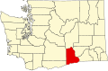
Paterson
Location within the state of Washington
Coordinates: 45°56′13″N119°36′4″W / 45.93694°N 119.60111°W / 45.93694; -119.60111
Country United States
State Washington
County Benton
Time zone UTC-8 (Pacific (PST))
  Summer (DST) UTC-7 (PDT)
ZIP code
99345 [1]
Area code 509
Paterson residential area as seen in July 2013. Paterson Residential district - July 2013.JPG
Paterson residential area as seen in July 2013.

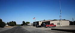
Paterson is an unincorporated community in Benton County, Washington, United States, located on the northern banks of the Columbia River at the junction of Washington State Route 14 and Washington State Route 221. [2] It was named for early settler Henry Paterson. [3]

Climate

According to the Köppen Climate Classification system, Paterson has a semi-arid climate, abbreviated "BSk" on climate maps. [4]

Related Research Articles

<span class="mw-page-title-main">Corvallis, Oregon</span> City in Oregon, United States

Corvallis is a city and the county seat of Benton County in central western Oregon, United States. It is the principal city of the Corvallis, Oregon Metropolitan Statistical Area, which encompasses all of Benton County. As of the 2020 United States Census, the population was 59,922. Corvallis is the location of Oregon State University and Good Samaritan Regional Medical Center. Corvallis is the westernmost city in the contiguous 48 states with a population larger than 50,000.

<span class="mw-page-title-main">Benton County, Washington</span> County in Washington, United States

Benton County is a county in the south-central portion of the U.S. state of Washington. As of the 2020 census, its population was 206,873. The county seat is Prosser, and its largest city is Kennewick. The Columbia River demarcates the county's north, south, and east boundaries.

<span class="mw-page-title-main">Passaic County, New Jersey</span> County in New Jersey, United States

Passaic County is a county in the U.S. state of New Jersey that is part of the New York metropolitan area. As of the 2020 United States census, the county was the state's eighth-most-populous county, with a population of 524,118, its highest decennial count ever and an increase of 22,892 (+4.6%) from the 2010 census count of 501,226, which in turn reflected an increase of 12,177 (+2.5%) from the 489,049 counted in the 2000 census. The most populous place in Passaic County is Paterson, with 159,732 residents at the 2020 Census, more than 29% of the county's population, while West Milford covered 80.32 square miles (208.0 km2), the largest total area of any municipality and more than 40% of the county's area.

<span class="mw-page-title-main">Washington County, Arkansas</span> County in Arkansas, United States

Washington County is a regional economic, educational, and cultural hub in the Northwest Arkansas region. Created as Arkansas's 17th county on November 30, 1848, Washington County has 13 incorporated municipalities, including Fayetteville, the county seat, and Springdale. The county is also the site of small towns, bedroom communities, and unincorporated places. The county is named for George Washington, the first President of the United States.

<span class="mw-page-title-main">Benton County, Arkansas</span> County in Arkansas, United States

Benton County is a county within the Northwest Arkansas region with a culture, economy, and history that have transitioned from rural and agricultural to suburban and white collar since the growth of Walmart, which is headquartered in Benton County. Created as Arkansas's 35th county on September 30, 1836, Benton County contains thirteen incorporated municipalities, including Bentonville, the county seat, and Rogers, the most populous city. The county was named after Thomas Hart Benton, a U.S. Senator from Missouri influential in Arkansas statehood.

<span class="mw-page-title-main">New Jersey Route 7</span> State highway in northern New Jersey, US

Route 7 is a state highway in the northern part of New Jersey in the United States. It has two sections, an east–west alignment running from U.S. Route 1/9 Truck in Jersey City to Route 21 in Belleville, and a north–south alignment running from the Newark/Belleville to the Nutley/Clifton border. The New Jersey Department of Transportation (NJDOT) lists Route 7 as a single north–south highway with a small gap between the alignments. The entire highway has a combined length of 9.46 mi (15.22 km).

<span class="mw-page-title-main">Bentonville, Arkansas</span> City in Arkansas, United States

Bentonville is the tenth-largest city in Arkansas, United States and the county seat of Benton County. The city is centrally located in the county with Rogers adjacent to the east. The city is the birthplace of and world headquarters location of Walmart, the world's largest retailer. It is one of the four main cities in the three-county Northwest Arkansas Metropolitan Statistical Area, which is ranked 105th in terms of population in the United States with 546,725 residents in 2020, according to the United States Census Bureau. The city itself had a population of 54,164 at the 2020 Census, an increase of 53% from the 2010 Census. Bentonville is considered to be one of the fastest growing cities in the state and consistently ranks amongst the safest cities in Arkansas. It is included in the Fayetteville–Springdale–Rogers Metropolitan Statistical Area.

<span class="mw-page-title-main">Springdale, Arkansas</span> City in Arkansas, United States

Springdale is the fourth-largest city in Arkansas, United States. It is located in both Washington and Benton counties in Northwest Arkansas. Located on the Springfield Plateau deep in the Ozark Mountains, Springdale has long been an important industrial city for the region. In addition to several trucking companies, the city is home to the world headquarters of Tyson Foods, the world's largest meat producing company. Originally named Shiloh, the city changed its name to Springdale when applying for a post office in 1872. It is included in the four-county Northwest Arkansas Metropolitan Statistical Area, which is ranked 102nd in terms of population in the United States with 546,725 in 2020 according to the United States Census Bureau. The city had a population of 84,161 at the 2020 Census.

<span class="mw-page-title-main">Benton Harbor, Michigan</span> City in Michigan, United States

Benton Harbor is a city in Berrien County in the U.S. state of Michigan. It is 46 miles southwest of Kalamazoo and 71 miles southwest of Grand Rapids. According to the 2020 census, its population was 9,103. It is the smaller, by population, of the two principal cities in the Niles–Benton Harbor Metropolitan Statistical Area, an area with 156,813 people. Benton Harbor and the city of St. Joseph are separated by the St. Joseph River and are known locally as the "Twin Cities". Fairplain and Benton Heights are unincorporated areas adjacent to Benton Harbor.

<span class="mw-page-title-main">Fort Benton, Montana</span> City in Montana, United States

Fort Benton is a city in and the county seat of Chouteau County, Montana, United States. Established in 1846, Fort Benton is the oldest continuously occupied settlement in Montana. Fort Benton was the most upstream navigable port on the Mississippi River System, and is considered "the world’s innermost port".

<span class="mw-page-title-main">Camden, Tennessee</span> City in Tennessee, United States

Camden is a city in Benton County, Tennessee. The population was 3,674 at the 2020 census. It is the county seat of Benton County.

<span class="mw-page-title-main">Washington State Route 14</span> Highway in Washington

State Route 14 (SR 14) is a 180.66-mile-long (290.74 km) state highway in the U.S. state of Washington. The highway travels east-west on the north side of the Columbia River, opposite Interstate 84 (I-84) to the south in Oregon. SR 14 forms a section of the Lewis and Clark Trail Scenic Byway and begins at an interchange with I-5 in Vancouver. The highway travels east as a four-lane freeway through Camas and Washougal and intersects I-205. SR 14 continues east as a two-lane highway through Clark, Skamania, Klickitat, and Benton counties before it ends at an interchange with I-82 and U.S. Route 395 (US 395) near Plymouth.

<span class="mw-page-title-main">Alsea, Oregon</span> Unincorporated community in the state of Oregon, United States

Alsea is an unincorporated community in Benton County, in the U.S. state of Oregon. It is on Oregon Route 34 and the Alsea River. For statistical purposes, the United States Census Bureau has defined Alsea as a census-designated place (CDP). The census definition of the area may not precisely correspond to local understanding of the area with the same name. As of the 2020 Census, the population was 165.

<span class="mw-page-title-main">Horse Heaven Hills</span> Range of hills in Washington, U.S.

The Horse Heaven Hills are a long range of high, rolling hills in Klickitat, Yakima, and Benton counties in Washington. The hills are an anticline ridge in the Yakima Fold Belt formed by north–south compression of lava flows in the Columbia River Basalt Group. The highest point is Bickleton Ridge in the west end of the hills. They lie within the rain shadow to the east of the Cascade Range, making them significantly drier and hotter than regions west of the Cascades.

<span class="mw-page-title-main">Benton, California</span> Census-designated place in California, United States

Benton is a census-designated place (CDP) in Mono County, California, United States. It includes the unincorporated communities of Benton and Benton Hot Springs and is 32 miles (51 km) north of the community of Bishop, at an elevation of 5,387 feet (1,642 m). The population of the CDP was 279 at the 2020 census.

<span class="mw-page-title-main">Washington State Route 221</span> Highway in Washington

State Route 221 (SR 221) is a 25.95-mile (41.76 km) long state highway located entirely within Benton County, Washington, United States. The highway serves to connect the unincorporated community of Paterson to the county seat Prosser. The highway has existed since at least 1926 and was designated as Primary State Highway 8E from 1937 until the 1964 renumbering of Washington state highways.

<span class="mw-page-title-main">Washington State Route 224</span> Highway in Washington

State Route 224 (SR 224) is a 10.15-mile (16.33 km) long state highway located entirely in Benton County, Washington, United States. The highway serves to connect SR 225 to Interstate 82 (I-82) and U.S. Route 12 (US 12), and to link Benton City to West Richland and Richland. Before the 1964 state highway renumbering the highway was numbered Secondary State Highway 3R. SR 224 is a lightly traveled rural highway except through Richland, where an average of 16,000 cars traveled the highway daily in 2009. The Washington State Department of Transportation (WSDOT) rebuilt its southern terminus as a roundabout in 2016, as part of a project to improve traffic congestion near the Red Mountain AVA.

The Vernita Bridge is a bridge on Washington State Route 24 over the Columbia River between Grant County and Benton County, located approximately 10 miles (16 km) south of Desert Aire and Mattawa, Washington. The bridge is in the Hanford Reach National Monument near the Hanford Site.

Spanish Transportation, officially Spanish Transportation Service Corporation, and operating under the name Express Service, is a privately operated bus company, which leases minibuses to individual operators, who provide service in and between various communities in northeastern New Jersey and to Manhattan in New York City. The fleet consists mostly of jitneys, often called "the Spanish bus" or "dollar vans" by their English-speaking users, or guaguas by their majority-Spanish clientele.

<span class="mw-page-title-main">Tri-Cities metropolitan area</span> Metropolitan statistical area in Washington, United States

The Kennewick–Pasco–Richland metropolitan area—colloquially referred to as the Tri-Cities metropolitan area, and officially known as the Kennewick–Richland, WA Metropolitan Statistical Area—is a metropolitan area consisting of Benton and Franklin counties in Washington state, anchored by the cities of Kennewick, Pasco, and Richland. As of July 1, 2022, the U.S. Census Bureau estimates the population of the metropolitan area to be 311,469, making it the third-largest metropolitan area located entirely in Washington, after the Seattle metropolitan area and the Spokane metropolitan area. Although it is located outside of the metropolitan area, the CDP of Burbank is part of the Tri-Cities urban area.

References

  1. "Paterson ZIP Code". zipdatamaps.com. 2022. Retrieved November 30, 2022.
  2. Paterson, Washington WA, profile (Benton County) - hotels, festivals, genealogy, newspapers - ePodunk
  3. Meany, Edmond S. (1923). Origin of Washington geographic names. Seattle: University of Washington Press. p. 209.
  4. Climate Summary for Paterson, Washington