Finley, Washington | |
---|---|
Coordinates: 46°09′32″N119°01′26″W / 46.15889°N 119.02389°W | |
Country | United States |
State | Washington |
County | Benton |
Area | |
• Total | 14.6 sq mi (37.7 km2) |
• Land | 11.5 sq mi (29.8 km2) |
• Water | 3.0 sq mi (7.9 km2) |
Elevation | 341 ft (104 m) |
Population (2020) | |
• Total | 6,152 |
• Density | 501.2/sq mi (193.5/km2) |
Time zone | UTC-8 (Pacific (PST)) |
• Summer (DST) | UTC-7 (PDT) |
ZIP code | 99337 |
Area code | 509 |
FIPS code | 53-23865 [2] |
GNIS feature ID | 2408211 [1] |
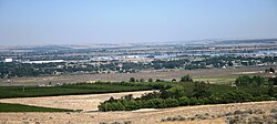
Finley is a census-designated place (CDP) in Benton County, Washington, United States. The population was 6,152 at the 2020 census. It is located to the southeast of the larger city of Kennewick.
A post office called Finley was established in 1906, and remained in operation until 1935. [3] The community was named after George E. Finley, a pioneer settler. [4] It includes the community of Hedges.
According to the United States Census Bureau, the CDP has a total area of 14.6 square miles (37.7 km2), of which, 11.5 square miles (29.8 km2) of it is land and 3.0 square miles (7.9 km2) of it (20.88%) is water.
Census | Pop. | Note | %± |
---|---|---|---|
1990 | 4,897 | — | |
2000 | 5,770 | 17.8% | |
2010 | 6,012 | 4.2% | |
2020 | 6,152 | 2.3% | |
U.S. Decennial Census |
As of the census [2] of 2000, there were 5,770 people, 1,987 households, and 1,585 families residing in the CDP. The population density was 501.2 people per square mile (193.6/km2). There were 2,082 housing units at an average density of 180.8/sq mi (69.8/km2). The racial makeup of the CDP was 91.40% White, 0.03% African American, 1.11% Native American, 0.24% Asian, 0.12% Pacific Islander, 4.71% from other races, and 2.37% from two or more races. Hispanic or Latino of any race were 8.99% of the population.
There were 1,987 households, out of which 39.1% had children under the age of 18 living with them, 62.7% were married couples living together, 10.5% had a female householder with no husband present, and 20.2% were non-families. 14.9% of all households were made up of individuals, and 4.3% had someone living alone who was 65 years of age or older. The average household size was 2.90 and the average family size was 3.19.
In the CDP, the age distribution of the population shows 29.5% under the age of 18, 8.4% from 18 to 24, 28.5% from 25 to 44, 24.8% from 45 to 64, and 8.8% who were 65 years of age or older. The median age was 36 years. For every 100 females, there were 101.7 males. For every 100 females age 18 and over, there were 101.8 males.
The median income for a household in the CDP was $42,820, and the median income for a family was $47,983. Males had a median income of $41,103 versus $23,818 for females. The per capita income for the CDP was $17,282. About 6.2% of families and 6.5% of the population were below the poverty line, including 9.1% of those under age 18 and 8.4% of those age 65 or over.
Honalo is a census-designated place (CDP) in Hawaiʻi County, Hawaiʻi, United States. The population was 2,423 at the 2010 census, up from 1,987 at the 2000 census.
Mount Lena is a census-designated place (CDP) in Washington County, Maryland, United States. The population was 547 at the 2020 census.
Wilson-Conococheague is a census-designated place (CDP) in Washington County, Maryland, United States. The population was 2,262 at the 2020 census.
Finley Point is a census-designated place (CDP) in Lake County, Montana, United States. As of the 2010 census the population was 480.
Evaro is a census-designated place (CDP) in Missoula County, Montana, United States, and part of the Missoula metropolitan area. It is located on the southernmost part of the Flathead Indian Reservation, approximately 20 miles (32 km) north of downtown Missoula via US Highway 93. As of the 2020 census, the population of the CDP was 373, up from 322 in 2010.
Turpin Hills is a census-designated place (CDP) in Anderson Township, Hamilton County, Ohio, United States. The population was 5,162 at the 2020 census.
Montrose-Ghent is a census-designated place (CDP) in Summit County, Ohio, United States, composed of the unincorporated communities of Montrose and Ghent. The population was 5,254 at the 2020 census. It is part of the Akron Metropolitan Statistical Area.
Thompsonville is a census-designated place (CDP) in Washington County, Pennsylvania, United States. The population was 3,520 at the 2010 census.
Highland is a unincorporated community and census-designated place (CDP) in Benton County, Washington, United States. The population was 3,388 at the 2000 census.
East Hill-Meridian is a former census-designated place (CDP) in King County, Washington. The population was 29,878 at the time of the 2010 census. The majority of the census area is now within the limits of Kent and Renton.
Parkwood is a census-designated place (CDP) in Kitsap County, Washington, United States. The population was 7,635 at the 2020 census.
Skokomish is a census-designated place (CDP) in Mason County, Washington, United States. The population was 617 at the 2010 census. The town is the headquarters of the Skokomish Indian Tribe.
Canyon Creek is a census-designated place (CDP) in Snohomish County, Washington, United States. The population was 3,445 at the 2020 census, up from 3,200 at the 2010 census. Prior to the 2010 census, the CDP was known as Jordan Road-Canyon Creek.
Lake Bosworth is a census-designated place (CDP) in Snohomish County, Washington, United States. The population was 868 at the 2020 census, up from 667 at the 2010 census.
Lake Ketchum is a census-designated place (CDP) in Snohomish County, Washington, United States. The population was 1,268 at the 2020 census, up from 930 at the 2010 census.
Lake Roesiger is a census-designated place (CDP) in Snohomish County, Washington, United States. The population was 611 at the 2020 census, up from 503 at the 2010 census.
Three Lakes is a census-designated place (CDP) in Snohomish County, Washington, United States. The population was 3,941 at the 2020 census.
Verlot is a census-designated place (CDP) in Snohomish County, Washington, United States. The population was 340 at the 2020 census.
Woods Creek is a census-designated place (CDP) in Snohomish County, Washington, United States. The population was 6,017 at the 2020 census.
Otis Orchards-East Farms is a census-designated place (CDP) in Spokane County, Washington, United States, near the county's border with Idaho. The population was 6,299 at the 2020 census. The CDP includes the unincorporated communities of Otis Orchards and East Farms. Otis Orchards contains the bulk of the businesses of the community.