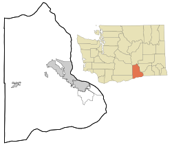
Whitstran is a small, unincorporated community in Benton County, Washington, located approximately four miles Northeast of Prosser and approximately ten miles west of Benton City. The focal point of the community is at the intersection of North Rothrock Road and Foisy Road, where there is a small grocery store, and nearby Whitstran Elementary School.
Donald is a census-designated place and unincorporated community in Yakima County, Washington, United States. The population was 91 at the 2010 census.

Sawyer is an unincorporated community in Yakima County, Washington, United States.
Yethonat is an unincorporated community in Yakima County, Washington, United States. The community developed along the Toppenish, Simcoe and Western Railway Company line. Yethonat is located between Wapato and Toppenish off U.S. Route 97 and is a small, rural agricultural community.
Ashue is an unincorporated community in Yakima County, Washington, United States, located approximately two mile southwest of Wapato.
Farron is an unincorporated community in Yakima County, Washington, United States, located approximately five miles southwest of Wapato.
Flint is an unincorporated community in Yakima County, Washington, United States, located approximately three miles east of Wapato.
Holtzinger is an unincorporated community in Yakima County, Washington, United States, located approximately five miles northwest of Yakima.
Venner is an unincorporated community in Yakima County, Washington, United States, located approximately four miles southwest of Wapato.
Nass is an unincorporated community in Yakima County, Washington, United States, located approximately one mile east of Granger.
Lichty is an unincorporated community in Yakima County, Washington, United States, located between Sunnyside and Grandview on U.S. Route 12.
Byron is an unincorporated community in Yakima County, Washington, United States, located approximately three miles west of Prosser.
Birchfield is an unincorporated community in Yakima County, Washington, United States, located between Terrace Heights and Moxee.
Pomona is an unincorporated community in Yakima County, Washington, United States, located immediately northeast of Selah.
Weikel is an unincorporated community in Yakima County, Washington, United States, located approximately one mile north of Yakima, adjacent to Cowiche Creek, at the west end of Cowiche Canyon.
Fruitvale is an unincorporated community in Yakima County, Washington, United States, located within the north city limits of Yakima.
Badger is an unincorporated community in Benton County, Washington, United States, located approximately three miles southwest of Richland, near Badger Springs and Badger Canyon.
Berrian was an unincorporated community in Benton County, Washington, located approximately nine miles east of Umatilla, Oregon, on the north bank of the Columbia River.

Gibbon is an unincorporated community in Benton County, Washington, United States, between Prosser and Benton City.
Longview is an unincorporated historic community in Benton County, Washington, United States, located approximately three miles west of Umatilla, Oregon on the north bank of the Columbia River, just above Devil's Bend Rapids.


