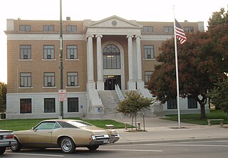
Pawnee County is a county located in the U.S. state of Kansas. Its county seat and largest city is Larned. As of the 2020 census, the county population was 6,253. The county is named after the Pawnee tribe.

Ellsworth County is a county located in the U.S. state of Kansas. Its county seat and most populous city is Ellsworth. As of the 2020 census, the county population was 6,376. The county was named after Fort Ellsworth.

Edwards County is a county located in the U.S. states of Kansas. Its county seat and most populous city is Kinsley. As of the 2020 census, the county population was 2,907, The county was founded in 1874 and named for W. C. Edwards, of Hutchinson, a pioneer settler who owned much land in the area.

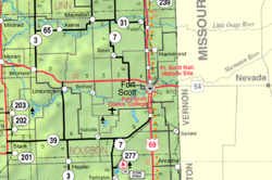
Bourbon County is a county located in Southeast Kansas. Its county seat and most populous city is Fort Scott. As of the 2020 census, the county population was 14,360. The county was named after Bourbon County, Kentucky, the former home of many early settlers.

Fort Larned National Historic Site preserves Fort Larned which operated from 1859 to 1878. It is approximately 5.5 miles (8.9 km) west of Larned, Kansas, United States.

Xenia is an unincorporated community in Franklin Township, Bourbon County, Kansas, United States.

Pawnee Township is a township in Bourbon County, Kansas, United States. As of the 2000 census, its population was 308.

Aulne is an unincorporated community in Marion County, Kansas, United States. The Aulne name was suggested by officials of the railroad when it was built through Aulne during the 19th century. It is located southwest of Marion at the intersection of Pawnee Road and 140th Street next to the Union Pacific Railroad.

Canada is an unincorporated community in Marion County, Kansas, United States. It is named for many Canadian immigrants coming to the area. It is located between Hillsboro and Marion about 0.5 miles south of the intersection of Nighthawk Road and U.S. Route 56 highway, southwest of the Hillsboro Cove of the Marion Reservoir.
Melville Judson Salter was a politician and civic leader who was twice elected the eighth Lieutenant Governor of Kansas serving under Governor Thomas A. Osborn.

Hiattville is an unincorporated community in Bourbon County, Kansas, United States.
Ash Valley is an unincorporated community in Pawnee County, Kansas, United States.
Frizell is an unincorporated community in Pawnee County, Kansas, United States.
Sanford is an unincorporated community in Pawnee County, Kansas, United States.

Hammond is an unincorporated community in Bourbon County, Kansas, United States.

Barnesville is an unincorporated community in Bourbon County, Kansas, United States.

Porterville is an unincorporated community in Bourbon County, Kansas, United States.

Godfrey is an unincorporated community in Bourbon County, Kansas, United States.

Harding is an unincorporated community in Bourbon County, Kansas, United States.
Zook is an unincorporated community in Pawnee County, Kansas, United States. It is located approximately 8 miles south of Larned east of the intersection of K-19 highway and East Rd.


