Tulare County is a county located in the U.S. state of California. As of the 2020 census, the population was 473,117. The county seat is Visalia. The county is named for Tulare Lake, once the largest freshwater lake west of the Great Lakes. Drained for agricultural development, the site is now in Kings County, which was created in 1893 from the western portion of the formerly larger Tulare County.

Linn County is a county located in east-central Kansas and is part of the Kansas City metropolitan area. As of the 2020 census, the county population was 9,591. Its county seat is Mound City, and its most populous city is Pleasanton. The county was named for Lewis F. Linn, a U.S. Senator from Missouri.

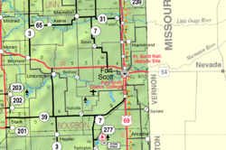
Bourbon County is a county located in Southeast Kansas. As of the 2020 census, the county population was 14,360. Its county seat and most populous city is Fort Scott.

Porterville is a city in the San Joaquin Valley, in Tulare County, California, United States. It is part of the Visalia-Porterville metropolitan statistical area. Since its incorporation in 1902, the city's population has grown as it annexed nearby unincorporated areas. The city's July 2019 population was estimated at 59,599.

Mapleton is a city in Bourbon County, Kansas, United States. As of the 2020 census, the population of the city was 96.

Redfield is a city in Bourbon County, Kansas, United States. As of the 2020 census, the population of the city was 90.

Xenia is an unincorporated community in Franklin Township, Bourbon County, Kansas, United States.

St. Joseph is an unincorporated community in Cloud County, Kansas, United States.
Porterville is a census-designated place and unincorporated community in Kemper County, Mississippi. It lies a slight distance away from U.S. Route 45 southeast of the city of De Kalb, the county seat of Kemper County. Its elevation is 200 feet (61 m). It has a post office with the ZIP code 39352. It is adjacent to Lake Porterville.

Garland is an unincorporated community in Bourbon County, Kansas, United States. As of the 2020 census, the population of the community and nearby areas was 31. It is located along the Missouri state line 8.5 miles (13.7 km) southeast of Fort Scott.
Porterville, also known as Eaton, is an unincorporated community in Crawford County, Illinois, United States. Porterville is 6 miles (9.7 km) north-northwest of Robinson. The community was platted as East Berlin and first saw growth when Richard Porter opened a blacksmith shop there in 1850. A post office opened under the name Eaton in 1852 and closed at a later date.

Hiattville is an unincorporated community in Bourbon County, Kansas, United States.

Marmaton is an unincorporated community in Bourbon County, Kansas, United States. The community is located three miles east of Redfield, and two miles south of U.S. Route 54, at the intersection of 155th Street and Limestone Road.

Devon is an unincorporated community in Bourbon County, Kansas, United States. As of the 2020 census, the population of the community and nearby areas was 71.

Pawnee Station is an unincorporated community in Bourbon County, Kansas, United States.

Hammond is an unincorporated community in Bourbon County, Kansas, United States.

Berlin is an unincorporated community in Bourbon County, Kansas, United States.

Barnesville is an unincorporated community in Bourbon County, Kansas, United States.

Godfrey is an unincorporated community in Bourbon County, Kansas, United States.

Harding is an unincorporated community in Bourbon County, Kansas, United States.


