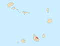
Santiago is the largest island of Cape Verde, its most important agricultural centre and home to half the nation’s population. Part of the Sotavento Islands, it lies between the islands of Maio and Fogo. It was the first of the islands to be settled: the town of Ribeira Grande was founded in 1462. Santiago is home to the nation's capital city of Praia.
Santa Cruz is a concelho (municipality) of Cape Verde. It is situated in the eastern part of the island of Santiago. Its seat is the city Pedra Badejo. Its population was 26,617 at the 2010 census, and its area is 112.2 km2.
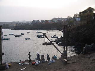
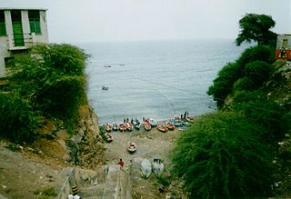
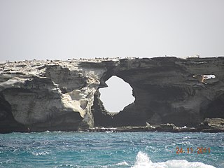
Pedra Badejo is a city in the eastern part of the island of Santiago, Cape Verde. It is situated on the east coast, 25 km north of the island capital Praia, 8 km southeast of Calheta de São Miguel and 15 km east of Assomada. It is the seat of Santa Cruz municipality. At the 2010 census, the town had 9,859 inhabitants.

Monte Gordo is a mountain on the island of São Nicolau, Cape Verde. At 1,312 m elevation, it is the island's highest point. It is situated in the western part of the island, 6 km west of the island capital Ribeira Brava. The mountain is of volcanic origin, less than 1 million years old. The boundary of the municipalities Tarrafal de São Nicolau and Ribeira Brava runs over the mountain. It is part of the Monte Gordo Natural Park.

Achada Fazenda is a settlement in the eastern part of the island of Santiago, Cape Verde. In 2010 its population was 2,592. It is situated near the east coast, 2 km southeast of Pedra Badejo, near the estuary of the Ribeira Seca.
Achada Monte is a town in the northern part of the island of Santiago, Cape Verde and is part of the municipality of São Miguel. It is situated near the east coast, 8 km northwest of Calheta de São Miguel. In 2010 its population was 1,652. It is on the road connecting Praia and Tarrafal through Pedra Badejo, the EN1-ST02. The small bay Mangue de Sete Ribeiras is located east of the settlement. Ribeira Principal flows west of the village.
Jubho Lagoon is a large shallow brackish lagoon located in Sindh, Pakistan. In May 2011 Jubhoo lagoon was inducted into the list of Ramsar sites, consisting of wetlands of international importance.

Bertha's Beach Important Bird Area comprises 3300 ha of coastal wetlands at the entrance to Choiseul Sound, on the east coast of East Falkland, in the Falkland Islands. It lies about 8 km south-east of Mount Pleasant Airport and 40 km south-west of Stanley. It has been identified by BirdLife International as an Important Bird Area (IBA) because of its significancer for a variety of migratory waders and other waterbirds. Overlapping it is the 4000 ha Bertha's Beach Ramsar site, recognising it as a wetland of international importance.

Lagoa da Fajã dos Cubres is a lagoon located in the parish of Ribeira Seca, on the north coast of the Portuguese island of São Jorge. The lagoon was listed along with Lagoa da Caldeira as a "Wetland of International Importance" under the Ramsar Convention in 2005. The term fajã refers to the plain areas created from landslides of the abrupt coastal cliffs.

Lagoa da Fajã de Santo Cristo is a lagoon located on the north coast of the Portuguese island of São Jorge. The lagoon was listed along with Lagoa da Fajã dos Cubres as a "Wetland of International Importance" under the Ramsar Convention in 2005. The fajãs and coastal area connecting the two lagoons make up the remainder of the wetland.
Logan Lagoon is a 2172 ha wetland Conservation Area on Flinders Island, the largest of the Furneaux Group at the eastern end of Bass Strait, which is part of the Australian state of Tasmania.
The Ilhéu de Curral Velho and adjacent coast Important Bird Area lies in the southeastern part of the island of Boa Vista in the Cape Verde archipelago off the coast of north-west Africa in the Atlantic Ocean. It is a 986 ha site consisting of the Ilhéu de Curral Velho, as well as the area opposite it on Boa Vista centred on the deserted village of Curral Velho. It was designated as a Ramsar wetland of international importance on July 18, 2005.
Montanha is a settlement in the central part of the island of Santiago, Cape Verde. It is situated 2 km north of João Teves and 8 km southwest of Pedra Badejo. The area is intensively farmed; mainly maize, beans and sugar-cane.

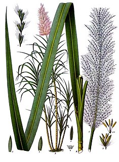
The Lagoa do Rabil is a wetland site in the Cape Verde archipelago, on the island of Boa Vista. It has been recognised as a wetland of international importance by designation under the Ramsar Convention since 2005. The site lies at the mouth of the seasonally flowing Ribeira do Rabil, near the town of Rabil on the west coast of Boa Vista. The site comprises the river mouth, the associated lagoon, the surrounding dunes system and its vegetation dominated by Tamarix, Cyperus, Zygophyllum and Euphorbia species. The site supports a population of Iago sparrows and several species of waders, including Eurasian spoonbill. The endemic lizards Hemidactylus bouvieri and Chioninia stangeri are present.
Ribeira do Rabil is a seasonal stream in the central and western part of the island of Boa Vista in Cape Verde. It is 27 km long, and its basin area is 199 km2 (77 sq mi). Its source is in the southeastern part of the island, north of the island's highest point Monte Estância. It flows generally northwest, passes east of the town Rabil and flows into the Atlantic Ocean near the Aristides Pereira International Airport. The estuary, Lagoa do Rabil, is an important wetland area.
Lagoa Cimidor is a small coastal lagoon in the southeastern part of the island of Maio in Cape Verde. It is situated 3.5 km northeast of the village Ribeira Dom João and 13 km east of the island capital Cidade do Maio. It is part of a 3.89 km2 (1.50 sq mi) protected area which also includes the adjacent coast. One of the largest permanent bodies of water on the island, it is an important area for birds and turtles.
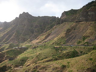
EN1-ST01 is a first class national road on the island of Santiago, Cape Verde. It runs from the capital Praia in the south to Tarrafal in the north, through the mountainous interior of the island. It is 61 km long. The main intersections are:

Ribeira Seca is the largest stream of the island of Santiago in Cape Verde. It is 18 km (11 mi) long and its basin area is 71.5 km2 (27.6 sq mi). Located in the eastern part of the island, it flows through the municipalities of São Lourenço dos Órgãos and Santa Cruz. Its source is near the highest point of the island, Pico de Antónia, from where it flows to the east to João Teves. It turns to the northeast and flows into the Atlantic Ocean at Achada Fazenda, 2 km southeast of Pedra Badejo. It is called Ribeira de Pico da Antónia in its uppermost part, and Ribeira de Lage near João Teves.

Salinas of the English Port is a saline wetland in the southwestern part of the island of Maio, Cape Verde, northwest of the city Porto Inglês. It is a 5.34 km2 (2.06 sq mi) protected area and a Ramsar site. It encompasses ecological, landscape, historical and cultural values. The site is frequented by species of birds of conservation interest, some of them protected by national laws and international conventions, and some endemic to the archipelago.