
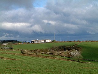
Penelewey is a hamlet southeast of Playing Place in Cornwall, England, UK. [1] Penelewey is on the B3289 road. [2]
Penelewey is a hamlet southeast of Playing Place in Cornwall, England, UK. [1] Penelewey is on the B3289 road. [2]

St Anthony-in-Meneage is a coastal civil parish and village in Cornwall, England, United Kingdom. The parish is in the Meneage district of the Lizard peninsula. In the 2001 census the parish had a population of 171, decreasing to 168 at the 2011 census.

Blowinghouse is the name of two settlements in Cornwall, England, United Kingdom.

Bodrean and Frogmore are farmstead settlements in Cornwall, England, United Kingdom, situated two miles north-northeast of Truro.

Chiverton Cross is a road junction in west Cornwall, England, United Kingdom, about four miles north-east of Redruth and five miles (8 km) west of Truro at OS grid ref SW747469. Its name derives from Chyverton House which is in the extreme east of the parish of Perranzabuloe.

New Mills is a hamlet in Cornwall, England, United Kingdom. It is situated in a wooded valley north of Ladock approximately seven miles (11 km) northeast of Truro at OS grid reference SW899523.

Chynhale is a house near Callestick in mid Cornwall, England. Chynhale is in the civil parish of Perranzabuloe and is situated 3.7 miles (6.0 km) east of St Agnes.
Cox Hill is a hamlet in the parish of Chacewater, Cornwall, England.

Gillan is a hamlet in the parish of St Anthony-in-Meneage, Cornwall, England. Gillan Creek is one of the creeks of the Helford River.

Gloweth is a housing estate west of Treliske on the western outskirts of Truro in Cornwall, England.
Hale Mills is a hamlet in the parish of Chacewater, Cornwall, England.

Halvosso is a hamlet in the civil parish of Mabe in west Cornwall, England, UK. It is in the civil parish of Constantine.
Herniss is a hamlet in the civil parish of Mabe in west Cornwall, England. Herniss is on the A394 main road. It is in the civil parish of Stithians

Hick's Mill is a hamlet in Cornwall, England. It is about a mile southeast of Trewen on the River Inny. It is in the civil parish of Gwennap

Kerley Downs is a moorland southeast of Chacewater in Cornwall, England.
Newtown-in-St Martin is a hamlet in the parish of St Martin-in-Meneage, Cornwall, England. Newtown is south-southeast of St Martin's Green.

Paramoor is a hamlet near St Mewan in Cornwall, England. Paramoor is southwest of Sticker and Paramoor Wood is nearby.
Penwartha Coombe is a hamlet south of Perranporth, Cornwall, England.

Carrine Common & Penwethers is a Site of Special Scientific Interest (SSSI) in Cornwall, England, UK, noted for its biological characteristics. The 46-hectare (110-acre) site is located at the settlement of Penweathers, within the civil parish of Kea, half a mile south of the city of Truro.

Gerrans Bay to Camels Cove is a coastal Site of Special Scientific Interest (SSSI) in south Cornwall, England, UK, noted for both its biological and geological interest.

Meneage Coastal Section is a coastal Site of Special Scientific Interest (SSSI) in southern Cornwall, England, UK, noted for its geological characteristics.
| Unitary authorities | |
|---|---|
| Major settlements |
|
| Rivers | |
| Topics | |
Coordinates: 50°13′23″N5°03′43″W / 50.223°N 5.062°W
| | This Cornwall location article is a stub. You can help Wikipedia by expanding it. |