Allegheny County is a county in the Commonwealth of Pennsylvania. It is located in Southwestern Pennsylvania. As of the 2020 census, the population was 1,250,578, making it the state's second-most populous county, following Philadelphia County. The county seat is Pittsburgh. Allegheny County is included in the Pittsburgh, PA Metropolitan Statistical Area, and in the Pittsburgh Designated Market Area.

Harrison Township is a township in Allegheny County in the U.S. state of Pennsylvania. The population was 10,169 at the 2020 census. Pennsylvania Route 28 passes through Harrison Township connecting Kittanning to the northeast and Pittsburgh to the southwest. Allegheny Technologies has extensive steel mill facilities in Harrison Township, including its Allegheny Ludlum Brackenridge Works. Harrison Township is located at the far northeast corner of Allegheny County. Its northern border is the Butler County line and the Allegheny River forms the township's eastern boundary with Westmoreland County. Its northeast corner also touches Armstrong County.

The Allegheny Observatory is an American astronomical research institution, a part of the Department of Physics and Astronomy at the University of Pittsburgh. The facility is listed on the National Register of Historic Places and is designated as a Pennsylvania state and Pittsburgh History and Landmarks Foundation historic landmark.
Livermore, Pennsylvania is an abandoned town that was located on the Conemaugh River between Blairsville and Saltsburg in Derry Township, Westmoreland County, Pennsylvania. The town was abandoned and partially razed in the early 1950s following authorization by the Flood Control Act of 1936 and Flood Control Act of 1938 for construction of the Conemaugh Dam and Lake to prevent flooding of Pittsburgh. Much of the former town site now lies under the reservoir and floodplains.

Allegheny Center is a neighborhood on Pittsburgh's North Side. Its zip code is 15212, and it has representation on Pittsburgh City Council by both council members for District 6 and District 1 (Northside).

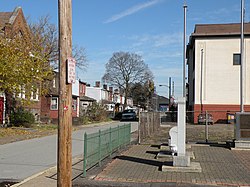
California-Kirkbride is a neighborhood on Pittsburgh, Pennsylvania's North Side.

Fineview — known to older generations as Nunnery Hill — is a neighborhood on Pittsburgh's North Side with expansive views of downtown Pittsburgh. The most famous of these views is from the Fineview Overlook at the corner of Catoma Street and Meadville Street.

This is a list of the National Register of Historic Places listings in Allegheny County, Pennsylvania.
Natrona Heights is an unincorporated community in Harrison Township, Allegheny County in the U.S. state of Pennsylvania. It is located in Western Pennsylvania within the Pittsburgh Metropolitan Statistical Area, approximately 24 miles (39 km) northeast of Pittsburgh. Natrona Heights is situated near the Allegheny River, Natrona, Brackenridge, and Tarentum.

The Allegheny Arsenal, established in 1814, was an important supply and manufacturing center for the Union Army during the American Civil War, and the site of the single largest civilian disaster during the war. It was located in the community of Lawrenceville, Pennsylvania, which was annexed by the city of Pittsburgh in 1868.
Salina is an unincorporated community in northern Westmoreland County, Pennsylvania, United States. Located near Route 819, it lies near communities such as Tinsmill and Avonmore. Salina also is located near Kiski Area School District's elementary school, Bell-Avon.

Natrona is an unincorporated community in Harrison Township, Allegheny County in the U.S. state of Pennsylvania. It is located in western Pennsylvania within the Pittsburgh Metropolitan Statistical Area, approximately 24 miles (39 km) northeast of Downtown Pittsburgh. Natrona is situated along the Allegheny River at Lock and Dam Four, Pools Three and Four between Brackenridge, Natrona Heights, Karns, Allegheny Township, and Lower Burrell.
Karns is an unincorporated community in Harrison Township, Allegheny County, Pennsylvania, USA; it is located in Western Pennsylvania within the Pittsburgh Metropolitan Statistical Area, approximately 24 miles (39 km) northeast of Pittsburgh. Karns is situated along the Allegheny River at Pool 4 across from Jacks Island just above Lock and Dam 4 between Natrona, Natrona Heights, and Sligo. The elevation of Karns is 817 feet above sea level.

Natrona Bottling Company is an independently-owned soft drink bottling company in Harrison Township, Pennsylvania that produces a line of soft drinks that uses cane sugar and is packaged in glass bottles. Located approximately 24 miles (39 km) northeast of Pittsburgh, the company is the last glass soda pop bottling company in Allegheny County.

Washington County History & Landmarks Foundation is a non-profit educational institution in Washington, Pennsylvania. Its purpose is to encourage and assist the preservation of historic structures in Washington County, Pennsylvania. The foundation operates its own landmark certification process, as well as working with the National Park Service to document and place landmarks on the National Register of Historic Places. It also offers advice and assistance for historic building owners who wish to preserve their facilities. Since its inception, the foundation has been successful in helping many historic building owners in the preservation of their structures.

The Walker-Ewing Log House is an historic, eighteenth century loghouse located in Collier Township, Allegheny County, Pennsylvania. Owned and managed by the Pioneers West Historical Society beginning in the 1990s, the home and land were acquired by the Allegheny Land Trust in 2020 with oversight responsibility for the building's preservation and easement given to the Western Pennsylvania Conservancy.

The H. J. Heinz Company complex, part of which is currently known as Heinz Lofts, is a historic industrial complex in the Troy Hill neighborhood of Pittsburgh, Pennsylvania. The buildings were built by the H. J. Heinz Company from 1907 through 1958. The complex is listed on the National Register of Historic Places (NRHP) and five of the buildings are listed as a Pittsburgh History and Landmarks Foundation Historic Landmark.

Pittsburgh Renaissance Historic District is a historic district in the Central Business District of Pittsburgh, Pennsylvania, United States. Bounded by Stanwix Street and the Allegheny, Monongahela and Ohio Rivers, it was listed on the National Register of Historic Places on May 2, 2013. It includes within its boundary the Forks of the Ohio, as well as Gateway Center, the Bell Telephone Company Building, and the Pittsburgh Post-Gazette Building which was constructed in 1927.

The Lawrenceville Historic District is a U.S. historic district in Pittsburgh, Pennsylvania, which encompasses the majority of the Lawrenceville neighborhood. The historic district includes 3,217 contributing resources, many of which are rowhouses, commercial buildings, and former industrial properties built between the 1830s and early 20th century. The district was listed on the National Register of Historic Places in 2019.