Pequod Mountain

Last updated
Pequod Mountain
Pequod Mountain, Pequod Glacier.jpg
East aspect in winter
Highest point
Elevation 2,979 m (9,774 ft) [1] [2]
Prominence 67 m (220 ft) [3]
Parent peak Mount Proteus (3,198 m) [3]
Isolation 0.263 km (0.163 mi) [3]
Listing Mountains of British Columbia
Coordinates 50°57′43″N117°23′56″W / 50.96194°N 117.39889°W / 50.96194; -117.39889 [4]
Naming
Etymology Pequod
Geography
Canada British Columbia relief location map.jpg
Red triangle with thick white border.svg
Pequod Mountain
Location of Pequod Mountain in British Columbia
Canada relief map 2.svg
Red triangle with thick white border.svg
Pequod Mountain
Pequod Mountain (Canada)
Country Canada
Province British Columbia
District Kootenay Land District
Parent range Selkirk Mountains
Battle Range
Topo map NTS 82K14 Westfall River [4]
Climbing
First ascent 1958 [5]

Pequod Mountain is a 2,979-metre (9,774-foot) summit in British Columbia, Canada.

Contents

Description

Pequod Mountain is located 0.5 km (0.31 mi) east of Moby Dick Mountain in the Battle Range of the Selkirk Mountains. [6] The remote peak is set approximately 10 km (6.2 mi) south of Glacier National Park. Precipitation runoff from the mountain drains north into headwaters of Butters Creek and south into Houston Creek which are both tributaries of the Duncan River. Pequod Mountain is more notable for its steep rise above local terrain than for its absolute elevation. Topographic relief is significant as the summit rises 1,500 meters (4,921 ft) above Houston Creek in 3 km (1.9 mi). The first ascent of the summit was made in 1958 by Douglas Anger, Bryan Mitchener and Daniel Neifert. [7]

Etymology

The landform is named after the Pequod , which was the whaling ship of Herman Melville's novel Moby-Dick that was published in 1851. [6] In turn, the ship was named for the Algonquian-speaking Pequot tribe of Native Americans. The name was submitted in 1960 by mountaineer Sam Silverstein of the Alpine Club of Canada and follows the Herman Melville-associated naming theme of the area established in 1958–59 by the Sam Silverstein-Douglas Anger climbing party. [6] The mountain's toponym was officially adopted on November 1, 1963, by the Geographical Names Board of Canada. [4]

Climate

Based on the Köppen climate classification, Pequod Mountain is located in a subarctic climate zone with cold, snowy winters, and mild summers. [8] Winter temperatures can drop below −20 °C with wind chill factors below −30 °C. This climate supports the Pequod Glacier on the east slope of the peak, the Moby Dick Glacier on the south slope, and an unnamed glacier on the north slope.

See also

Related Research Articles

<span class="mw-page-title-main">Mount Carr</span> Mountain in the country of Canada

Mount Carr is a 2,590-metre (8,497-foot) mountain summit located in British Columbia, Canada.

<span class="mw-page-title-main">Face Mountain (British Columbia)</span>

Face Mountain is a 2,485-metre (8,153-foot) mountain summit located in British Columbia, Canada.

<span class="mw-page-title-main">Flattop Peak</span> Mountain in British Columbia, Canada

Flattop Peak is a 3,063-metre (10,049-foot) summit in British Columbia, Canada.

<span class="mw-page-title-main">Mount Butters (British Columbia)</span>

Mount Butters is a 3,141-metre (10,305-foot) mountain summit in British Columbia, Canada.

<span class="mw-page-title-main">Omoo Peak</span>

Omoo Peak is a 2,674-metre (8,773-foot) mountain summit in British Columbia, Canada.

<span class="mw-page-title-main">Beaver Mountain (British Columbia)</span> Mountain in the country of Canada

Beaver Mountain is a 3,212-metre (10,538-foot) mountain summit in British Columbia, Canada.

<span class="mw-page-title-main">Mount Proteus</span> Mountain in the country of Canada

Mount Proteus is a 3,198-metre (10,492-foot) mountain summit in British Columbia, Canada.

<span class="mw-page-title-main">Typee Mountain</span>

Typee Mountain is a 2,897-metre (9,505-foot) summit in British Columbia, Canada.

<span class="mw-page-title-main">Moby Dick Mountain</span> Mountain in the country of Canada

Moby Dick Mountain is a 3,154-metre (10,348-foot) summit in British Columbia, Canada.

<span class="mw-page-title-main">Nautilus Mountain</span> Mountain in the country of Canada

Nautilus Mountain is a 3,130-metre (10,270-foot) summit in British Columbia, Canada.

<span class="mw-page-title-main">Outrigger Peak</span>

Outrigger Peak is a 2,850-metre (9,350-foot) mountain summit in British Columbia, Canada.

<span class="mw-page-title-main">Scylla Mountain</span> Mountain in the country of Canada

Scylla Mountain is a 2,920-metre (9,580-foot) summit in British Columbia, Canada.

<span class="mw-page-title-main">Wrong Peak</span> Mountain in the country of Canada

Wrong Peak is a 2,869-metre (9,413-foot) summit in British Columbia, Canada.

<span class="mw-page-title-main">Northpost Spire</span> Mountain in British Columbia, Canada

Northpost Spire is a 2,911-metre (9,551-foot) peak in British Columbia, Canada.

<span class="mw-page-title-main">Wallace Peak</span> Mountain in British Columbia, Canada

Wallace Peak is a 2,940-metre (9,650-foot) summit in British Columbia, Canada.

<span class="mw-page-title-main">Mount Nemo (British Columbia)</span>

Mount Nemo is a 2,901-metre (9,518-foot) summit in British Columbia, Canada.

<span class="mw-page-title-main">Mount English</span> Mountain summit in British Columbia, Canada

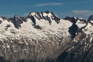
Mount English is a 2,680-metre (8,793-foot) mountain summit located in the Gold Range of the Monashee Mountains of British Columbia, Canada. Situated 17 km (11 mi) southwest of Revelstoke, this peak is visible from the Trans-Canada Highway and Revelstoke Mountain Resort ski slopes. Neighbors include Mount Macpherson 8 km (5.0 mi) to the northeast, Mount Tilley 5 km (3.1 mi) to the east, and Mount Begbie is 8 km (5.0 mi) to the east. Precipitation runoff from Mount English drains into tributaries of the Eagle River. Topographic relief is significant as the summit rises 1,540 meters (5,052 ft) above Wap Creek in 3 km (1.9 mi).

<span class="mw-page-title-main">Catamount Peak</span> Mountain peak in British Columbia

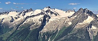
Catamount Peak is a 2,733-metre (8,967-foot) mountain located in Glacier National Park in British Columbia, Canada. Catamount Peak is part of the Hermit Range of the Selkirk Mountains and is 7 km (4.3 mi) west of Rogers Pass. It is approximately midway between Revelstoke and Golden. Neighbors include Cheops Mountain, 5.05 km (3.14 mi) to the east, and Ursus Major Mountain, 1.83 km (1.14 mi) to the northeast. Precipitation runoff from the mountain's south slope drains to Illecillewaet River via Cougar Brook, and the north slope drains to the Beaver River via Ursus Creek. Topographic relief is significant as the summit rises 1,230 metres (4,035 ft) above Ursus Creek in 2 km (1.2 mi) and 930 m (3,051 ft) above Cougar Brook in 1 km (0.62 mi). This peak is visible from the Trans-Canada Highway.

<span class="mw-page-title-main">Kumkan Peak</span>

Kumkan Peak is a 2,742-metre (8,996-foot) mountain summit located in British Columbia, Canada.

<span class="mw-page-title-main">Hall Peak (British Columbia)</span>

Hall Peak is a 3,048-metre (10,000-foot) mountain summit located in British Columbia, Canada.

References

  1. Glen W. Boles, William Lowell Putnam, Roger W. Laurilla (2006), "Canadian Mountain Place Names", Rocky Mountain Books, ISBN   9781894765794, p. 197.
  2. BC Basemap topographic map
  3. 1 2 3 "Pequod Mountain, Peakvisor.com" . Retrieved 2023-02-14.
  4. 1 2 3 "Pequod Mountain". Geographical Names Data Base . Natural Resources Canada . Retrieved 2023-02-14.
  5. William Lowell Putnam, (1975), A Climber's Guide to the Interior Ranges of British Columbia, American Alpine Club, p. 177.
  6. 1 2 3 "Pequod Mountain". BC Geographical Names . Retrieved 2023-02-14.
  7. The Canadian Alpine Journal Volume 43, (1960), p. 86.
  8. Peel, M. C.; Finlayson, B. L.; McMahon, T. A. (2007). "Updated world map of the Köppen−Geiger climate classification". Hydrol. Earth Syst. Sci. 11: 1633–1644. ISSN   1027-5606.