Picassent

Last updated • 2 min readFrom Wikipedia, The Free Encyclopedia

Picassent
Picassent MMXIV 37.JPG
Escut de Picassent.svg
Spain location map with provinces.svg
Red pog.svg
Picassent
Location in Spain
Coordinates: 39°21′40″N0°27′36″W / 39.36111°N 0.46000°W / 39.36111; -0.46000
CountryFlag of Spain.svg  Spain
Autonomous community Flag of the Valencian Community (2x3).svg  Valencian Community
Province Valencia
Comarca Horta Sud
Judicial district Picassent
Government
   Mayoress María Concepción García Ferrer (2003) (PSOE)
Area
  Total
85.78 km2 (33.12 sq mi)
Elevation
50 m (160 ft)
Population
 (2018) [1]
  Total
20,709
  Density240/km2 (630/sq mi)
Demonym(s) Picassentí, picassentina
Time zone UTC+1 (CET)
  Summer (DST) UTC+2 (CEST)
Postal code
46220
Official language(s) Valencian
Website Official website

Picassent (Valencian pronunciation: [pikaˈsent] ) is a municipality in the comarca of Horta Sud in the Valencian Community, Spain.

Contents

Picassent is a town of close to twenty thousand people. Originally the town's main economic activity was agriculture, however during the last twenty years Picassent developed two industrial areas adjacent to the city centre. The excellent communications and its distance to the main City of Valencia have converted Picassent in an ideal and cheaper location for the city workers that commute every day.

In the surrounding countryside, one of the largest of the county (comarca), the locals grow orange trees.

The municipality is composed by several neighbourhoods, some more formal than others. Traditionally these neighbourhoods were attached to the three Churches sited next to three main town squares: "San Cristobal" next to the townhall square, "Milagrosa" next to the Market square and "l´hermita de la Vallivana" next to "l'hermita" square.

The town celebrates two main festivals a year, one on 10 July in honour of "San Cristobal" and another on 8 September in honour to "Virgen de la Vallivana". During the July festival there is a week of "bous al carrer", a version of the well known "San Fermin" in Pamplona. Also in September the main day (the 8th) is surrounded by a week of multiple activities: from religious processions to classic and rock music concerts and fireworks.

Villa behind orange and palm trees OrangeTreesPicassent.jpg
Villa behind orange and palm trees

Picassent has an Underground station (Line 1) whose name is "Picassent". [2] This connects the city centre of the municipality with the capital València. It takes half an hour more or less going from Picassent to Valencia city centre.

It hosts the two main prisons of Valencia. [3]

History

The village origins are old. Antiques have been found from the Bronze Age. It got the entitlement of 'village' in 1324, and on 22 October 1364 it came under the control of Pere Boil Colom. Its population in 1510 was less than 400 people, around 100 families, which got halved with the expulsion of the Muslims and the general crisis in 1646 with the loss of some settlements like Ninyerola and Espioca. It didn't recover until the year 1713 when it reached 100 families again and has continued growing until now.

The older area is known as the "Carrerons" (meaning long streets in the local language).

The village kept its original walls until 1820.

Some remaining historic building are

[4]

Related Research Articles

<span class="mw-page-title-main">Villarreal</span> Town in Valencian Community, Spain

Villarreal is a city and municipality in the province of Castellón which is part of the Valencian Community in the east of Spain.

<span class="mw-page-title-main">Ontinyent</span> Municipality in Valencian Community, Spain

Ontinyent is a municipality in the comarca of Vall d'Albaida, Valencian Community, Spain. It is situated on the banks of the Clariano River, a tributary of the Xúquer, and on the Xàtiva–Alcoi railway. Ontinyent is near the Sierra de Mariola Natural Park.

<span class="mw-page-title-main">Benimaclet</span>

Benimaclet is a former village which is now part of the city of Valencia, Spain. The placename is of Arabic origin dating from Moorish times. It is located in the north east of the city and borders the districts of Orriols in the west, Alboraia in the north, the University of Valencia district in the East and the Primat Reig area in the south. Benimaclet is, by extension, the name of the postal district 46020 of the city of Valencia. This postal district unites the district with the recently urbanised neighbouring areas such as the Polytechnic University of Valencia district, which is known locally as camí de Vera. Extensive building in the last 30 years has meant that the final parts of the rural area known as l'horta have vanished in Benimaclet in recent years.

<span class="mw-page-title-main">Vall d'Albaida</span> Comarca in Valencian Community, Spain

Vall d'Albaida is a comarca in the province of Valencia, Valencian Community, Spain.

<span class="mw-page-title-main">Jérica</span> Town in Castellón, Spain

Jérica is a town in the Castellón province of Valencian Community, Spain. It is in the comarca (region) of Alto Palancia. Its population was 1,703 at the end of 2009.

<span class="mw-page-title-main">El Puig de Santa Maria</span> Municipality in Valencian Community, Spain

El Puig, officially El Puig de Santa Maria since 2012, is a village situated 15 km north of the city of Valencia in the comarca of Horta Nord, Spain. Its name means "hill" in Valencian). The municipality comprises three main areas, the first being the village itself, which is dominated by a monastery, and two large wooded hills next to it, the largest of which has the ruins of a castle fortress at the top. Originally, however, there was another hill named La Pedrera which disappeared gradually during the 20th century to make way for the V-21 motorway, with the rock being used to construct one of the jetties at Valencia's port. The second section is the coastal area of 4 km of beach with eight housing developments that are generally only inhabited in the summer; and finally, there is an industrial park located between them.

<span class="mw-page-title-main">Ademuz</span> Municipality in Valencian Community, Spain

Ademuz is a municipality in the comarca of Rincón de Ademuz in the Valencian Community, Spain. The name in Valencian is Ademús, but the local language is Spanish, not Valencian.

<span class="mw-page-title-main">Chella, Spain</span> Municipality in Valencian Community, Spain

Chella is a municipality in the comarca of Canal de Navarrés in the Valencian Community, Spain.

Chelva is a municipality in the comarca of Los Serranos in the Valencian Community, Spain. Its name in Valencian is Xelva, but the local language is Spanish and not Valencian.

<span class="mw-page-title-main">Pinet, Spain</span> Municipality in Valencian Community, Spain

Pinet is a municipality located in the north-east of the comarca of Vall d'Albaida in the south of the province of Valencia, Valencian Community, Spain, and some 82.6 km from the regional capital, Valencia.

<span class="mw-page-title-main">Quart de Poblet</span> Municipality in Valencian Community, Spain

Quart de Poblet, or simply Quart, is a municipality in the comarca of Horta Oest in the Valencian Community, Spain. It has 25,499 inhabitants.

<span class="mw-page-title-main">Simat de la Valldigna</span> Municipality in Valencian Community, Spain

Simat de la Valldigna is a municipality in the comarca of Safor in the Valencian Community, Spain. It is 50 km from Valencia, and 20 km from Cullera and Gandia. It is also near Xàtiva and Alzira.

<span class="mw-page-title-main">La Yesa</span> Municipality and town in Valencian Community, Spain

La Yesa is a small town and municipality in the comarca of Los Serranos in the Valencian Community, Spain. The name in Valencian is La Iessa, but the local language is Spanish, not Valencian.

<span class="mw-page-title-main">Viver</span> Town in Valencian Community, Spain

Viver is a town in the Castellón province of Valencian Community, Spain. It is in the comarca (region) of Alto Palancia.

<span class="mw-page-title-main">Morella, Spain</span> Place in Valencian Community, Spain

Morella is an ancient walled city located on a hill-top in the province of Castellón, Valencian Community, Spain. The town is the capital and administrative centre of the comarca of Els Ports, in the historic Maestrat (Maestrazgo) region.

<span class="mw-page-title-main">La Vall d'Uixó</span> Place in Valencian Community, Spain

La Vall d'Uixó is a town situated in eastern Spain, in the Valencian province of Castelló. La Vall is located 25 km to the south of the province's capital Castelló, 45 km to the north of the community's capital Valencia and 8 km to the Mediterranean Sea, and sits at 118 m above sea level.

<span class="mw-page-title-main">Vallibona</span> Municipality in Valencian Community, Spain

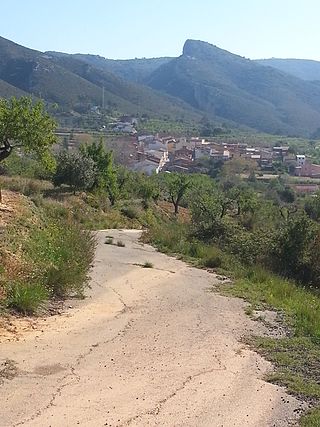
Vallibona is a small town and municipality located in the Ports comarca, province of Castelló, part of the autonomous community of Valencia, Spain. According to the 2009 census, it has a total population of 90 inhabitants. It is located in the upper valley of the Cérvol River, between the Serra del Turmell and the Ports de Beseit mountain ranges, in a very lonely area, relatively far from other towns. Vallibona is part of the Taula del Sénia free association of municipalities.

<span class="mw-page-title-main">Valencians</span> Ethnic group

Valencians are the native people of the Valencian Community, in eastern Spain. Since 2006, the Valencian people are officially recognised in the Valencian Statute of Autonomy as a nationality "within the unity of the Spanish nation". The official languages of Valencia are Valencian and Spanish.

<span class="mw-page-title-main">Serra de l'Espadella</span>

Serra de l'Espadella is an over 4 km (2 mi) long mountain range in the Baix Maestrat comarca, Valencian Community, Spain. Its highest point is Espadella. These mountains are frequently covered in snow in the winter.

Xilxes (Valencian) or Chilches (Spanish) is a municipality located in the province of Castellón, Valencian Community, Spain.

References

  1. Municipal Register of Spain 2018. National Statistics Institute.
  2. Moverse con Metrovalencia - Ficha de estación
  3. Prisiones de la Comunidad Valenciana
  4. Aproximació històrica i social [ permanent dead link ]

Other references

National Statistics Institute of Spain