Utiel | |
|---|---|
 Flag  Coat of arms | |
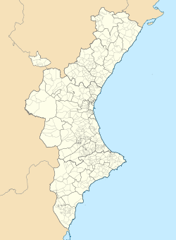 Utiel Location in Spain  Utiel Utiel (Spain) | |
| Coordinates: 39°34′2″N1°12′24″W / 39.56722°N 1.20667°W | |
| Province | Valencia |
| Comarca | Plana de Utiel |
| Judicial district | Requena |
| Government | |
| • Alcalde | José Luis Ramírez Ortiz (2011) (PP) |
| Area | |
• Total | 236.9 km2 (91.5 sq mi) |
| Elevation | 720 m (2,360 ft) |
| Population (2025-01-01) [1] | |
• Total | 11,663 |
| • Density | 49.23/km2 (127.5/sq mi) |
| Demonym(s) | Utielano, Utielana |
| Time zone | UTC+1 (CET) |
| • Summer (DST) | UTC+2 (CEST) |
| Postal code | 46300 |
| Official language(s) | Spanish |
| Website | Official website |
Utiel is a municipality in the comarca of Plana de Utiel in the Valencian Community, Spain.
Contents
According to the 2014 census, [2] the municipality has a population of 12,082 inhabitants.
The Shrine of El Remedio is located on top of the Sierra de Utiel range, near Utiel. [3]