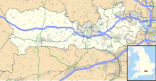
Brimpton Pit is a 1.6-hectare (4.0-acre) geological Site of Special Scientific Interest west of Aldermaston in Berkshire. It is a Geological Conservation Review site.

Southerham Grey Pit is a 8.5-hectare (21-acre) geological Site of Special Scientific Interest south-east of Lewes in East Sussex. It is a Geological Conservation Review site.
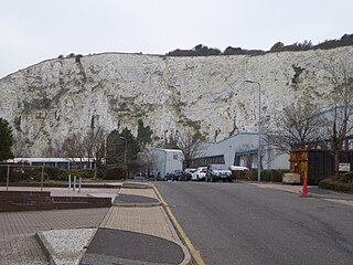
Southerham Works Pit is a 1-hectare (2.5-acre) geological Site of Special Scientific Interest in Lewes in East Sussex. It is a Geological Conservation Review site.

Abbey Wood is a 6.3-hectare (16-acre) geological Site of Special Scientific Interest in Abbey Wood in the London Borough of Bexley. It is located in Lesnes Abbey Woods south-east of the ruins of Lesnes Abbey. Members of the public can dig for fossils in a small area designated as the Fossil Bed with the permission of the Lesnes Abbey ranger.
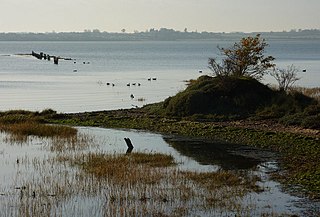
Stour Estuary is a 2,523 hectare biological and geological Site of Special Scientific Interest which stretches from Manningtree to Harwich in Essex and Suffolk. It is also an internationally important wetland Ramsar site, a Special Protection Area and a Nature Conservation Review site. It is part of the Suffolk Coast and Heaths Area of Outstanding Natural Beauty, and there are Geological Conservation Review sites in Wrabness, Stutton, and Harwich Part of the site is managed by the Royal Society for the Protection of Birds, and a small area is Wrabness Nature Reserve, a Local Nature Reserve managed by the Essex Wildlife Trust.

Winterbourne Chalk Pit is a 0.05-hectare (0.12-acre) geological Site of Special Scientific Interest west of Winterbourne in Berkshire. It is a Geological Conservation Review site. It is located within the North Wessex Downs.

Hamstead Marshall Pit is a 0.2-hectare (0.49-acre) geological Site of Special Scientific Interest north of Hamstead Marshall in Berkshire. It is a Geological Conservation Review site.
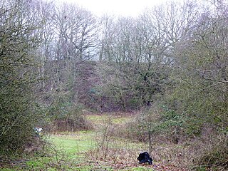
Cold Ash Quarry is a 0.4-hectare (0.99-acre) geological Site of Special Scientific Interest north of Newbury in Berkshire. It is a Geological Conservation Review site.

Fognam Chalk Quarry is a 3-hectare (7.4-acre) geological Site of Special Scientific Interest west of Upper Lambourn in Berkshire. It is a Geological Conservation Review site. It is in the North Wessex Downs.

Bognor Reef is a 39.7-hectare (98-acre) biological and geological Site of Special Scientific Interest which stretches along the foreshore of Bognor Regis in West Sussex. It is a Geological Conservation Review site.

Chinnor Chalk Pit is a 20.4-hectare (50-acre) geological Site of Special Scientific Interest south of Chinnor in Oxfordshire. It is a Geological Conservation Review site.

Dry Sandford Pit is a 4.2-hectare (10-acre) biological and geological Site of Special Scientific Interest north-west of Abingdon-on-Thames in Oxfordshire. It is a Geological Conservation Review site and it is managed as a nature reserve by the Berkshire, Buckinghamshire and Oxfordshire Wildlife Trust.

Kirtlington Quarry is a 3.1-hectare (7.7-acre) geological Site of Special Scientific Interest west of Kirtlington in Oxfordshire. It is a Geological Conservation Review site, and it is part of the 7.4-hectare (18-acre) Kirtlington Quarry Local Nature Reserve.

Rock Edge is a 1.7-hectare (4.2-acre) geological Site of Special Scientific Interest in Oxford in Oxfordshire. It is a Geological Conservation Review site and a Local Nature Reserve

Cothill Fen is a 43.3-hectare (107-acre) biological and geological Site of Special Scientific Interest north-west of Abingdon-on-Thames in Oxfordshire. It is a Special Area of Conservation and parts of it are a Geological Conservation Review site, a Nature Conservation Review site, Grade 1, and a National Nature Reserve. It also includes two areas which are nature reserves managed by the Berkshire, Buckinghamshire and Oxfordshire Wildlife Trust, Lashford Lane Fen and Parsonage Moor.
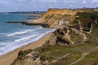
Highcliffe to Milford Cliffs is a 110.1-hectare (272-acre) geological Site of Special Scientific Interest which stretches along the south coast of England from Christchurch in Dorset to Milford on Seain Hampshire. It includes several Geological Conservation Review sites.

Lee-on-The Solent to Itchen Estuary is a 585.9-hectare (1,448-acre) biological and geological Site of Special Scientific Interest which stretches along the coast between Southampton and Gosport in Hampshire. It is a Geological Conservation Review site. It is part of Solent and Southampton Water Ramsar site and Special Protection Area, and of Solent Maritime Special Area of Conservation. Three areas are Local Nature Reserves, Chessel Bay, Hook with Warsash and Mercury Marshes. One area is Hamble Common Camp, a Scheduled Monument.

North Solent is a 1,186.7-hectare (2,932-acre) biological and geological Site of Special Scientific Interest along the north bank of the Solent between East End and Calshot in Hampshire. It is a Nature Conservation Review site, Grade I. Part of it is in North Solent National Nature Reserve and two areas are Geological Conservation Review sites. It is part of Solent and Southampton Water Ramsar site and Special Protection Area, and of Solent Maritime Special Area of Conservation. Boldre Foreshore is a local nature reserve.

