Pine Hill, Queensland

Last updated

Pine Hill
Queensland
Outback Grazing Land - panoramio.jpg
Grazing land beside the Central Western railway in Pine Hill, 2013
Australia Queensland location map.svg
Red pog.svg
Pine Hill
Coordinates 23°30′20″S147°06′19″E / 23.5055°S 147.1052°E / -23.5055; 147.1052 Coordinates: 23°30′20″S147°06′19″E / 23.5055°S 147.1052°E / -23.5055; 147.1052
Population3 (2016 census) [1]
 • Density0.0033/km2 (0.0086/sq mi)
Postcode(s) 4724
Area904.9 km2 (349.4 sq mi)
Time zone AEST (UTC+10:00)
Location
LGA(s) Barcaldine Region
State electorate(s) Gregory
Federal division(s) Maranoa
Suburbs around Pine Hill:
Beaufort Quetta Peak Vale
Beaufort Pine Hill Willows
Port Wine Port Wine Willows

Pine Hill is a former rural locality in the Barcaldine Region, Queensland, Australia. [2] In the 2016 census, Pine Hill had a population of 3 people. [1]

Contents

On 22 November 2019 the Queensland Government decided to amalgamate the localities in the Barcaldine Region, resulting in five expanded localities based on the larger towns: Alpha, Aramac, Barcaldine, Jericho and Muttaburra. Pine Hill was incorporated into Alpha. [3] [4] [5]

Geography

Drummond Range in Pine Hill, 2013 Drummond Ranges - panoramio.jpg
Drummond Range in Pine Hill, 2013

The Central Western railway line forms the southern boundary of the locality with the Capricorn Highway forming the eastern part of the southern boundary. [6]

The Drummond Range forms the western part of the locality. A number of creeks rise in the slopes of the range and flow variously west and north, all eventually becoming tributaries of the Belyando River within the North East Coast drainage basin. [6]

The predominant land use is grazing on native vegetation. [6]

History

Queensland National Bank, Pine Hill, 1883 Queensland National Bank, Pine Hill, 1883.jpg
Queensland National Bank, Pine Hill, 1883

The Central Western railway line reached Pine Hill in 1883, with the Pinehill railway station at 23°39′01″S146°57′23″E / 23.6503°S 146.9565°E / -23.6503; 146.9565 (Pinehill railway station) its terminus. [7] The station buildings were completed in July 1883. [8] According to the Queensland Railways Department, the railway station was so named because the surrounding ridges were once covered in cypress pine. [9]

On August 1883 there was a land sale for 56 town lots and 180 country lots at Pine Hill. [10] Yielding nearly £ 3000, it was a success, with buyers planning to build a hotel and shops in the new town. However, the newspaper of the day speculated that the land might be worthless in two years, presumably in the expectation that Pine Hill would not remain the terminus. [11] The railway line opened on 1 November 1883, [12] and the Queensland National Bank relocated their business there from Bogantungan, the previous terminus, in the same month. [13] The town was described unfavourably in a newspaper article of December 1883: [14]

"There is dust everywhere, not only in the streets but in the houses. You breathe it, you eat it, you drink it, you sniff it, touch what you will it is there. It sometimes almost blinds you, and it will no doubt assist in producing premature deafness in some cases, for your ears get filled with dust and thus all the five senses are affected ... it ought to have been named The Dust Flat".

On 22 September 1884 the railway line had reached its new terminus of Alpha, and Pine Hill was described as "unsuited for permanent settlement", which led to criticism of the Queensland Government for profiting from land sales in short-lived terminus towns like Pine Hill. [15]

Pine Hill State School opened circa 1884 but closed in 1905. It reopened on 25 January 1926 but closed circa 1946. [16]

The town's streets and allotments had been laid out in the area immediately to the south of the railway station and can still be seen on maps, but there is no evidence remaining of any building. It is now the northernmost part of the Port Wine locality. [6]

Education

There are no schools in Pine Hill. The nearest primary school is in Alpha. The nearest secondary school is in Alpha but only to Year 10. The nearest secondary school to Year 12 is in Emerald. [6] Boarding schools and distance education are other options. [17]

Related Research Articles

<span class="mw-page-title-main">Aramac, Queensland</span> Town in Queensland, Australia

Aramac is a rural town and locality in the Barcaldine Region, Queensland, Australia. In the 2016 census, Aramac had a population of 299 people.

<span class="mw-page-title-main">Alpha, Queensland</span> Town in Queensland, Australia

Alpha is a rural town and a locality in the Barcaldine Region, Queensland, Australia. At the 2021 census, the locality had a population of 559 people.

<span class="mw-page-title-main">Jericho, Queensland</span> Town in Queensland, Australia

Jericho is a rural town and locality in the Barcaldine Region, Queensland, Australia. In the 2021 census, the locality of Jericho had a population of 229 people.

<span class="mw-page-title-main">Barcaldine Region</span> Local government area in Queensland, Australia

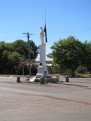
The Barcaldine Region is a local government area in Central West Queensland, Australia. Established in 2008, it was preceded by three previous local government areas which had existed for over a century.

<span class="mw-page-title-main">Cornish Creek, Queensland</span> Suburb of Barcaldine Region, Queensland, Australia

Cornish Creek is a former rural locality in the Barcaldine Region, Queensland, Australia. In the 2016 census, Cornish Creek had a population of 16 people.

Ibis is a former rural locality in the Barcaldine Region, Queensland, Australia. In the 2016 census, Ibis had a population of 4 people.

Sardine is a former rural locality in the Barcaldine Region, Queensland, Australia. In the 2016 census, Sardine had a population of 5 people.

<span class="mw-page-title-main">Barcaldine Downs</span> Suburb of Barcaldine Region, Queensland, Australia

Barcaldine Downs is a former rural locality in the Barcaldine Region, Queensland, Australia. In the 2016 census, Barcaldine Downs had a population of 14 people.

Evora is a former rural locality in the Barcaldine Region, Queensland, Australia. In the 2016 census, Evora had a population of 0 people.

Grant is a former rural locality in the Barcaldine Region, Queensland, Australia. In the 2016 census, Grant had a population of 11 people.

<span class="mw-page-title-main">Saltern Creek, Queensland</span> Suburb of Barcaldine Region, Queensland, Australia

Saltern Creek is a former rural locality in the Barcaldine Region, Queensland, Australia. In the 2016 census, Saltern Creek had a population of 12 people.

Tara Station is a former rural locality in the Barcaldine Region, Queensland, Australia. In the 2016 census, Tara Station had a population of 10 people.

Beaufort is a former rural locality in the Barcaldine Region, Queensland, Australia. In the 2016 census, Beaufort had a population of 46 people. On 22 November 2019 the Queensland Government decided to amalgamate the localities in the Barcaldine Region, resulting in five expanded localities based on the larger towns: Alpha, Aramac, Barcaldine, Jericho and Muttaburra. Beaufort was incorporated into Alpha.

Drummondslope is a former rural locality in the Barcaldine Region, Queensland, Australia. In the 2016 census, Drummondslope had a population of 43 people. On 22 November 2019 the Queensland Government decided to amalgamate the localities in the Barcaldine Region, resulting in five expanded localities based on the larger towns: Alpha, Aramac, Barcaldine, Jericho and Muttaburra. Drummondslope was incorporated into Alpha.

Garfield is a former rural locality in the Barcaldine Region, Queensland, Australia. In the 2016 census, Garfield had a population of 37 people.

<span class="mw-page-title-main">Hobartville, Queensland</span> Suburb of Barcaldine Region, Queensland, Australia

Hobartville is a former rural locality in the Barcaldine Region, Queensland, Australia. In the 2016 census, Hobartville had a population of 50 people.

Mexico is a former rural locality in the Barcaldine Region, Queensland, Australia. In the 2016 census, Mexico had a population of 26 people.

Port Wine is a former rural locality in the Barcaldine Region, Queensland, Australia. In the 2016 census, Port Wine had a population of 27 people.

Sedgeford is a former rural locality in the Barcaldine Region, Queensland, Australia. In the 2016 census, Sedgeford had a population of 0 people.

<span class="mw-page-title-main">Surbiton, Queensland</span> Suburb of Barcaldine Region, Queensland, Australia

Surbiton is a former rural locality in the Barcaldine Region, Queensland, Australia. In the 2016 census, Surbiton had a population of 80 people.

References

  1. 1 2 Australian Bureau of Statistics (27 June 2017). "Pine Hill (SSC)". 2016 Census QuickStats. Retrieved 20 October 2018. OOjs UI icon edit-ltr-progressive.svg
  2. "Pine Hill – locality in Barcaldine Region (entry 47110)". Queensland Place Names. Queensland Government . Retrieved 10 June 2019.
  3. "Recent place name decisions". Queensland Government. 22 November 2019. Archived from the original on 22 October 2019. Retrieved 15 January 2020.
  4. "Proposed Locality Boundaries and Names: Barcaldine Regional: Alpha, Aramac, Barcaldine, Jericho and Muttaburra" (PDF). Queensland Government. 17 May 2019. Archived (PDF) from the original on 15 January 2020. Retrieved 15 January 2020.
  5. "Locality Boundaries and Names: Barcaldine Regional Council: Alpha, Aramac, Barcaldine, Jericho and Muttaburra" (PDF). Queensland Government. 17 May 2019. Archived (PDF) from the original on 15 January 2020. Retrieved 15 January 2020.
  6. 1 2 3 4 5 "Queensland Globe". State of Queensland . Retrieved 13 August 2019.
  7. "Pinehill – railway station in the Barcadine Region (entry 26860)". Queensland Place Names. Queensland Government . Retrieved 13 August 2019.
  8. "MOUNT BRITTON". The Brisbane Courier . Vol. XXXVIII, no. 7, 969. Queensland, Australia. 27 July 1883. p. 3. Retrieved 13 August 2019 via National Library of Australia.
  9. "SKETCHER". The Queenslander . No. 2456. Queensland, Australia. 11 April 1914. p. 8. Retrieved 13 August 2019 via National Library of Australia.
  10. "Classified Advertising". The Queenslander . Vol. XXIV, no. 410. Queensland, Australia. 4 August 1883. p. 22. Retrieved 13 August 2019 via National Library of Australia.
  11. "BOGANTUNGAN". Morning Bulletin . Vol. XXXI, no. 4818. Queensland, Australia. 4 September 1883. p. 3. Retrieved 13 August 2019 via National Library of Australia.
  12. Kerr, John (1990). Triumph of narrow gauge : a history of Queensland Railways. Boolarong Publications. p. 224. ISBN   978-0-86439-102-5.
  13. "MISCELLANEA". The Telegraph . No. 3, 469. Queensland, Australia. 27 November 1883. p. 2. Retrieved 13 August 2019 via National Library of Australia.
  14. "The Western Champion". The Western Champion . Vol. V, no. 235. Queensland, Australia. 12 December 1883. p. 2. Retrieved 13 August 2019 via National Library of Australia.
  15. "Current Notes". The Capricornian . Vol. 10, no. 37. Queensland, Australia. 13 September 1884. p. 14. Retrieved 13 August 2019 via National Library of Australia.
  16. Queensland Family History Society (2010), Queensland schools past and present (Version 1.01 ed.), Queensland Family History Society, ISBN   978-1-921171-26-0
  17. "Distance Education". Education. Queensland Government. 25 July 2019. Archived from the original on 6 August 2019. Retrieved 7 August 2019.