Plaridel, Quezon

Last updated
Plaridel
Siain
Municipality of Plaridel
The Most Holy Rosary Parish Plaridel, Quezon.JPG
Holy Rosary Parish
Flag of Plaridel, Quezon.png
Plaridel, Quezon Official Seal.png
Ph locator quezon plaridel.png
Map of Quezon with Plaridel highlighted
OpenStreetMap
Plaridel, Quezon
Philippines location map (square).svg
Red pog.svg
Plaridel
Location within the Philippines
Coordinates: 13°57′04″N122°01′13″E / 13.9511°N 122.0203°E / 13.9511; 122.0203
Country Philippines
Region Calabarzon
Province Quezon
District 4th district
Founded June 16, 1962
Barangays 9 (see Barangays)
Government
[1]
  Type Sangguniang Bayan
   Mayor Jose D. Saavedra
   Vice Mayor Bernardo V. Tumagay
   Representative Keith Micah DL. Tan
   Municipal Council
Members
  • Sixto A. Alva
  • Rommel E. Caparros
  • Victor V. Tumagay
  • Denise Dianne A. Magbuhos
  • Don-Don M. Anda
  • Rodante C. Camba
  • Estelita M. Javier
  • Darwin B. Alvarez
   Electorate 8,656 voters (2025)
Area
[2]
  Total
35.05 km2 (13.53 sq mi)
Elevation
38 m (125 ft)
Highest elevation
248 m (814 ft)
Lowest elevation
0 m (0 ft)
Population
 (2024 census)
  Total
10,866
  Density310.0/km2 (802.9/sq mi)
   Households
2,552
Demonym(s) Siainin, Plaridelin
Economy
   Income class 5th municipal income class
   Poverty incidence
22.81
% (2021)
   Revenue 93.82 million (2022)
   Assets 168 million (2022)
   Expenditure 79.05 million (2022)
   Liabilities 19.19 million (2022)
Service provider
  ElectricityQuezon 1 Electric Cooperative (QUEZELCO 1)
Time zone UTC+8 (PST)
ZIP code
4306
PSGC
IDD : area code +63(0)42
Native languages Tagalog

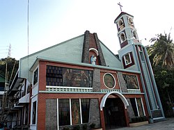
Plaridel, officially the Municipality of Plaridel (Tagalog : Bayan ng Plaridel), is a municipality in the province of Quezon, Philippines. According to the 2020 census, it has a population of 10,129 people.

Contents

The municipality was created in 1962 by virtue of Republic Act No. 3493 where its territories carved out from Atimonan. [3]

History

Under the Republic Act No. 3493, barrios were taken from Atimonan, Quezon to constitute the Municipality of Plaridel. These barrios include Siain, Ilosong, Concepcion, Duhat, and Tanauan. As the Act decreed, Siain became the seat of government. [4]

The Act was based on House Bill No. 822 introduced by Congressman Eladio A. Caliwara who was then representing the Second District of Quezon. It was signed in June 1962 by Philippine president Diosdado Macapagal enacting it as a law. [4]

The Municipality of Plaridel was inaugurated on October 27, 1962. [4]

Geography

The smallest municipality in the province of Quezon, Plaridel has an area of 33 square kilometers comprising nine barangays - four of which are poblaciones - and its population is around 11,000. It lies between the towns of Atimonan and Gumaca, hugging the coastline of the Province alongside Maharlika Highway. Its inhabitants are occupied primarily with fishing. Those engaged in Agriculture plant mostly coconut and rice. A visitor this town must taste and savor its local version of Suman.

Plaridel is 55 kilometres (34 mi) from Lucena and 185 kilometres (115 mi) from Manila.

Barangays

Plaridel is politically subdivided into 9 barangays, as indicated below. Each barangay consists of puroks and some have sitios.

Barangays Duhat, Ilaya, and Ilosong are south of the Poblacion, and are accessed by a paved road which connects with the National Maharlika Highway at Barangay Pampaaralan (also called Paaralan). This road is also the main access to Barangay Kulawit, part of the Municipality of Atimonan to the west.

Climate

Climate data for Plaridel, Quezon
MonthJanFebMarAprMayJunJulAugSepOctNovDecYear
Mean daily maximum °C (°F)26
(79)
27
(81)
29
(84)
31
(88)
31
(88)
30
(86)
29
(84)
29
(84)
29
(84)
29
(84)
28
(82)
26
(79)
29
(84)
Mean daily minimum °C (°F)22
(72)
22
(72)
22
(72)
23
(73)
24
(75)
24
(75)
24
(75)
24
(75)
24
(75)
24
(75)
23
(73)
23
(73)
23
(74)
Average precipitation mm (inches)83
(3.3)
55
(2.2)
44
(1.7)
37
(1.5)
90
(3.5)
123
(4.8)
145
(5.7)
125
(4.9)
135
(5.3)
166
(6.5)
163
(6.4)
152
(6.0)
1,318
(51.8)
Average rainy days15.110.811.911.419.923.726.323.923.922.120.218.6227.8
Source: Meteoblue [5]

Demographics

Population census of Plaridel
YearPop.±% p.a.
1970 5,665    
1975 6,051+1.33%
1980 6,386+1.08%
1990 7,473+1.58%
1995 8,666+2.81%
2000 9,501+1.99%
2007 10,069+0.80%
2010 10,238+0.61%
2015 10,935+1.26%
2020 10,129−1.60%
2024 10,866+1.70%
Source: Philippine Statistics Authority [6] [7] [8] [9]

Religion

Economy

Poverty incidence of Plaridel

10
20
30
40
50
2000
34.58
2003
44.02
2006
15.60
2009
12.30
2012
16.61
2015
14.14
2018
7.27
2021
22.81

Source: Philippine Statistics Authority [10] [11] [12] [13] [14] [15] [16] [17]

Government

Municipal Hall Plaridel Municipal Hall, Quezon, Feb 2024.jpg
Municipal Hall

Elected officials

Municipal council (2022-2025):

Education

The Plaridel Schools District Office governs all educational institutions within the municipality. It oversees the management and operations of all private and public, from primary to secondary schools. [18]

Primary and elementary schools

  • Concepcion Elementary School
  • Ilosong Elementary School
  • Plaridel Central School
  • Tanauan Elementary School

Secondary schools

References

  1. Municipality of Plaridel | (DILG)
  2. "2015 Census of Population, Report No. 3 – Population, Land Area, and Population Density" (PDF). Philippine Statistics Authority. Quezon City, Philippines. August 2016. ISSN   0117-1453. Archived (PDF) from the original on May 25, 2021. Retrieved July 16, 2021.
  3. "Republic Act No. 3493 - An Act Creating the Municipality of Plaridel in the Province of Quezon". Chan Robles Virtual Law Library. 16 June 1962. Retrieved 2 March 2016.
  4. 1 2 3 "Plaridel, Quezon – Executive Summary (2013)" (PDF). Commission on Audit of the Philippines .
  5. "Plaridel: Average Temperatures and Rainfall". Meteoblue. Retrieved 27 January 2020.
  6. Census of Population (2015). "Region IV-A (Calabarzon)". Total Population by Province, City, Municipality and Barangay. Philippine Statistics Authority . Retrieved 20 June 2016.
  7. Census of Population and Housing (2010). "Region IV-A (Calabarzon)" (PDF). Total Population by Province, City, Municipality and Barangay. National Statistics Office . Retrieved 29 June 2016.
  8. Censuses of Population (1903–2007). "Region IV-A (Calabarzon)". Table 1. Population Enumerated in Various Censuses by Province/Highly Urbanized City: 1903 to 2007. National Statistics Office.
  9. "Province of". Municipality Population Data. Local Water Utilities Administration Research Division. Retrieved 17 December 2016.
  10. "Poverty incidence (PI):". Philippine Statistics Authority. Retrieved December 28, 2020.
  11. "Masterlist of Schools" (PDF). Department of Education. January 15, 2021. Retrieved October 16, 2025.