Pagbilao

Last updated

Pagbilao
Municipality of Pagbilao
Saint Catherine of Alexandria.jpg
Quezon National Forest Park.jpg
Pueblo La Playa Resort, Here is the magnificent palace of Peter, is right on the sea - panoramio - evert1949 (1).jpg
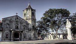
From top, left to right : St. Catherine of Alexandria Parish Church • Zigzag Road, Quezon National Forest Park • Pueblo La Playa Resort
Flag of Pagbilao, Quezon.png
Ph locator quezon pagbilao.png
Map of Quezon with Pagbilao highlighted
OpenStreetMap
Pagbilao
Philippines location map (square).svg
Red pog.svg
Pagbilao
Location within the Philippines
Coordinates: 13°58′19″N121°41′13″E / 13.972°N 121.687°E / 13.972; 121.687
Country Philippines
Region Calabarzon
Province Quezon
District 1st district
Founded August 29, 1730
Barangays 27 (see Barangays)
Government
[1]
  Type Sangguniang Bayan
   Mayor Angelica P. Tatlonghari
   Vice Mayor Shierre Ann P. Palicpic
   Representative Wilfrido Mark M. Enverga
   Municipal Council
Members
   Electorate 51,109 voters (2022)
Area
[2]
  Total170.96 km2 (66.01 sq mi)
Elevation
24.2 m (79.4 ft)
Highest elevation
259 m (850 ft)
Lowest elevation
−1 m (−3 ft)
Population
 (2020 census) [3]
  Total78,700
  Density460/km2 (1,200/sq mi)
   Households
19,501
Demonym Pagbilawin/Pagbilaowin
Economy
   Income class 1st municipal income class
   Poverty incidence
6.31
% (2018) [4]
   Revenue 470.9 million (2020)
   Assets 1,586 million (2020)
   Expenditure 326.7 million (2020)
   Liabilities 519.9 million (2020)
Service provider
  ElectricityManila Electric Company (Meralco)
Time zone UTC+8 (PST)
ZIP code
4302
PSGC
IDD : area code +63(0)42
Native languages Tagalog
Website www.pagbilao.gov.ph

Pagbilao, officially the Municipality of Pagbilao (Tagalog : Bayan ng Pagbilao), is a 1st class municipality in the province of Quezon, Philippines. According to the 2020 census, it has a population of 78,700 people. [3]

Contents

It is located on the northern shore of Tayabas Bay on Luzon, just east of Lucena, the provincial capital.

Pagbilao is 9 kilometres (5.6 mi) from Lucena and 139 kilometres (86 mi) from Manila.

Etymology

The name of Pagbilao is said to have been derived from the Tagalog words papag (bamboo beds) and bilao (winnowing basket). [5]

Geography

Barangays

Pagbilao is politically subdivided into 27 barangays. Each barangay consists of puroks and some have sitios.

  • Alupaye
  • Añato
  • Antipolo
  • Bantigue
  • Barangay 1 Castillo (Poblacion)
  • Barangay 2 Daungan (Poblacion)
  • Barangay 3 Del Carmen (Poblacion)
  • Barangay 4 Parang (Poblacion)
  • Barangay 5 Santa Catalina (Poblacion)
  • Barangay 6 Tambak (Poblacion)
  • Bigo
  • Binahaan
  • Bukal
  • Ibabang Bagumbungan
  • Ibabang Palsabangon (detour)
  • Ibabang Polo
  • Ikirin
  • Ilayang Bagumbungan
  • Ilayang Palsabangon
  • Ilayang Polo
  • Kanlurang Malicboy
  • Mapagong
  • Mayhay
  • Pinagbayanan
  • Silangang Malicboy
  • Talipan
  • Tukalan

Climate

Climate data for Pagbilao, Quezon
MonthJanFebMarAprMayJunJulAugSepOctNovDecYear
Mean daily maximum °C (°F)26
(79)
27
(81)
29
(84)
31
(88)
31
(88)
30
(86)
29
(84)
29
(84)
29
(84)
29
(84)
28
(82)
26
(79)
29
(84)
Mean daily minimum °C (°F)22
(72)
22
(72)
22
(72)
23
(73)
24
(75)
24
(75)
24
(75)
24
(75)
24
(75)
24
(75)
23
(73)
23
(73)
23
(74)
Average precipitation mm (inches)83
(3.3)
55
(2.2)
44
(1.7)
37
(1.5)
90
(3.5)
123
(4.8)
145
(5.7)
125
(4.9)
135
(5.3)
166
(6.5)
163
(6.4)
152
(6.0)
1,318
(51.8)
Average rainy days15.110.811.911.419.923.726.323.923.922.120.218.6227.8
Source: Meteoblue [6]

Demographics

Population census of Pagbilao
YearPop.±% p.a.
1903 6,085    
1918 6,879+0.82%
1939 11,379+2.43%
1948 12,978+1.47%
1960 17,303+2.43%
1970 26,587+4.38%
1975 29,304+1.97%
1980 31,681+1.57%
1990 41,635+2.77%
1995 49,605+3.34%
2000 53,442+1.61%
2007 62,561+2.20%
2010 65,996+1.96%
2015 75,023+2.47%
2020 78,700+0.95%
Source: Philippine Statistics Authority [7] [8] [9] [10]

Economy

Pueblo La Playa Resort Pueblo La Playa Resort, Here is the magnificent palace of Peter, is right on the sea - panoramio - evert1949.jpg
Pueblo La Playa Resort

Most of the vast lands of Pagbilao are mainly used for agricultural. These agricultural land are mostly coconut, rice and poultry farms. But some of these lands became industrial areas. Most of these industrial lands are ice plants, rice and oil mills which can be seen along the highway.

The Province of Quezon announced that they are planning to make an industrial park or economic zone in the Barangays of Alupaye and Bantigue of Pagbilao. It will really help the employment of the people of Quezon Province.

Commerce is also rapidly grown not only in the downtown area, but also spreading in the whole town. Commercial establishments are growing from Talipan up to downtown along the highway. La Suerte Mega Warehouse, the largest commercial center in town, is found in Alupaye, which most of the bus terminals can be found here.

Tourism is also growing in Pagbilao. There are many hotel and resorts can be found along the highway or in the beachfront of Barangay Bantigue, which has a great view of the islands of the town.

The DEPED-Division of Quezon Province has its main office in town. It is one of largest employers not only in Pagbilao, but the whole Quezon Province. The municipal government is also one of the top employers in town, which focuses on public services.

The Pagbilao Power Station, one of the Philippine's largest power plant stations, is found on Isla Grande in Pagbilao. It is said to be the largest employer in town.

Government

Elected officials

Municipal council (2019–2022):

Infrastructure

Transportation

The intersection of Pan-Philippine Highway and Pagbilao-Padre Burgos Road in Barangay Silangang Malicboy Pan-Philippine Highway-N610 highway junction.jpg
The intersection of Pan-Philippine Highway and Pagbilao–Padre Burgos Road in Barangay Silangang Malicboy
New Diversion Road Diversion Road, Pagbilao, Quezon, Feb 2024 (2).jpg
New Diversion Road

The municipality is connected with Manila by the Pan-Philippine Highway. Until 2014, there were also daily rail services to and from Naga and Legazpi provided by the Philippine National Railways. A new Pagbilao station has already been set for construction under the PNR South Long Haul project, a reconstruction of the PNR South Main Line that passes through the area. [18]

In order to spur development in the municipality, the Toll Regulatory Board declared Toll Road 5 the extension of South Luzon Expressway. [19] A 420-kilometer, four lane expressway starting from the terminal point of the now under construction SLEX Toll Road 4 at Barangay Mayao, Lucena City in Quezon to Matnog, Sorsogon, near the Matnog Ferry Terminal. On August 25, 2020, San Miguel Corporation announced that they will invest the project which will reduce travel time from Lucena to Matnog from 9 hours to 5.5 hours. [20]

Another expressway that will serve Pagbilao is the Quezon-Bicol Expressway (QuBEx), which will link between Lucena and San Fernando, Camarines Sur. [21]

Communications

Pagbilao has numerous mobile phone, internet and cable services providers. The following are:

Education

Pagbilao has numerous primary and secondary educational institutions. The following are:

Elementary Schools

Secondary Schools

Tertiary Schools

Private Schools

Related Research Articles

<span class="mw-page-title-main">Liliw</span> Municipality in Laguna, Philippines

Liliw, officially the Municipality of Liliw, is a 4th class municipality in the province of Laguna, Philippines. According to the 2020 census, it has a population of 39,491 people.

<span class="mw-page-title-main">Santa Cruz, Laguna</span> Capital of Laguna, Philippines

Santa Cruz, officially the Municipality of Santa Cruz, is a 1st class municipality and capital of the province of Laguna, Philippines. According to the 2020 census, it has a population of 123,574 people.

<span class="mw-page-title-main">Gumaca</span> Municipality in Quezon, Philippines

Gumaca, officially the Municipality of Gumaca, is a 1st class municipality in the province of Quezon, Philippines. According to the 2020 census, it has a population of 71,942 people.

<span class="mw-page-title-main">Lucena</span> Capital of Quezon, Philippines

Lucena, officially the City of Lucena, is a 1st class highly urbanized city in the Calabarzon region of the Philippines. It is the capital city of the province of Quezon where it is geographically situated but, in terms of government and administration, the city is politically independent from the province. For statistical and geographical purposes, Lucena is grouped with the province of Quezon. According to the 2020 census, it has a population of 278,924 people.

<span class="mw-page-title-main">Matnog</span> Municipality in Sorsogon, Philippines

Matnog, officially the Municipality of Matnog, is a 3rd class municipality in the province of Sorsogon, Philippines and is the southernmost part of Luzon. According to the 2020 census, it has a population of 41,989 people.

<span class="mw-page-title-main">Del Gallego</span> Municipality in Camarines Sur, Philippines

Del Gallego, officially the Municipality of Del Gallego, is a 4th class municipality in the province of Camarines Sur, Philippines. According to the 2020 census, it has a population of 26,403 people.

<span class="mw-page-title-main">Lupi, Camarines Sur</span> Municipality in Camarines Sur, Philippines

Lupi, officially the Municipality of Lupi, is a 3rd class municipality in the province of Camarines Sur, Philippines. According to the 2020 census, it has a population of 33,897 people.

<span class="mw-page-title-main">Ragay</span> Municipality in Camarines Sur, Philippines

Ragay, officially the Municipality of Ragay, is a 1st class municipality in the province of Camarines Sur, Philippines. According to the 2020 census, it has a population of 59,770 people.

<span class="mw-page-title-main">Sipocot</span> Municipality in Camarines Sur, Philippines

Sipocot, officially the Municipality of Sipocot, is a 1st class municipality in the province of Camarines Sur, Philippines. According to the 2020 census, it has a population of 68,169 people.

<span class="mw-page-title-main">Agdangan</span> Municipality in Quezon, Philippines

Agdangan, officially the Municipality of Agdangan, is a 5th class municipality in the province of Quezon, Philippines. According to the 2020 census, it has a population of 12,764 people.

<span class="mw-page-title-main">Lucban</span> Municipality in Quezon, Philippines

Lucban, officially the Municipality of Lucban, is a 2nd class municipality in the province of Quezon, Philippines. According to the 2020 census, it has a population of 53,091 people.

<span class="mw-page-title-main">Mauban</span> Municipality in Quezon, Philippines

Mauban, officially the Municipality of Mauban, is a 1st class municipality in the province of Quezon, Philippines. According to the 2020 census, it has a population of 71,081 people.

<span class="mw-page-title-main">Mulanay</span> Municipality in Quezon, Philippines

Mulanay, officially the Municipality of Mulanay, is a 1st class municipality in the province of Quezon, Philippines. According to the 2020 census, it has a population of 55,576 people.

<span class="mw-page-title-main">Pitogo, Quezon</span> Municipality in Quezon, Philippines

Pitogo, officially the Municipality of Pitogo, is a 4th class municipality in the province of Quezon, Philippines. According to the 2020 census, it has a population of 22,798 people.

<span class="mw-page-title-main">San Francisco, Quezon</span> Municipality in Quezon, Philippines

San Francisco, officially the Municipality of San Francisco, is a 2nd class municipality in the province of Quezon, Philippines. According to the 2020 census, it has a population of 62,097 people.

<span class="mw-page-title-main">Tagkawayan</span> Municipality in Quezon, Philippines

Tagkawayan, officially the Municipality of Tagkawayan, is a 1st class municipality in the province of Quezon, Philippines. According to the 2020 census, it has a population of 54,003 people.

<span class="mw-page-title-main">Tiaong</span> Municipality in Quezon, Philippines

Tiaong, officially the Municipality of Tiaong, is a 1st class municipality in the province of Quezon, Philippines. According to the 2020 census, it has a population of 106,265 people.

<span class="mw-page-title-main">Unisan, Quezon</span> Municipality in Quezon, Philippines

Unisan, officially the Municipality of Unisan, is a 4th class municipality in the province of Quezon, Philippines. According to the 2020 census, it has a population of 25,448 people.

<span class="mw-page-title-main">Tayabas</span> Component city in Quezon, Philippines

Tayabas, officially the City of Tayabas, is a 6th class component city in the province of Quezon, Philippines. According to the 2020 census, it has a population of 112,658 people.

<span class="mw-page-title-main">Atimonan</span> Municipality in Quezon, Philippines

Atimonan, officially the Municipality of Atimonan, is a 1st class municipality in the province of Quezon, Philippines. According to the 2020 census, it has a population of 64,260 people.

References

  1. Municipality of Pagbilao | (DILG)
  2. "2015 Census of Population, Report No. 3 – Population, Land Area, and Population Density" (PDF). Philippine Statistics Authority. Quezon City, Philippines. August 2016. ISSN   0117-1453. Archived (PDF) from the original on May 25, 2021. Retrieved July 16, 2021.
  3. 1 2 Census of Population (2020). "Region IV-A (Calabarzon)". Total Population by Province, City, Municipality and Barangay. Philippine Statistics Authority . Retrieved July 8, 2021.
  4. "PSA Releases the 2018 Municipal and City Level Poverty Estimates". Philippine Statistics Authority. December 15, 2021. Retrieved January 22, 2022.
  5. Abracia, Ramir T. "Pagbilao History". pagbilao.gov.ph. Retrieved January 12, 2023.
  6. "Pagbilao: Average Temperatures and Rainfall". Meteoblue. Retrieved January 27, 2020.
  7. Census of Population (2015). "Region IV-A (Calabarzon)". Total Population by Province, City, Municipality and Barangay. Philippine Statistics Authority . Retrieved June 20, 2016.
  8. Census of Population and Housing (2010). "Region IV-A (Calabarzon)" (PDF). Total Population by Province, City, Municipality and Barangay. National Statistics Office . Retrieved June 29, 2016.
  9. Censuses of Population (1903–2007). "Region IV-A (Calabarzon)". Table 1. Population Enumerated in Various Censuses by Province/Highly Urbanized City: 1903 to 2007. National Statistics Office.{{cite encyclopedia}}: CS1 maint: numeric names: authors list (link)
  10. "Province of Quezon". Municipality Population Data. Local Water Utilities Administration Research Division. Retrieved December 17, 2016.
  11. "Poverty incidence (PI):". Philippine Statistics Authority. Retrieved December 28, 2020.
  12. "Estimation of Local Poverty in the Philippines" (PDF). Philippine Statistics Authority. November 29, 2005.
  13. "2003 City and Municipal Level Poverty Estimates" (PDF). Philippine Statistics Authority. March 23, 2009.
  14. "City and Municipal Level Poverty Estimates; 2006 and 2009" (PDF). Philippine Statistics Authority. August 3, 2012.
  15. "2012 Municipal and City Level Poverty Estimates" (PDF). Philippine Statistics Authority. May 31, 2016.
  16. "Municipal and City Level Small Area Poverty Estimates; 2009, 2012 and 2015". Philippine Statistics Authority. July 10, 2019.
  17. "PSA Releases the 2018 Municipal and City Level Poverty Estimates". Philippine Statistics Authority. December 15, 2021. Retrieved January 22, 2022.
  18. "Foreign Assisted Projects". www.ps-philgeps.gov.ph. Procurement Service, Republic of the Philippines. June 4, 2021. Retrieved June 5, 2021.
  19. "SLEX Toll Road 5 to connect Quezon province to Sorsogon". YugaTech. August 18, 2020. Retrieved January 14, 2021.
  20. "San Miguel investing P122B for SLEX Toll Road 5, Pasig River Expressway projects". GMA News Online. August 25, 2020. Retrieved January 14, 2021.
  21. "QUEZON–BICOL EXPRESSWAY | Department of Public Works and Highways". www.dpwh.gov.ph. Archived from the original on February 6, 2017. Retrieved February 6, 2017.