
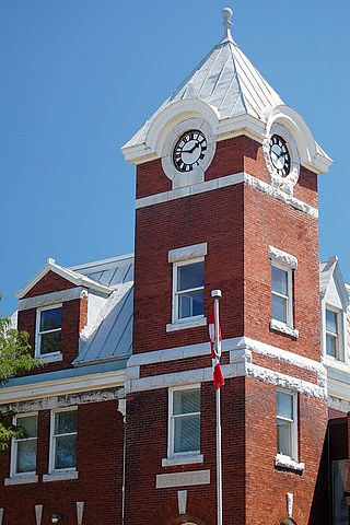
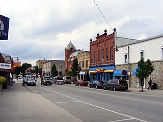
Lindsay is a community of 22,367 people on the Scugog River in the Kawartha Lakes region of south-eastern Ontario, Canada. It is approximately 43 km (27 mi) west of Peterborough. It is the seat of the City of Kawartha Lakes, and the hub for business and commerce in the region.

The City of Kawartha Lakes is a unitary municipality in Central Ontario, Canada. It is a municipality legally structured as a single-tier city; however, Kawartha Lakes is the size of a typical Ontario county and is mostly rural. It is the second largest single-tier municipality in Ontario by land area.
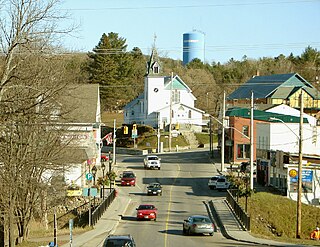
Port Perry is a community located in Scugog, Ontario, Canada. The town is located 84 kilometres (52 mi) northeast of central Toronto, north of Oshawa, and east of Whitby. Port Perry has a population of 9,553 as of 2021. Port Perry serves as the administrative and commercial centre for the township of Scugog. The town is home to a 24-bed hospital, Scugog Township's municipal offices and many retail establishments. Port Perry serves as a hub for many small communities in the Scugog area, such as Greenbank, Raglan, Caesarea, Blackstock and Nestleton/Nestleton Station. The Great Blue Heron Charitable Casino is a major employer. Located at the basin of the Trent-Severn Waterways is Lake Scugog, one of Ontario's largest man-made lakes.
Bancroft is a town located on the York River in Hastings County in the Canadian province of Ontario. It was first settled in the 1850s by United Empire Loyalists and Irish immigrants. From the mid-1950s to about 1982, mining was the primary industry. A village until 1999, Bancroft then merged with Dungannon Township to form the Town of Bancroft. The population at the time of the 2016 Census was 3,881; the regional population is 40,000. There are 150,000 visitors to Bancroft, annually.
Stouffville is the primary urban area within the town of Whitchurch-Stouffville in York Region, Ontario, Canada. It is situated within the Greater Toronto Area and the inner ring of the Golden Horseshoe. The urban area is centred at the intersection of Main Street, Mill Street, and Market Street. Between 2006 and 2011, the population of the Community of Stouffville grew 100.5% from 12,411 to 24,886, or from 51% to 66% of the total population of the larger town of Whitchurch-Stouffville. The population of Stouffville from the 2021 census is 36,753.
Asphodel–Norwood is a lower tier township municipality in Peterborough County in Central Ontario, Canada, with a 2021 population of 4,658. The land on which the township is situated is the traditional territory of the Mississauga, and became open to European colonization following its survey in 1820. The site that would become Norwood was settled in 1823, and it was incorporated as a village in 1878. The township, in its current form, was created in 1998 by the reunification of the village of Norwood with the surrounding township of Asphodel.
Whitewater Region is a township on the Ottawa River in Renfrew County, located within the scenic Ottawa Valley in eastern Ontario, Canada. Whitewater Region is made up of the former municipalities of Beachburg, Cobden, Ross and Westmeath, which were amalgamated into the current township on January 1, 2001.
Durham County is an historic county in Ontario, Canada. It was named for the English County Durham and city of Durham. It was created in 1792 but was later merged Northumberland County to form the United Counties of Northumberland and Durham. In 1974, the two counties were split and reorganized, with the former portions of Durham County reorganized into the Regional Municipality of Durham.

Stouffville GO Station is a railway station in the GO Transit network located in Stouffville, Ontario, Canada. It was the northern terminus of the Stouffville line train service until the line was extended to Lincolnville on September 2, 2008. Buses serve the station from stops on the street due to space limitations.

Kinmount is a village with a population of approximately 500, located on the Burnt River in Ontario, Canada. The village is apportioned by three municipalities, they are, City of Kawartha Lakes, Minden Hills and Trent Lakes. The village's hinterland covers large sections of both Haliburton and Peterborough counties for which it is a shopping and cultural centre. Prior to the formation of the City of Kawartha Lakes, Kinmount was the seat of Somerville Township.
Harriston is a community in the Town of Minto in Wellington County, Ontario, Canada. In 1999, Harriston was amalgamated with the communities of Palmerston, Clifford, and Minto Township to form the Town of Minto. Harriston is located at the headwaters of the Maitland River, and has several shops, restaurants, a library, an art gallery and cultural centre.

Marshfield is a small unincorporated community in Steuben Township, Warren County, in the U.S. state of Indiana.
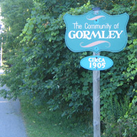
Gormley is a hamlet in York Region, Ontario, Canada that overlaps parts of Richmond Hill, and Whitchurch–Stouffville, two municipalities within the Greater Toronto Area. It was divided into two parts due to the construction of Highway 404. A portion of Gormley situated within Richmond Hill's political boundaries is subject to "Heritage Conservation District" controls. A post office in Gormley (East) serves as the mailing address for the Whitchurch–Stouffville communities of Bethesda, Gormley, Preston Lake, Vandorf, and Wesley Corners.

The amalgamation of Toronto was the creation of the city limits of Toronto, Ontario, Canada after amalgamating, annexing, and merging with surrounding municipalities since the 18th century. The most recent occurrence of amalgamation was in 1998, which dissolved the federation of Metropolitan Toronto and its constituent municipalities, and created the current "megacity" of Toronto.

The Township of Mariposa was a municipality located in the southwest corner of the former Victoria County, now the city of Kawartha Lakes, in the Canadian province of Ontario. The other municipal neighbours of Mariposa are Ops and Fenelon on the east, Eldon on the north, Brock on the west, and Scugog on the south, with the latter two located in the Durham Regional Municipality. The former township includes the communities of Little Britain, Manilla, Mariposa, Valentia, and Oakwood. Today, most of the former township is represented in the City of Kawartha Lakes by the Ward 8 Councillor, John Pollard, and Ward 4 Councillor Andrew Veale.

The Township of Verulam was a rural municipality within the former Victoria County, now the city of Kawartha Lakes. It was bounded on the north by the geographic township of Somerville, the south by the geographic township of Emily, the west by the geographic township of Fenelon, and the east by the County of Peterborough. For the purposes of government, land surveying and reference, it is now properly referred to as the "Geographic Township of Verulam".

Stone Mills is a lower-tier township north of Greater Napanee in Lennox and Addington County, Ontario, Canada. According to the 2016 census, the township has a population of 7,702.

The Toronto and Nipissing Railway (T&N) was the first public narrow-gauge railway in North America. It chartered in 1868 to build from Toronto to Lake Nipissing in Ontario, Canada, via York, Ontario, and Victoria counties. At Nipissing it would meet the transcontinental lines of the Canadian Pacific, providing a valuable link to Toronto. It opened in 1871, with service between Scarborough and Uxbridge. By December 1872 it was extended to Coboconk, but financial difficulties led to plans of the line being built further abandoned at this point. The railway merged with the Midland Railway of Canada in 1882.
The Georgian Bay and Seaboard Railway (GB&S) was a former short-line railway in Ontario, Canada, owned and operated by Canadian Pacific Railway (CPR). The first sections opened in 1908, and the entire 140 kilometres (87 mi) route was fully completed in 1912.
