Pozas, Ciales, Puerto Rico

Last updated
Pozas
Barrio
Barrio Pozas, Ciales, Puerto Rico.jpg
View of Orocovis mountains from Pozas
Pozas, Ciales, Puerto Rico locator map.png
Location of Pozas within the municipality of Ciales shown in red
Caribbean location map.svg
Red pog.svg
Pozas
Location of Puerto Rico
Coordinates: 18°16′17″N66°28′39″W / 18.271428°N 66.477498°W / 18.271428; -66.477498 [1]
Commonwealth Flag of Puerto Rico.svg  Puerto Rico
Municipality Flag of Ciales.svg Ciales
Area
[1]
  Total7.03 sq mi (18.2 km2)
  Land7.03 sq mi (18.2 km2)
  Water0 sq mi (0 km2)
Elevation
[2]
1,122 ft (342 m)
Population
 (2010)
  Total1,430
  Density203.4/sq mi (78.5/km2)
 Source: 2010 Census
Time zone UTC−4 (AST)

Pozas is a barrio in the municipality of Ciales, Puerto Rico. Its population in 2010 was 1,430. [3] [4] [5]

Contents

History

The barrio was in Spain's gazetteers [6] until Puerto Rico was ceded by Spain in the aftermath of the Spanish–American War under the terms of the Treaty of Paris of 1898 and became an unincorporated territory of the United States. In 1899, the United States Department of War conducted a census of Puerto Rico finding that the population of Pozas barrio was 2,796. [7]

Historical population
CensusPop.Note
1900 2,796
1910 2,705−3.3%
1920 2,7190.5%
1930 2,558−5.9%
1940 2,88012.6%
1950 1,987−31.0%
1960 1,975−0.6%
1980 1,316
1990 1,4066.8%
2000 1,5036.9%
2010 1,430−4.9%
U.S. Decennial Census
1899 (shown as 1900) [8] 1910-1930 [9]
1930-1950 [10] 1980-2000 [11] 2010 [12]

Sectors

Barrios (which are, in contemporary times, roughly comparable to minor civil divisions) [13] in turn are further subdivided into smaller local populated place areas/units called sectores (sectors in English). The types of sectores may vary, from normally sector to urbanización to reparto to barriada to residencial, among others. [14] [15] [16]

The following sectors are in Pozas barrio: [17]

Sector Blacho, Sector Cascana, Sector Capilla, Sector Cuesta Mata, Sector El Cedro, Sector El Gundo, Sector El Hoyo, Sector Frontera, Sector Las Lomas, Sector Llanadas, Sector Manicaboa, and Sector Villanueva.

See also

Related Research Articles

<span class="mw-page-title-main">Mameyal</span> Barrio of Dorado, Puerto Rico

Mameyal is a barrio in the municipality of Dorado, Puerto Rico. Its population in 2010 was 11.

<span class="mw-page-title-main">Jaguas, Ciales, Puerto Rico</span> Barrio of Puerto Rico

Jaguas is a barrio in the municipality of Ciales, Puerto Rico. Its population in 2010 was 4,545.

<span class="mw-page-title-main">Calabazas, Yabucoa, Puerto Rico</span> Barrio of Puerto Rico

Calabazas is a barrio in the municipality of Yabucoa, Puerto Rico. Its population in 2010 was 7,675.

<span class="mw-page-title-main">Pozas, San Sebastián, Puerto Rico</span> Barrio of Puerto Rico

Pozas is a barrio in the municipality of San Sebastián, Puerto Rico. Its population in 2010 was 3,515.

<span class="mw-page-title-main">Piñas, Toa Alta, Puerto Rico</span> Barrio of Puerto Rico

Piñas is a barrio in the municipality of Toa Alta, Puerto Rico. Its population in 2010 was 1,354.

<span class="mw-page-title-main">Cuyón, Aibonito, Puerto Rico</span> Barrio of Puerto Rico

Cuyón is a barrio in the municipality of Aibonito, Puerto Rico. Its population in 2010 was 977.

<span class="mw-page-title-main">Camino Nuevo</span> Barrio of Yabucoa, Puerto Rico

Camino Nuevo is a barrio in the municipality of Yabucoa, Puerto Rico. Its population in 2010 was 3,391.

<span class="mw-page-title-main">Culebrinas</span> Barrio of San Sebastián, Puerto Rico

Culebrinas is a barrio in the municipality of San Sebastián, Puerto Rico. Its population in 2010 was 3,787.

<span class="mw-page-title-main">Cialitos, Ciales, Puerto Rico</span> Barrio of Puerto Rico

Cialitos is a barrio in the municipality of Ciales, Puerto Rico. Its population in 2010 was 1,449.

<span class="mw-page-title-main">Cordillera, Ciales, Puerto Rico</span> Barrio of Puerto Rico

Cordillera is a barrio in the municipality of Ciales, Puerto Rico. Its population in 2010 was 2,348.

<span class="mw-page-title-main">Frontón, Ciales, Puerto Rico</span> Barrio of Puerto Rico

Frontón is a barrio in the municipality of Ciales, Puerto Rico. Its population in 2010 was 2,228.

<span class="mw-page-title-main">Pesas, Ciales, Puerto Rico</span> Barrio of Puerto Rico

Pesas is a barrio in the municipality of Ciales, Puerto Rico. Its population in 2010 was 2,361.

<span class="mw-page-title-main">Toro Negro, Ciales, Puerto Rico</span> Barrio of Puerto Rico

Toro Negro is a barrio in the municipality of Ciales, Puerto Rico. Its population in 2010 was 970.

<span class="mw-page-title-main">Ciales barrio-pueblo</span> Historical and administrative center (seat) of Ciales, Puerto Rico

Ciales barrio-pueblo is a barrio and the administrative center (seat) of Ciales, a municipality of Puerto Rico. Its population in 2010 was 1,009.

<span class="mw-page-title-main">Río Abajo, Cidra, Puerto Rico</span> Barrio of Puerto Rico

Río Abajo is a barrio in the municipality of Cidra, Puerto Rico. Its population in 2010 was 1,097.

<span class="mw-page-title-main">Rincón, Cidra, Puerto Rico</span> Barrio of Puerto Rico

Rincón is a barrio in the municipality of Cidra, Puerto Rico. Its population in 2010 was 4,332.

<span class="mw-page-title-main">Beatriz, Cidra, Puerto Rico</span> Barrio of Puerto Rico

Beatriz is a barrio in the municipality of Cidra, Puerto Rico. Its population in 2010 was 3,095.

<span class="mw-page-title-main">Hato Viejo, Ciales, Puerto Rico</span> Barrio of Puerto Rico

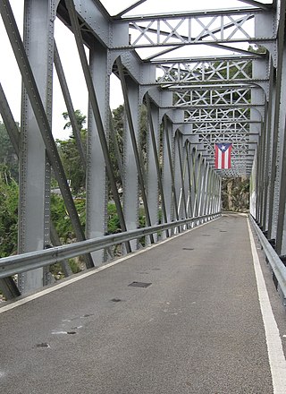
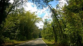
Hato Viejo is a barrio in the municipality of Ciales, Puerto Rico. Its population in 2010 was 2,442. Hato Viejo has more than a dozen sectors, a historic bridge, and folklore about a boy and a cave.

<span class="mw-page-title-main">Arenalejos, Arecibo, Puerto Rico</span> Barrio of Puerto Rico

Arenalejos is a barrio in the municipality of Arecibo, Puerto Rico. Its population in 2010 was 3,064. Arenalejos is near the center of Arecibo, west of Miraflores.

<span class="mw-page-title-main">Vaga, Morovis, Puerto Rico</span> Barrio of Puerto Rico

Vaga is a barrio in the municipality of Morovis, Puerto Rico. Vaga has three sectors and its population in 2010 was 471.

References

  1. 1 2 "US Gazetteer 2019". US Census. US Government.
  2. U.S. Geological Survey Geographic Names Information System: Pozas barrio
  3. Picó, Rafael; Buitrago de Santiago, Zayda; Berrios, Hector H. Nueva geografía de Puerto Rico: física, económica, y social, por Rafael Picó. Con la colaboración de Zayda Buitrago de Santiago y Héctor H. Berrios. San Juan Editorial Universitaria, Universidad de Puerto Rico,1969.
  4. Gwillim Law (20 May 2015). Administrative Subdivisions of Countries: A Comprehensive World Reference, 1900 through 1998. McFarland. p. 300. ISBN   978-1-4766-0447-3 . Retrieved 25 December 2018.
  5. Puerto Rico: 2010 Population and Housing Unit Counts.pdf (PDF). U.S. Dept. of Commerce, Economics and Statistics Administration, U.S. Census Bureau. 2010.
  6. "Anuario del comercio, de la industria, de la magistratura y de la administración. 1881". Biblioteca Nacional de España (in Spanish). p. 1614. Retrieved 4 April 2023.
  7. Joseph Prentiss Sanger; Henry Gannett; Walter Francis Willcox (1900). Informe sobre el censo de Puerto Rico, 1899, United States. War Dept. Porto Rico Census Office (in Spanish). Imprenta del gobierno. p.  161.
  8. "Report of the Census of Porto Rico 1899". War Department Office Director Census of Porto Rico. Archived from the original on July 16, 2017. Retrieved September 21, 2017.
  9. "Table 3-Population of Municipalities: 1930 1920 and 1910" (PDF). United States Census Bureau. Archived (PDF) from the original on August 17, 2017. Retrieved September 21, 2017.
  10. "Table 4-Area and Population of Municipalities Urban and Rural: 1930 to 1950" (PDF). United States Census Bureau. Archived (PDF) from the original on August 30, 2015. Retrieved September 21, 2014.
  11. "Table 2 Population and Housing Units: 1960 to 2000" (PDF). United States Census Bureau. Archived (PDF) from the original on July 24, 2017. Retrieved September 21, 2017.
  12. Puerto Rico: 2010 Population and Housing Unit Counts.pdf (PDF). U.S. Dept. of Commerce Economics and Statistics Administration U.S. Census Bureau. 2010. Archived (PDF) from the original on 2017-02-20. Retrieved 2019-08-02.
  13. "US Census Barrio-Pueblo definition". factfinder.com. US Census. Archived from the original on 13 May 2017. Retrieved 5 January 2019.
  14. "Agencia: Oficina del Coordinador General para el Financiamiento Socioeconómico y la Autogestión (Proposed 2016 Budget)". Puerto Rico Budgets (in Spanish). Retrieved 28 June 2019.
  15. Rivera Quintero, Marcia (2014), El vuelo de la esperanza: Proyecto de las Comunidades Especiales Puerto Rico, 1997-2004 (first ed.), San Juan, Puerto Rico Fundación Sila M. Calderón, ISBN   978-0-9820806-1-0
  16. "Leyes del 2001". Lex Juris Puerto Rico (in Spanish). Retrieved 24 June 2020.
  17. "DESGLOSE DE SECTORES Y CENTROS DE VOTACIÓN CIALES 023" (PDF). Comisión Estatal de Elecciones Puerto Rico (in Spanish). 19 October 2018. Retrieved 15 June 2020.