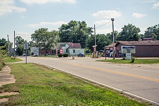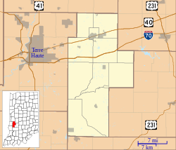
Clay County is a county located in the U.S. state of Indiana. As of 2020, the population was 26,466. The county seat is Brazil.

Jackson Township is one of thirteen townships in Parke County, Indiana, United States. As of the 2010 census, its population was 737 and it contained 475 housing units.

Jefferson Township is one of thirteen townships in Owen County, Indiana, United States. As of the 2010 census, its population was 1,129 and it contained 525 housing units.

Marion Township is one of thirteen townships in Owen County, Indiana, United States. As of the 2010 census, its population was 916 and it contained 464 housing units.

Curry Township is one of nine townships in Sullivan County, Indiana, United States. As of the 2010 census, its population was 3,559 and it contained 1,643 housing units. All three of Terre Haute's television affiliates and several radio stations have or share transmitter towers in the northern end of the township just south of Farmersburg.

Fairbanks Township is one of nine townships in Sullivan County, Indiana, United States. As of the 2010 census, its population was 733 and it contained 344 housing units.
Billtown is an unincorporated community in Posey Township, Clay County, Indiana. It is part of the Terre Haute Metropolitan Statistical Area.

Bowling Green is an unincorporated community in Washington Township, Clay County, Indiana. It is part of the Terre Haute Metropolitan Statistical Area.

Cloverland is an unincorporated community in Posey Township, Clay County, Indiana. It is part of the Terre Haute Metropolitan Statistical Area.

Saline City is an unincorporated community in Sugar Ridge Township, Clay County, Indiana. It is part of the Terre Haute Metropolitan Statistical Area.
Turner is an unincorporated community in Posey Township, Clay County, Indiana. It is part of the Terre Haute Metropolitan Statistical Area.

Prairie Creek is an unincorporated community in southeastern Prairie Creek Township, Vigo County, in the U.S. state of Indiana. Its elevation is 528 feet (161 m), and it is located at 39°16′30″N87°29′50″W. Because the community has had multiple names, the Board on Geographic Names officially decided in favor of "Prairie Creek" in 1959. Although Prairie Creek is unincorporated, it has a post office, with the ZIP code of 47869.
Brunswick is an unincorporated community in Lewis Township, Clay County, Indiana. It is part of the Terre Haute Metropolitan Statistical Area.

Middlebury is an unincorporated community in Harrison Township, Clay County, Indiana. It is part of the Terre Haute Metropolitan Statistical Area.
Antioch is an unincorporated community in the southwestern part of Wright Township, Greene County, Indiana, United States. It lies near the intersection of County Road 575 North and County Road 500 North, which is a community nearly twenty miles west of the city of Bloomfield, the county seat of Greene County. Its elevation is 531 feet, and it is located at 39°05′55″N87°14′15″W.
Denmark is an unincorporated community in the southwest portion of Marion Township, Owen County, in the U.S. state of Indiana. It lies near the intersection of County Road 1400 West and County Road 150 South, which is a community about fifteen miles west of the city of Spencer, the county seat of Owen County. Its elevation is 722 feet, and it is located at 39°16′11″N87°1′33″W.
Hubbell is an unincorporated community in the southwestern corner of Jefferson Township, Owen County, in the U.S. state of Indiana. It lies near the intersection of County Road 750 South and Indiana Highway 157, which is a community nearly twenty miles southwest of the city of Spencer, the county seat. Its elevation is 528 feet, and it is located at 39°10′59″N87°0′44″W. This community is also known as Hubbells Station.
Braysville is an unincorporated community in the western part of Clay Township, Owen County, in the U.S. state of Indiana. It lies near the intersection of Freedom Road and Ranard Road, which is a community about six miles south of the city of Spencer, the county seat. Its elevation is 735 feet, and it is located at 39°12′42″N86°46′28″W.
Smithville is an unincorporated community in the northwest corner of Marion Township, Owen County, in the U.S. state of Indiana. It lies near the intersection of County Road 200 North and County Road 1400 West, which is a community about fifteen miles west of the city of Spencer, the county seat. Its elevation is 591 feet, and it is located at 39°19′15″N87°1′33″W.
Hickory Corner is an unincorporated community in the northwest corner of Marion Township, Owen County, in the U.S. state of Indiana. It lies near the intersection of County Road 1500 West and Orman Road, which is a community about twenty miles west of the city of Spencer, the county seat. Its elevation is 643 feet, and it is located at 39°18′18″N87°2′40″W.


