
Hartlepool is a seaside and port town in County Durham, England. It is governed by a unitary authority borough named after the town. The borough is part of the devolved Tees Valley area. With an estimated population of 92,600, it is the second-largest settlement in County Durham, after Darlington.

Croxdale is a village in the civil parish of Croxdale and Hett, situated about 3 miles (4.8 km) south of Durham City, in County Durham, England and on the A167 road, formerly part of the Great North Road. It is on the route of the East Coast Main Line and at one time had a station. The railway crosses over Croxdale Viaduct, built in 1872, just north of the village. The Weardale Way long distance footpath passes through the nearby Croxdale Hall estate.

Aislaby is a small village and civil parish on the north bank of the River Tees within the borough of Stockton-on-Tees and the ceremonial county of County Durham, England. It is located to the west of Eaglescliffe and Yarm.

Hesleden is a village in County Durham, England, south of Peterlee. The name is a combination of Dene and Hesle, which is from "hazel". The combined population of the five communities making up the parish of Monk Hesleden was 5,722 at the 2011 Census.

Horden is a village and electoral ward in County Durham, England. It is situated on the North Sea coast, to the east of Peterlee, approximately 12 miles south of Sunderland. Horden was a mining village until the closure of the Horden Colliery in 1987. Main features include the Welfare and Memorial Parks and St Mary's church. It is connected to the villages of Blackhall Colliery and Blackhall Rocks to its south by a spectacular rail viaduct which spans Castle Eden Dene near Denemouth. Horden Dene provides Horden's northern boundary with Easington Colliery.

Thornley is a village and civil parish in County Durham, England, about 5 miles (9 km) to the east of Durham and 5 miles (7 km) west of Peterlee. The community grew around a coal mine established in 1835, which remained open until 1970.
Haswell is a village in County Durham, in England. It is situated 6 miles (9.7 km) east of the city of Durham, 9 miles (14 km) south of the city of Sunderland and 3.1 miles (5.0 km) north-west of the town of Peterlee.

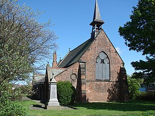
Cornsay Colliery is a village in County Durham, England. It is situated a few miles to the west of Durham, close to Cornsay, Quebec and Esh Winning.

Esh is a village and civil parish situated around five miles north-west of Durham in County Durham, England. The central area of the village contains a stone cross, which probably replaced a former market cross. This is locally known as St Cuthberts Cross and bears the inscription I. H. S., and the date 1687. Esh is a rural village, nestled between a number of working farms; it has two primary schools, a pub and two churches, St Michael and All Angels and St. Michael's.

Esh Winning is a village, and location of a former colliery, in County Durham, England. It is situated in the Deerness Valley 5 miles (8 km) to the west of Durham.

Langley Moor is an old pit village in County Durham, England. It is located approximately 2 miles south-west of Durham City. Langley Moor is within the civil parish of Brandon and Byshottles which is itself within the City of Durham constituency, as of 2019 represented by Mary Foy MP.

Langley Park is a village in County Durham, England. The historic city of Durham lies 4 miles (6.4 km) to the east.

Waterhouses is a village in Brandon and Byshottles civil parish, in County Durham, England. It is situated to the west of Durham, near Esh Winning, on the northern Bank of the River Deerness.

Wideopen, also occasionally misspelled as Wide Open, is a village in the North Tyneside metropolitan borough of Tyne and Wear, England, around 5 miles (8.0 km) north of Newcastle.

The A689 is a road in northern England that runs east from the A595, 3.1 miles (5.0 km) to the west of Carlisle in Cumbria, to Hartlepool in County Durham.

Springwell Village is a village in the City of Sunderland, bordering Gateshead, approximately 7.6 miles (12.2 km) from Newcastle upon Tyne, 9 miles (14 km) from Sunderland, and 13 miles (21 km) from Durham. In 2011, Census data for the City of Sunderland ward of Washington West recorded a total population of 11,833.
John Thomas Hill was an English footballer who played as a centre forward in the Football League for Newport County and Darlington, and in non-league football for Esh Winning, Jarrow, West Stanley, Spennymoor United, and Horden Colliery Welfare.

Blackhall Rocks was one of two railway stations to have served the Blackhalls in County Durham, North East England, and was a stop on the Durham Coast Line. The station was poorly sited for the village that grew around Blackhall Colliery in the years following its opening and, after the opening of the more conveniently sited Blackhall Colliery station in 1936, it came to primarily serve the more southerly village of Blackhall Rocks.


