Quichuay | |
|---|---|
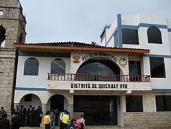 Town hall | |
 Quichuay Location of Quichuay in the Huancayo province | |
| Coordinates: 11°53′S75°17′W / 11.89°S 75.29°W | |
| Country | |
| Region | Junín |
| Province | Huancayo |
| Founded | November 24, 1955 |
| Capital | Quichuay |
| Government | |
| • Mayor | Gonzalo Alfonso Parraga Camarena |
| Area | |
• Total | 34.79 km2 (13.43 sq mi) |
| Elevation | 3,430 m (11,250 ft) |
| Population | |
• Total | 2,186 |
| • Density | 63/km2 (160/sq mi) |
| Time zone | UTC-5 (PET) |
| UBIGEO | 120127 |
Quichuay District is one of twenty-eight districts of the province Huancayo in Peru. [1]