
Ecuador is a country in western South America, bordering the Pacific Ocean at the Equator, for which the country is named. Ecuador encompasses a wide range of natural formations and climates, from the desert-like southern coast to the snowcapped peaks of the Andes mountain range to the plains of the Amazon Basin. Cotopaxi in Ecuador is one of the world's highest active volcanos. It also has a large series of rivers that follow the southern border and spill into the northwest area of Peru.

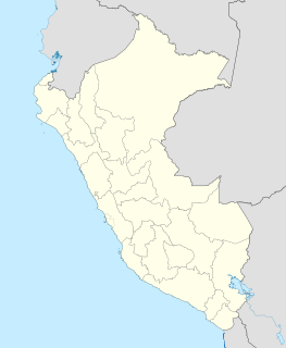
Peru is a country on the central western coast of South America facing the Pacific Ocean. It lies wholly in the Southern Hemisphere, its northernmost extreme reaching to 1.8 minutes of latitude or about 3.3 kilometres (2.1 mi) south of the equator. Peru shares land borders with Ecuador, Colombia, Brazil, Bolivia, and Chile, with its longest land border shared with Brazil.

The Köppen climate classification is one of the most widely used climate classification systems. It was first published by German-Russian climatologist Wladimir Köppen (1846–1940) in 1884, with several later modifications by Köppen, notably in 1918 and 1936. Later, the climatologist Rudolf Geiger (1894-1981) introduced some changes to the classification system, which is thus sometimes called the Köppen–Geiger climate classification system.

Victoria is the capital and largest city of the Republic of the Seychelles, situated on the north-eastern side of Mahé island, the archipelago's main island. The city was first established as the seat of the British colonial government. In 2010, the population of Greater Victoria was 26,450 out of the country's total population of 90,945.

Junín is a department and region in the central highlands and westernmost Peruvian Amazon. Its capital is Huancayo.

Junín is a city in the province of Buenos Aires, Argentina, and administrative seat of the partido of Junín. It has a population of 85,420 and is located 260 km (162 mi) west of the city of Buenos Aires. It is mostly known for being the hometown of former first lady of Argentina Eva Perón.

Chachapoyas is a city in northern Peru at an elevation of 2,335 meters (7,661 ft). The city has a population of 32,026 people (2017). Situated in the mountains far from the Peruvian coast, Chachapoyas remains fairly isolated from other regions of Peru. It is served by buses to Chiclayo and Cajamarca, and flights to domestic locations from Chachapoyas Airport.

San Ramón is one of two main towns in the Chanchamayo Province of the Junín Region, on the eastern slopes of the Andean Cordillera Oriental in Peru. The nearest town downstream is La Merced, the province's capital, at a distance of 12 km (7.5 mi).

Satipo Province is the largest and easternmost province in the Junín Region, located in the central Amazon rainforest of Peru. Its capital is the town of Satipo.

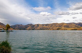
Climate of Peru describes the diverse climates of this large South American country with an area of 1,285,216 km2 (496,225 sq mi). Peru is located entirely in the tropics but features desert and mountain climates as well as tropical rainforests. Elevations above sea level in the country range from −37 to 6,778 m and precipitation ranges from less than 20 mm (0.79 in) annually to more than 8,000 mm (310 in). There are three main climatic regions: the Pacific Ocean coast is one of the driest deserts in the world but with some unique features; the high Andes mountains have a variety of microclimates depending on elevation and exposure and with temperatures and precipitation from temperate to polar and wet to dry; and the Amazon basin has tropical climates, mostly with abundant precipitation, along with sub-tropical climates in elevations above 1,550 m (5,090 ft).
Jauja Province is a Peruvian province. It is one of the nine provinces of the Junín Region. To the north it borders with the Yauli, Tarma and Chanchamayo Provinces. To the east with the Satipo Province, to the south with the Concepción Province and to the west with the Lima Region. The capital of the Jauja Province is the city of Jauja. The city was founded by Francisco Pizarro as the first capital of Peru.

Huancayo Province is located in Peru. It is one of the 9 provinces composing the Junín Region. It borders to the north with the Concepción Province, the east with the Satipo Province, the south with the Huancavelica Region and the west with the Chupaca Province. The province has an approximate population of 545,615 inhabitants. The capital of the province is the city of Huancayo.

The Mantaro River is a long river running through the central region of Peru. Its Quechua name means "great river". The word "Mantaro" may be a word originally from the Ashaninka language, who live downstream along the Ene River. The Mantaro, along with the Apurimac River, are the sources of the Amazon River, depending on the criteria used for definition.
Satipo is a town in central Peru, in Satipo District, Satipo Province in Junín Region. It is the capital of Satipo Province.
Villa Rica District is one of eight districts of Oxapampa Province in Pasco Department, Peru. The district has an area of 896 square kilometres (346 sq mi) and a population of 18,673 in 2017. The capital of the district is the town of Villa Rica which had a population of 11,900 in 2017. The district is the location of the Cerro de la Sal or Salt Mountain, an important gathering place for indigenous people of the region and a center of Franciscan missionary activity in the 17th and 18th centuries. The town was founded in 1928 by settlers of German and Austrian origin from the town of Pozuzo.
The Asháninka Communal Reserve is a protected area in Peru located in the Junín Region, Satipo Province, Río Tambo District.
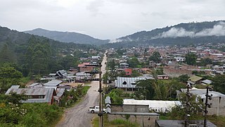
Alipio Ponce is a Peruvian football club based in the city of Mazamari, Satipo, Junín, Peru.

Inti Wañunan is a mountain in the Andes of Peru, about 4,600 m (15,092 ft) high. It is situated in the Huancavelica Region, Huancavelica Province, Acobambilla District, and in the Junín Region, Huancayo Province, Chongos Alto District.
The Gran Pajonal is an isolated interfluvial plateau in the Amazon Basin of Peru. It is located in the departments of Ucayali, Pasco and Junín. The plateau is inhabited by the Asháninka or Ashéninka people along with late-twentieth century immigrants largely from the Andes mountains of Peru. In the 1730s, Roman Catholic Franciscan missionaries established missions in the Gran Pajonal, but the missions were destroyed in the 1740s by the Ashaninka under the leadership of Juan Santos Atahualpa.
Vizcatán del Ene district is one of the nine constituent districts of Satipo Province situated in the eastern part of the Department of Junín, Peru. The district was founded on October 2, 2015 by the government of President Ollanta Humala by enactment of Law Number 30346.

