Ray, Alabama | |
|---|---|
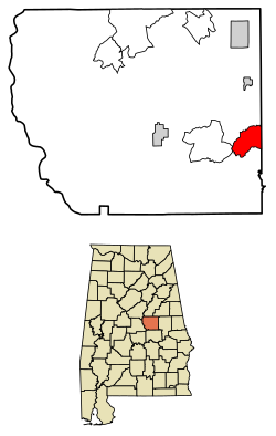 Location of Ray in Coosa County, Alabama. | |
| Coordinates: 32°52′23″N86°02′25″W / 32.87306°N 86.04028°W | |
| Country | United States |
| State | Alabama |
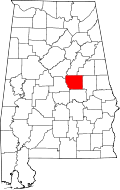
| County | Coosa |
| Area | |
• Total | 9.51 sq mi (24.64 km2) |
| • Land | 9.46 sq mi (24.51 km2) |
| • Water | 0.050 sq mi (0.13 km2) |
| Elevation | 709 ft (216 m) |
| Population (2020) | |
• Total | 326 |
| • Density | 34/sq mi (13.3/km2) |
| Time zone | UTC-6 (Central (CST)) |
| • Summer (DST) | UTC-5 (CDT) |
| Area codes | 256 & 938 |
| GNIS feature ID | 2582695 [2] |
Ray is a census-designated place and unincorporated community in Coosa County, Alabama, United States. Its population was 326 as of the 2020 census.