The North Sea Canal is a Dutch ship canal from Amsterdam to the North Sea at IJmuiden, constructed between 1865 and 1876 to enable seafaring vessels to reach the port of Amsterdam. This man-made channel terminates at Amsterdam in the closed-off IJ Bay, which in turn connects to the Amsterdam-Rhine Canal.

The Prinsengracht is a canal that runs parallel to the Keizersgracht in the center of Amsterdam. The canal, named after the Prince of Orange, is the fourth of the four main canals belonging to the canal belt.
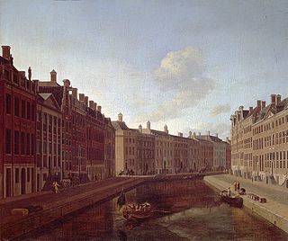
The Herengracht is the second of four Amsterdam canals belonging to the canal belt and lies between the Singel and the Keizersgracht. The Gouden Bocht in particular is known for its large and beautiful canal houses.

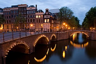
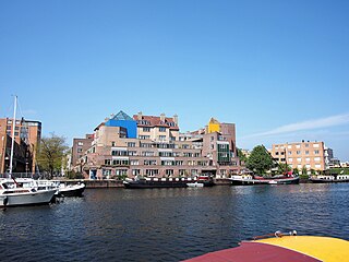
Amsterdam, capital of the Netherlands, has more than one hundred kilometers of grachten (canals), about 90 islands and 1,500 bridges. The three main canals, dug in the 17th century during the Dutch Golden Age, form concentric belts around the city, known as the Grachtengordel. Alongside the main canals are 1550 monumental buildings. The 17th-century canal ring area, including the Prinsengracht, Keizersgracht, Herengracht and Jordaan, were listed as UNESCO World Heritage Site in 2010, contributing to Amsterdam's fame as the "Venice of the North".

Amsterdam Pride or Amsterdam Gay Pride is a citywide gay-festival held annually at the center of Amsterdam during the first weekend of August. The festival attracts several hundred-thousand visitors each year and is one of the largest publicly held annual events in the Netherlands.

The Den Helder–Amsterdam railway is a railway line in the Netherlands running from Den Helder to Amsterdam, passing through Alkmaar and Zaandam. It is also called the Staatslijn K in Dutch. The line is 81 km long.

The Zeeheldenbuurt is a neighbourhood of Amsterdam, Netherlands. Located in the borough Amsterdam-West, it borders directly on the Westelijke Eilanden to the west. It lies between the Westerkanaal and the Westerdok; to the north is Houthaven and the IJ. The neighbourhood is served by the S100 road, and is sometimes confused with the nearby Admiralenbuurt.

Westelijke Eilanden are three islands in the Centrum district of Amsterdam: Bickerseiland, Prinseneiland and Realeneiland. They are located to the south of the IJ and the Zeeheldenbuurt, to the north of the railway line between Central Station and Amsterdam-Sloterdijk, to the west of the Westerdok and to the east of the Planciusbuurt on the Westerkanaal. The Westelijke Eilanden form the core of the Golden Reael area, which also includes the adjacent Westerdok island, the Haarlemmerbuurt and the Planciusbuurt.

The Singelgracht is the waterway that borders the entire Amsterdam Center and flows along the Nassaukade, Stadhouderskade and Mauritskade. Formerly the canal and the ramparts on the city side formed the outer defenses of the city.

The Oudezijds Voorburgwal, often abbreviated to OZ Voorburgwal, is a street and canal in De Wallen in the center of Amsterdam. The OZ Voorburgwal runs from the Grimburgwal in the south to the Zeedijk in the north, where it changes into the Oudezijds Kolk, which drains into the IJ.
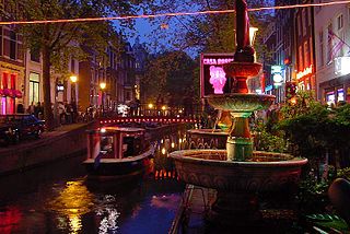
The Oudezijds Achterburgwal, often abbreviated to OZ Achterburgwal, is a street and canal in De Wallen, the red light district in the center of Amsterdam.

The Nieuwe Vaart or Nieuwevaart is a 17th-century canal in Amsterdam that runs from the center to Amsterdam-Oost.
The Waalseilandsgracht,or Waalseilandgracht, is a short, wide canal in the east part of the inner city of Amsterdam.

The Zoutkeetsgracht is a canal to the west of the center of Amsterdam.
The Eilandsgracht is a canal in Amsterdam between the Westelijke Eilanden and the mainland. It originally ran between the mainland and two of the islands, Prinseneiland and Bickerseiland. In 1928 the section along Bickerseiland was filled in.
The Wittenburgervaart is a short canal in Amsterdam, between the Oostelijke Eilanden.
This page is based on this
Wikipedia article Text is available under the
CC BY-SA 4.0 license; additional terms may apply.
Images, videos and audio are available under their respective licenses.