Remote sensing (archaeology)

Last updated

Remote sensing techniques in archaeology are an increasingly important component of the technical and methodological tool set available in archaeological research. [1] The use of remote sensing techniques allows archaeologists to uncover unique data that is unobtainable using traditional archaeological excavation techniques.

Contents

General techniques

Remote Sensing methods employed in the service of archaeological investigations include:

Ground-based geophysical methods such as Ground Penetrating Radar and Magnetometry are also used for archaeological imaging. Although these are sometimes classed as remote sensing, they are usually considered a separate discipline (see Geophysical survey (archaeology)).

Satellite archaeology

Satellite archaeology is an emerging field of archaeology that uses high resolution satellites with thermal and infrared capabilities to pinpoint potential sites of interest in the earth around a meter or so in depth. [2] The infrared light used by these satellites have longer wavelengths than that of visible light and are therefore capable of penetrating the Earth's surface. The images are then taken and processed by an archaeologist who specializes in satellite remote sensing in order to find any subtle anomalies on the Earth's surface.

Landscape features such as soil, vegetation, geology, and man-made structures of possible cultural interest have specific signatures that the multi-spectral satellites can help to identify. The satellites can then make a 3D image of the area to show if there are any man-made structures beneath soil and vegetation that can not be seen by the naked eye. Commercially available satellites have a .4m-90m resolution that make it possible to see most ancient sites and their associated features in such places as Egypt, Perù and Mexico. It is a hope of archaeologists that in the next few decades resolutions will improve to the point where they are capable of zooming in on a single pottery shard buried beneath the earth's surface.

Satellite archaeology is a non-invasive method for mapping and monitoring potential archaeological sites in an ever changing world that faces issues such as urbanization, looting, and groundwater pollution that could pose threats to such sites. In spite of this, satellites in archaeology are mostly a tool for broad scale survey and focused excavation. All archaeological projects need ground work in order to verify any potential findings.

Examples of regional applications

Maya research

Some of the most prominent remote sensing research has been done in regard to Maya studies in Mesoamerica. The Petén region of northern Guatemala is of particular focus because remote sensing technology is of very definite use there. The Petén is a densely forested region and it lacks modern settlements and infrastructure. As a result, it is extremely difficult to survey, and because of this remote sensing offers a solution to this research problem. The use of remote sensing techniques in this region is a great example of the applications these methods have for archaeologists. The Petén is a hilly, karstic, thickly forested landscape which offers an incredible barrier for field archaeologists to penetrate. With the advent of remote sensing techniques, a plethora of information has been uncovered about the region and about the people that inhabited it.

The Petén is arguably one of the most difficult of the Maya landscapes in which to subsist. It is questions regarding subsistence patterns and related problems that have driven remote sensing methodology in the hopes of understanding the complex adaptations that the Maya developed. [3] Remote sensing methods have also proven invaluable when working to discover features, cisterns, and temples. Archaeologists have identified vegetative differentiation associated with such features. With the advent of remote sensing, archaeologists are able to pinpoint and study the features hidden beneath this canopy without ever visiting the jungle.

A pioneer in the use of remote sensing in Maya research is NASA archaeologist Tom Sever, who has applied remote sensing to research in Maya site discovery as well as mapping causeways ( sacbeob ) and roads. Sever has stressed the enormous use of remote sensing in uncovering settlement patterns, population densities, societal structure, communication, and transportation. [4] Sever has done much of his research in the Petén region of northern Guatemala, where he and his research team have used satellite imagery and GIS to map undiscovered roads and causeways the ancient Maya built to connect cities and settlements. These landscape artifacts represent the advantage of using remote sensing as these causeways are not visible from the ground. By mapping these forms, Sever is able to locate new sites and further uncover ancient Maya methods of communicated and transportation. Sever and his team also use remote sensing methods to gather data on deforestation. The rain forests of the Petén are undergoing massive deforestation, and Sever's remote sensing offers another window into this understanding and halting this problem. Monitoring the rate of deforestation not only has important ecological value, but the use of remote sensing can detect landscape change. By measuring the magnitude of landscape change in terms of vegetative cover and soil geography, as well as shifting land use patterns and the associated cultural diversity, archaeologists are given a window into depletion rates and trends in anthropogenic landscape alteration. [5]

Much attention has been devoted to the mapping of canals and irrigation systems. [6] Synthetic Aperture Radar (SAR) has proved particularly useful in this research. SAR is a type of radar that is sensitive to linear and geometric features on the ground. [4] It is also important to include a method called ground truthing, or the process of physically visiting (on foot) the localities surveyed to verify the data and help inform the interpretation. GPS is often used to aid in this process.

Ground-based geophysical methods have also been employed in Maya research. Ground Penetrating Radar (GPR) has been performed on a number of sites, including Chichen Itza. The GPR research has detected buried causeways and structures that might have otherwise gone unnoticed. [7]

Maya "collapse"

One of Sever's research goals is understanding the comparatively sudden decline of many Maya centers in the central Lowlands region by the end of the 1st millennium CE, a happenstance often referred to as the "(Classic) Maya collapse". Sever's research on communication and transportation systems points to an extensive societal infrastructure capable of supporting the building and maintenance of the causeways and roadways. Using satellite imagery, researchers have been able to map canals and reservoirs. These offer a glimpse into Maya cultural adaptations during the period of their highest population density. At the height of the classic period, the population in the Maya lowlands was 500 - 1300 people per square mile in rural areas, and even more in urban regions. This far outweighs the carrying capacity for this region, but this follows centuries of successful adaptation. Other data shows that by the end of the classic period, the Maya had already depleted much of the rain forest. Understanding how the ancient Maya adapted to this karst topography could shed light on solutions to modern ecological problems that modern peoples in the Petén currently face, which is much the same, except there are fewer people who are causing even more damage to the biodiversity and cultural diversity. [8] Sever believes that the Maya collapse was a primarily ecological disaster. By detecting deforestation rates and trends can help us to understand how these same processes affected the Maya. An important contribution to the study of Maya has been provided by LiDAR thanks to its ability to penetrate dense tropical canopies. LiDAR has been applied to the site of Caracol, Belize in 2009, revealing an impressive monumental complex covered by jungle. [9] [10]

Satellite archaeology in Peru

In Peru, an Italian scientific mission of CNR, directed by Nicola Masini, provided important results by using satellite imagery for both site discovery and the protection of archaeological heritage. In particular, by processing QuickBird images a large buried settlement, including a pyramid, in the Nasca riverbed (Southern Peru), near the Ceremonial Center of Cahuachi, has been detected. [11] In the region of Lambayeque (Northern Peru), which is strongly affected by clandestine excavations, satellite imagery have been also employed for mapping and monitoring archaeological looting. [12]

Location of ancient Iram

Iram of the Pillars is a lost city (or region surrounding the lost city) on the Arabian Peninsula. In the early 1980s a group of researchers interested in the history of Iram used NASA remote sensing satellites, ground penetrating radar, Landsat program data and images taken from the Space Shuttle Challenger as well as SPOT data to identify old camel train routes and points where they converged. These roads were used as frankincense trade routes around 2800 BC to 100 BC.

One area in the Dhofar province of Oman was identified as a possible location for an outpost of the lost civilization. A team including adventurer Ranulph Fiennes, archaeologist Juris Zarins, filmmaker Nicholas Clapp, and lawyer George Hedges, scouted the area on several trips, and stopped at a water well called Ash Shisar. [13] Near this oasis was located a site previously identified as the 16th century Shis'r fort. Excavations uncovered an older settlement, and artifacts traded from far and wide were found. This older fort was found to have been built on top of a large limestone cavern which would have served as the water source for the fort, making it an important oasis on the trade route to Iram. As the residents of the fort consumed the water from underground, the water table fell, leaving the limestone roof and walls of the cavern dry. Without the support of the water, the cavern would have been in danger of collapse, and it seems to have done so some time between 300-500 AD, destroying the oasis and covering over the water source.

Four subsequent excavations were conducted by Dr. Juris Zarins, tracing the historical presence by the people of 'Ad, the assumed ancestral builders of Iram.

Egypt and the Roman Empire

Archaeologist Dr Sarah Parcak uses satellites to search for sub-surface remains, as described in her TED Talk on the subject of space archaeology and uses of citizen science. Parcak uses these satellites to hunt to for lost settlements, tombs, and pyramids in Egypt's Nile Delta. [14] [15] She has also prospectively identified several significant sites in various parts of the ancient Roman Empire. [16] [17]

See also

Related Research Articles

Archaeological site Place in which evidence of past activity is preserved

An archaeological site is a place in which evidence of past activity is preserved, and which has been, or may be, investigated using the discipline of archaeology and represents a part of the archaeological record. Sites may range from those with few or no remains visible above ground, to buildings and other structures still in use.

Geophysical survey (archaeology) Non-invasive physical sensing techniques used for archaeological imaging or mapping

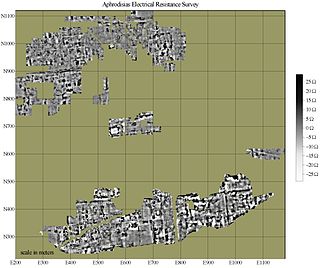
In archaeology, geophysical survey is ground-based physical sensing techniques used for archaeological imaging or mapping. Remote sensing and marine surveys are also used in archaeology, but are generally considered separate disciplines. Other terms, such as "geophysical prospection" and "archaeological geophysics" are generally synonymous.

El Mirador Pre-Columbian Maya settlement

El Mirador is a large pre-Columbian Maya settlement, located in the north of the modern department of El Petén, Guatemala.

Aerial archaeology is the study of archaeological remains by examining them from altitude.

Environmental archaeology is a sub-field of archaeology which emerged in 1970s and is the science of reconstructing the relationships between past societies and the environments they lived in. The field represents an archaeological-palaeoecological approach to studying the palaeoenvironment through the methods of human palaeoecology. Reconstructing past environments and past peoples' relationships and interactions with the landscapes they inhabited provides archaeologists with insights into the origin and evolution of anthropogenic environments, and prehistoric adaptations and economic practices.

Ground-penetrating radar Geophysical method that uses radar pulses to image the subsurface

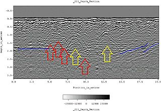
Ground-penetrating radar (GPR) is a geophysical method that uses radar pulses to image the subsurface. It is a non-intrusive method of surveying the sub-surface to investigate underground utilities such as concrete, asphalt, metals, pipes, cables or masonry. This nondestructive method uses electromagnetic radiation in the microwave band of the radio spectrum, and detects the reflected signals from subsurface structures. GPR can have applications in a variety of media, including rock, soil, ice, fresh water, pavements and structures. In the right conditions, practitioners can use GPR to detect subsurface objects, changes in material properties, and voids and cracks.

Survey (archaeology) Non-destructive exploration of the archaeological material in a given area

In archaeology, survey or field survey is a type of field research by which archaeologists search for archaeological sites and collect information about the location, distribution and organization of past human cultures across a large area. Archaeologists conduct surveys to search for particular archaeological sites or kinds of sites, to detect patterns in the distribution of material culture over regions, to make generalizations or test hypotheses about past cultures, and to assess the risks that development projects will have adverse impacts on archaeological heritage. The surveys may be: (a) intrusive or non-intrusive, depending on the needs of the survey team and; (b) extensive or intensive, depending on the types of research questions being asked of the landscape in question. Surveys can be a practical way to decide whether or not to carry out an excavation, but may also be ends in themselves, as they produce important information about past human activities in a regional context.

Enclosure (archaeology) Archaeological feature

In archaeology, an enclosure is one of the most common types of archaeological site – It is any area of land separated from surrounding land by earthworks, walls or fencing. Such a simple feature is found all over the world and during almost all archaeological periods. They may be few metres across or be large enough to encompass whole cities.

Nakbe

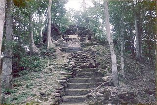
Nakbe is one of the largest early Maya archaeological sites. Nakbe is located in the Mirador Basin, in the Petén region of Guatemala, approximately 13 kilometers south of the largest Maya city of El Mirador. Excavations at Nakbe suggest that habitation began at the site during the Early Formative period and continued to be a large site until its collapse during the Terminal Formative period. The fall of Nakbe and El Mirador took place at roughly the same time.

Kinal Mayan archaeological site in Petén Department, Guatemala

Kinal is a major pre-Columbian Maya archaeological site in the Petén Department of the modern-day Petén Department of northern Guatemala. The major occupational phase for the site dates from the Late Classic period of Mesoamerican chronology, with evidence for a substantial and expansionary building program dating from the first half of the 8th century AD. Kinal was discovered in the 1960s by archaeologist Ian Graham while he was carrying out an archaeological survey of the region, although no excavations were undertaken at the site at that time.

Dr. Thomas L. Sever is an archaeologist with NASA's Marshall Space Flight Center. Dr. Sever is NASA's only archaeologist and works primarily with Dan Irwin to decode remote sensing readings. While most of his work has dealt with South American and ancient Mayan civilization, Dr. Sever has also used his skills in meteorology.

Sarah Parcak Archaeologist

Sarah Helen Parcak is an American archaeologist and Egyptologist, who has used satellite imaging to identify potential archaeological sites in Egypt, Rome, and elsewhere in the former Roman Empire. She is a professor of Anthropology and director of the Laboratory for Global Observation at the University of Alabama at Birmingham. In partnership with her husband, Greg Mumford, she directs survey and excavation projects in the Faiyum, Sinai, and Egypt's East Delta.

William Andrew "Bill" Saturno is an American archaeologist and Mayanist scholar who has made significant contributions toward the study of the pre-Columbian Maya civilization. As of February 2015, Saturno holds a position as assistant professor in archaeology at Boston University's (BU's) College of Arts and Sciences (CAS). He is also the director of the Proyecto San Bartolo-Xultun at the Instito de Antropologia e Historia in Guatemala, a national space research scientist at the Marshall Space Flight Center, as well as a research associate at the Peabody Museum at Harvard University. Prior to his position at BU, Saturno was a lecturer at the University of New Hampshire.

Archaeology Study of the past via material culture

Archaeology or archeology is the scientific study of human activity through the recovery and analysis of material culture. The archaeological record consists of artifacts, architecture, biofacts or ecofacts, sites, and cultural landscapes. Archaeology can be considered both a social science and a branch of the humanities. In Europe it is often viewed as either a discipline in its own right or a sub-field of other disciplines, while in North America archaeology is a sub-field of anthropology.

El Tintal

El Tintal is a Maya archaeological site in the northern Petén region of Guatemala, about 25 kilometres (16 mi) northeast of the modern-day settlement of Carmelita, with settlement dating to the Preclassic and Classic periods. It is close to the better known sites of El Mirador, to which it was linked by causeway, and Nakbé. El Tintal is a sizeable site that includes some very large structures and it is one of the four largest sites in the northern Petén; it is the second largest site in the Mirador Basin, after El Mirador itself. El Tintal features monumental architecture dating to the Middle Preclassic similar to that found at El Mirador, Nakbé and Wakna. Potsherds recovered from the site date to the Late Preclassic and Early Classic periods, and construction continued at the site in the Late Classic period.

Holmul Archaeological site

Holmul is a pre-Columbian archaeological site of the Maya civilization located in the northeastern Petén Basin region in Guatemala near the modern-day border with Belize.

Diane Zaino Chase is an American anthropologist and archaeologist who specializes in the study of the Ancient Maya.

Arlen F. Chase

Arlen F. Chase is a Mesoamerican archaeologist and a faculty member in the anthropology department at Pomona College, Claremont CA. Previously, he was a professor at the University of Nevada, Las Vegas and served a variety of administrative roles at the University of Central Florida over the course of his 32 year stay at that institution. He is noted for his long-term research at the ancient Maya city of Caracol, Belize and for exploring landscape traces of Maya civilization using lidar.

Anabel Ford is an American archaeologist specializing in the study of Mesoamerica, with a focus on the lowland Maya of Belize and Guatemala. She is recognized for her discovery of the ancient Maya city El Pilar. Ford is currently affiliated with the Institute of Social Behavioral and Economic Research (ISBER) and is the director of the MesoAmerican Research Center (MARC) at the University of California, Santa Barbara.

Point Rosee, previously known as Stormy Point, is a headland near Codroy at the southwest end of the island of Newfoundland, on the Atlantic coast of Canada.

References

  1. Rindfuss, Ronald R and Stern, Paul C. Linking Remote Sensing and Social Science: The Need and the New Challenges.People and Pixels: Linking Remote Sensing and Social Science.National Academy Press. Washington D.C.1998. ,
  2. "Satellite archaeology". National Geographic. Retrieved 13 February 2014.
  3. NOVA Science interview,
  4. 1 2 NASA archaeology website,
  5. Sever, Thomas L.Validating Prehistoric and Current Social Phenomena upon the Landscape of the Peten, Guatemala.People and Pixels: Linking Remote Sensing and Social Science.National Academy Press. Washington D.C.1998.,
  6. Pope, Kevin O. and Dahlin, Bruce H.Ancient Maya wetland agriculture: new insights from ecological and remote sensing research.Journal of field archaeology.Vol. 16 p. 87-106. 1989
  7. Desmond, Lawrence G. and William A. Sauck.Entering the Maya Underworld: A ground penetrating radar Survey at Chichen Itza, Yucatan, Mexico. Innovation et Technologie au Service de Patrimoine de l'Humanite, Actes du colloque organise par Admitech en collaboration avec l'Unesco, Paris, 24 June 1996, pp. 23-30.
  8. Sever, Thomas and L and Irwin, Daniel E.LANDSCAPE ARCHAEOLOGY: Remote-sensing investigation of the ancient Maya in the Peten rainforest of northern Guatemala. Ancient Mesoamerica. Issue 1, vol.14. January 2003
  9. Chase, A.F.; Chase, D. Z.; Weishampel, J. F.; Drake, J. B.; Shrestha, R. L.; Slatton, K. C.; Awe, J. J. & Carter W. E. (2010). Airborne LiDAR, archaeology, and the ancient Maya landscape at Caracol, Belize. Journal of Archaeological Science. doi : 10.1016/j.jas.2010.09.018
  10. "Archaeology Magazine - Lasers in the Jungle - Archaeology Magazine Archive".
  11. "Ancient Peru pyramid spotted by satellite". NBC News .
  12. Protecting Peru's ancient past https://www.bbc.co.uk/news/world-latin-america-16190824
  13. "The Frankincense Route Emerges From the Desert". New York Times. 1992-04-21. Retrieved 2007-12-06.
  14. Said-Moorhouse, Lauren. "Space archaeologist unlocks secrets to ancient civilizations". CNN Travel. 20 Sep. 2013. Website. 28 Jan. 2014.http://www.cnn.com/2013/09/02/travel/space-archaeologist-unlocks-secrets/
  15. "What is space archaeology?". Sarah Parcak. Website. 28 Jan. 2014. http://www.sarahparcak.com/index2.php#/multi-text_5/1/ Archived 2014-11-03 at the Wayback Machine .
  16. "Rome's Lost Empire, BBC One, review". Telegraph. Dec 10, 2012.
  17. BBC 4, 31 December 2013, Rome's Lost Empire