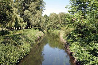
River Meden

Last updated

River Meden
River Meden.jpg
River at Burns Lane in Warsop.
Location
Country England
County Nottinghamshire
Physical characteristics
Source 
  location Huthwaite
Mouth River Idle
  location
Markham Moor
  coordinates
53°16′6″N0°56′52″W / 53.26833°N 0.94778°W / 53.26833; -0.94778 Coordinates: 53°16′6″N0°56′52″W / 53.26833°N 0.94778°W / 53.26833; -0.94778
Basin features
Tributaries 
  leftSookholme Brook
  rightThe Bottoms
River Meden
BSicon uexCONTg.svg
River Idle
BSicon uexSKRZ-Auq.svg
BSicon uexABZgr.svg
River Poulter
BSicon uexABZgl.svg
BSicon uexSTR+r.svg
River Meden and River Maun
BSicon uexSKRZ-Au.svg
A1 bridges, West Drayton
BSicon uexSTR+l.svg
BSicon uexSTRr.svg
BSicon uexSTR.svg
BSicon uexmKRZu.svg
BSicon exSTRq.svg
BSicon uexmKRZu.svg
disused railway
BSicon uexSTR.svg
BSicon uexSTR+l.svg
BSicon uexSTRr.svg
BSicon uexSKRZ-Yu.svg
B6387 bridges Bothamsall
BSicon uexSTRl.svg
BSicon uxWEIRl.svg
River Meden weir
BSicon uexABZgl.svg
BSicon uexSTRq.svg
River Maun
BSicon uexSKRZ-Au.svg
A614 Pickin's Bridge Perlethorpe
BSicon uexBHF.svg
Thoresby Lake
BSicon uexSKRZ-Au.svg
A616 bridge Budby
BSicon uxmKRZu.svg
Welbeck Colliery freight line
BSicon uxMILL.svg
Warsop water mill
BSicon uexSKRZ-Au.svg
A60 Church Rd Warsop
BSicon uexBHF.svg
Warsop mill pond
BSicon uexSTR+l.svg
BSicon uexABZgr.svg
Sookholme Brook
BSicon uxmKRZu.svg
BSicon uxmKRZu.svg
Shirebrook freight line
BSicon uexSTR.svg
BSicon uexABZgl.svg
BSicon uexSTR+r.svg
The Bottoms
BSicon uexSKRZ-Yu.svg
B6407 Sookholme Road
BSicon uexABZgr.svg
BSicon uexSTR.svg
BSicon uexSTR.svg
Sookholme Brook sources
BSicon uexSTR.svg
BSicon uexKHSTe.svg
BSicon uxmKRZu.svg
Robin Hood Line
BSicon uxSTRbm.svg
Pleasley Vale Mill 3
BSicon uexBHF.svg
mill pond
BSicon uxSTRbm.svg
Pleasley Vale Mill 2
BSicon uxSTRbm.svg
Pleasley Vale Mill 1
BSicon uexBHF.svg
mill pond
BSicon uexmKRZu.svg
dismantled railway
BSicon uexSKRZ-Au.svg
A617 bridge Pleasley
BSicon uxSLUICEbl.svg
Pleasley mill and sluice
BSicon uexBHF.svg
mill pond
BSicon exmKRZo.svg
BSicon uexABZgr.svg
from Car Ponds, Hardwick Hall
BSicon exmKRZo.svg
BSicon uexABZgr.svg
stream
BSicon uexABZgl.svg
BSicon uexSTRq.svg
stream
BSicon uexmKRZu.svg
BSicon exSTR+r.svg
BSicon uexmKRZu.svg
BSicon exABZg+r.svg
Skegby
BSicon uexSKRZ-Yu.svg
B6014 Fackley Rd, Stanton Hill
BSicon uexSTR+l.svg
BSicon uexABZlr.svg
BSicon uexSTR+r.svg
BSicon uexmKRZu.svg
BSicon exABZ+lr.svg
BSicon uexmKRZu.svg
dismantled railway
BSicon uexKHSTe.svg
BSicon exSTR.svg
BSicon uexKHSTe.svg
springs

The River Meden is a river in Nottinghamshire, England. Its source lies just north of Huthwaite, near the Derbyshire border, and from there it flows north east through Pleasley and Warsop before merging temporarily with the River Maun near Bothamsall. The rivers divide after a short distance and go on separately to a point near Markham Moor where they once more combine to form the River Idle.

Contents

The river was a source of water power for mills in Pleasley Vale from the 1760s until the 1980s. Three huge cotton mills and their associated mill ponds still dominate the Vale. The buildings were bought by Bolsover District Council in 1992, and have become a centre for light industry. On a much smaller scale was the water mill at Warsop, which still retains much of its internal machinery.

Route

The river rises as two main streams to the north of Huthwaite, above the 200-foot (61 m) contour, [1] on the coal measures that run along the western edge of Nottinghamshire. [2] Both are crossed by dismantled railway lines, before they unite and flow in a north-easterly direction to the north of Stanton Hill and Skegby. After crossings by two more redundant railways, the river is joined by a stream which flows from the Car Ponds on the edge of the Hardwick Hall estate. The county boundary between Nottinghamshire and Derbyshire follows the course of the stream, and continues along the river as it passes to the south of Pleasley and under the A617 road. Just before the bridge are two large ponds, [1] the second one constrained by a grade II listed dam, 66 feet (20 m) long by 10 feet (3.0 m) wide, with vertical wooded sluice gates on the upstream side. [3] The adjacent two-arched bridge was built in 1800, although it was modified somewhat in the twentieth century, [4] and its function has been partially superseded by the A617 bypass. Next the river passes through Pleasley Vale, where the water has cut through the underlying limestone escarpment to form a deep, narrow valley, much of which is wooded. Several mill buildings were constructed here out of local limestone. [2] Two large mill ponds remain, with two mill buildings, while a third building is located on a stream which flows from the north to join the Meden at this point. [1]

After passing under the Robin Hood Line, which runs from Worksop to Nottingham, the county border leaves the river, which continues in a north-easterly direction. Beyond the B6407 Sookholme Road bridge, it is joined by The Bottoms, which rises in Mansfield Woodhouse and flows northwards to the junction. The freight line to Shirebrook crosses the river, and also crosses Sookholme Brook, which has two sources near Shirebrook, and after they have joined, flows parallel to the Meden to its junction near Warsop Vale. The river passes between Church Warsop and Market Warsop, where it is crossed by the A60 road. [1] Just below the bridge is Warsop watermill, much of which dates from 1767. The building is grade II listed, and internally, the machinery and rolling mill date from the nineteenth century. There is also an early twentieth century water turbine. [5] The mill bridge and weir are also listed structures. [6] Turning eastwards, the river passes through Budby and into Thoresby Park, where it has been dammed to form a large ornamental lake called Thoresby Lake. [1] The difference in height between the lake and the river below it at the eastern end was sufficient for Earl Manvers, the owner of Thoresby Hall, to install two water turbines in 1941. They were supplied by Newtons of Derby and were of 22 kVA and 5 kVA capacity. The electricity generated supplied the hall. The generator house was demolished in the late 20th century. [7] Below the lake, the river passes the hamlet of Perlethorpe, to be joined by the River Maun, flowing northwards, and here called Whitewater. The Robin Hood Way, a long-distance footpath, crosses soon afterwards, and a weir creates two channels again, the south one deemed to be the Maun and the north one the Meden. They remain roughly parallel as they are crossed by the B6387 road near Bothamsall, a freight railway and the Robin Hood Way again. They diverge to the west of Markham Moor roundabout on the A1 road, pass under the road, and combine to form the River Idle. Just below the junction, the River Poulter swells the flow. [1] [8]

Mills

The river near Pleasley Vale has been utilised to provide power since at least 1767, when two forges and a corn mill are known to have been operating. The forges were run by George Sitwell, and were called Nether and Upper forge. The engineered river channel made it a good site for further development, and a consortium of businessmen from Nottingham and drapers from Mansfield leased the vale and Pleasley Park in 1782, in order to construct water-powered cotton mills. The Upper Mill (now called Mill 1) was built first, on the site of the previous corn mill, and was operational by 1785. The Lower Mill (now Mill 3) was completed seven years later at a cost of £1,190, and was much bigger. A manager's house and a row of ten houses for the workers were also completed in 1792. The mills supplied cotton to the expanding East Midland hosiery industry. One of the original three businessmen was Henry Hollins, and by the early 18th century, the mills were run by William Hollins and Co. They were the first and one of the most successful cotton producers in the East Midlands. [9]

The Upper Mill (now Mill 1) at Pleasley Vale, with the mill pond in the foreground Pleasley Mills - geograph.org.uk - 121575.jpg
The Upper Mill (now Mill 1) at Pleasley Vale, with the mill pond in the foreground

The Hollins family managed the mills for many years, but from the 1830s were joined by the Pagets, who introduced steam power to the mills. Fire destroyed the Upper Mill on 25 December 1840, but it was rebuilt by 1844. The Lower Mill also burnt down, and was replaced in 1847. Newer equipment fitted as part of the rebuilding enabled the mills to stay competitive. William Hollins lived at Pleasley Vale, and oversaw the expansion of the community, with the construction of more houses for the workers, the provision of public facilities including a school, wash house, and a cooperative society, and attention to leisure activities by the establishing of a Mechanics Institute, a library and a cricket club. A company farm was also established. St Chad's Chapel and the vicarage were commissioned by Charles Paget in 1876. [10] The chapel was opened in 1881, but was reputedly built in 1861 at Stuffynwood, Derbyshire, and later moved to its present site. It has a small bell turret at its western end, and a number of its features mimic thirteenth and fourteenth century styles. Internally, there is a brass memorial to Paget and his wife Helen Elizabeth. [11]

From the 1890s, the mills produced Viyella, a mixture of cotton with Merino wool, which produces a soft fabric. [12] They continued to flourish, as various extensions show. The Upper Mill was extended in the 1890s, when a fourth storey was added, and again, probably in 1913, when extensions were added to the north and rear. [13] A large combing shed, where cotton fibres were straightened and aligned prior to the production of fabric, was built just below it in 1913. This was a two-storey building, with a single storey wing at the back. It was extended in 1952, when an extra two floors were added to the main shed, and a three-storey block was added at the side. At this point, it became a mill, and is now called Mill 2. [14] The Lower Mill was also extended, but because it was much larger than the Upper Mill when it was built, and the extensions were relatively small, it retains more of its original character. [15] There were 980 workers employed at the site in 1934, but decline gradually set in. The first workers houses were demolished in 1961, to be followed by the school, the baths and the Mechanics Institute. By 1987, production had moved abroad, and the mills closed. Bolsover District Council bought the mill buildings in 1992, using compulsory purchase powers, and they have been revitalised, to be used for light industry and offices. The mill ponds have also survived. [12]

Water quality

The Environment Agency measures water quality of the river systems in England. Each is given an overall ecological status, which may be one of five levels: high, good, moderate, poor and bad. There are several components that are used to determine this, including biological status, which looks at the quantity and varieties of invertebrates, angiosperms and fish. Chemical status, which compares the concentrations of various chemicals against known safe concentrations, is rated good or fail. [16]

The water quality of the Meden and its tributaries was as follows in 2019.

SectionEcological StatusChemical StatusLengthCatchment
Meden from Source to Sookholme Brook [17] Good Fail 14.8 miles (23.8 km)20.25 square miles (52.4 km2)
Sookholme Brook Catchment (trib of Meden) [18] Poor Fail 2.3 miles (3.7 km)4.09 square miles (10.6 km2)
Meden from Sookholme Brook to Maun [19] Poor Fail 9.2 miles (14.8 km)16.06 square miles (41.6 km2)

Water quality in the upper river has improved but has deteriorated in the lower river, as both were moderate in 2016. Like many rivers in the UK, the chemical status changed from good to fail in 2019, due to the presence of polybrominated diphenyl ethers (PBDE) and mercury compounds, neither of which had previously been included in the assessment.

Points of interest

Map all coordinates using: OpenStreetMap  
Download coordinates as: KML

Bibliography

Related Research Articles

Pleasley Human settlement in England

Pleasleylisten  is a village and civil parish with parts in both Derbyshire and Nottinghamshire. It lies between Chesterfield and Mansfield, 5 miles (8 km) south east of Bolsover, Derbyshire, England and 2.5 miles (4 km) north west of Mansfield, Nottinghamshire. The River Meden, which forms the county boundary in this area, runs through the village.

River Maun River in Nottinghamshire, England

The River Maun is a river in Nottinghamshire, England. Its source lies in Kirkby-in-Ashfield, and from there it flows north east through Mansfield, Edwinstowe and Ollerton, these being the heart of the Sherwood Forest area. It becomes known as Whitewater near the village of Walesby and connects to the River Meden temporarily where the Robin Hood Way crosses them. They diverge, and near Markham Moor it merges again with the River Meden this time becoming the River Idle. Its main tributaries are Rainworth Water, Vicar Water and Cauldwell Water.

River Poulter

The River Poulter which rises near Scarcliffe in Derbyshire, England is a tributary river of the River Idle in Nottinghamshire. It supplied power to mills along its route, most of which are now gone, although their mill ponds remain. Cuckney mill building is used as a primary school. The river has been dammed to create several lakes in the Dukeries estates of Welbeck Abbey and Clumber House now the National Trust property of Clumber Park. The ornamental Gouldsmeadow Lake, Shrubbery Lake and Great Lake on the Welbeck estate are supplied by a tributary of the Poulter, while Carburton Forge Dam and Carburton Dam were built to power a forge and a mill. Clumber Lake, consisting of an upper and lower lake, which is spanned by a Grade II* listed ornamental bridge, is part of the Clumber estate, and has suffered from subsidence.

Mansfield (UK Parliament constituency) Parliamentary constituency in the United Kingdom, 1885 onwards

Mansfield is a constituency created in 1885 represented in the House of Commons of the UK Parliament since 2017 by Ben Bradley of the Conservative Party, who gained the seat at the 2017 general election, from the Labour Party. This is the first time the seat has been represented by a Conservative since its creation in 1885.

Mansfield Woodhouse railway station Railway station in Nottinghamshire, England

Mansfield Woodhouse railway station serves the settlement of Mansfield Woodhouse, which adjoins the town of Mansfield, both located in Nottinghamshire, England.

Meden Vale Human settlement in England

Meden Vale is a small former coal mining village originally known as Welbeck Colliery Village prior to renaming in the late 1960s.

A617 road

The A617 road runs through the northern East Midlands, England, between Newark-on-Trent and Chesterfield.

Rainworth Water Tributary of the River Maun near Rainworth, Nottinghamshire, England

Rainworth Water is a watercourse that is a tributary of the River Maun near Rainworth, Nottinghamshire, England. It is characterised by a number of lakes, including that which forms part of the country park at Rufford Abbey. L Lake at Rainworth forms part of the Rainworth Lakes Site of Special Scientific Interest. There are two designated Local Nature Reserves along its length, one of which is also known by the name Rainworth Water. The Rainworth Water LNR is owned and managed by Nottinghamshire County Council.

Scarcliffe Village in Derbyshire, England

Scarcliffe is a village and civil parish in the Bolsover district of Derbyshire, England. It is sometimes called Scarcliffe with Palterton. The population of the parish at the 2001 UK Census was 5,211, increasing to 5,288 at the 2011 Census.

River Doe Lea River in the Derbyshire, England

The River Doe Lea is a river which flows near Glapwell and Doe Lea in Derbyshire, England. The river eventually joins the River Rother near Renishaw. The river contained 1,000 times the safe level of dioxins in 1991, according to a statement made by Dennis Skinner, (MP) in the House of Commons in 1992. The river flows through the site of the former Coalite plant near Bolsover, where coke, tar and industrial chemicals were manufactured until the plant closed in 2004.

Warsop railway station Former railway station in Nottinghamshire, England

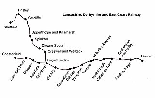
Warsop railway station is a former railway station in Market Warsop, Nottinghamshire, England.

Warsop Human settlement in England

Warsop is a town and civil parish in the Mansfield district, Nottinghamshire, England, on the outskirts of the remnants of Sherwood Forest. At the 2001 census it had a population of 12,365, reducing to 11,999 at the 2011 Census including Church Warsop, Meden Vale and Spion Kop.

Vicar Water River in Nottinghamshire, England

Vicar Water is a small river in Nottinghamshire, England. It is a tributary of the River Maun, and runs through an area which was once the royal hunting ground of Clipstone Park. It gained its present name in the early nineteenth century, and was dammed in 1870, in order to make a trout fishery, which was used to stock the lakes at nearby Welbeck Abbey. Since the cessation of coal mining, much of it has been incorporated into a country park, and is a designated Local Nature Reserve.

Church of St Chad, Pleasley Vale Church in Nottinghamshire, England

The Church of St Chad is on Church Lane, Pleasley Vale, Nottinghamshire, England. It is an active Church of England parish church in the deanery of Mansfield, the Archdeaconry of Newark, and the Southwell and Nottingham diocese. Its benefice has two churches, Church of St Edmund, Mansfield Woodhouse is the main parish church and St Chad's the other. The church is recorded in the National Heritage List for England as a designated Grade II listed building.

Meden may refer to:

Perlethorpe cum Budby is a civil parish in the Newark and Sherwood district, within the county of Nottinghamshire, England. The overall area had a population of 183 at the 2011 census. The parish lies in the north west of the county and district. It is 125 miles north of London, 8 miles north east of Mansfield and 20 miles north of the city of Nottingham. The parish and wider area is at the heart of Sherwood Forest, which is associated with the Robin Hood legend. Thoresby Hall, which is a notable ducal country house and estate is also within the boundaries of the parish.

Norton and Cuckney Civil parish in Bassetlaw, England

Norton and Cuckney is a civil parish in the Bassetlaw district, within the county of Nottinghamshire, England. The overall area had a population of 351 at the 2011 census. The parish lies in the north west of the county, and south west within the district. The parish lies close to the county border with Derbyshire. It is 125 miles north west of London, 20 miles north of the city of Nottingham, and 5 miles north of the market town of Mansfield. The area is bordering Sherwood Forest and has associations with mining interests and the Welbeck Estate.

Sookholme Human settlement in England

Sookholme is a hamlet in the Mansfield district of western Nottinghamshire, England. It is 120 miles (190 km) north west of London, 16+34 miles (27.0 km) north of the county town and city of Nottingham, and 3+12 miles (5.6 km) north of the town of Mansfield. It is in the civil parish of Warsop. It retains an agricultural character, having been largely unaffected by the Industrial Revolution, which had a transformative impact on the settlement pattern and built form of numerous other settlements situated within the North Midlands coalfields. Whilst relatively close to the built up areas of Mansfield and Shirebrook, Sookholme is remote and rural.

Warsop Vale Village in Nottinghamshire, England

Warsop Vale is a small village in the Mansfield district of western Nottinghamshire, England. It is 120 miles (190 km) north west of London, 17+12 miles (28.2 km) north of the county town and city of Nottingham, and 4+14 miles (6.8 km) north of the town of Mansfield. It is in the civil parish of Warsop. Warsop Vale's heritage is primarily as a former mining village. It lies in the very picturesque area known as the Dukeries and is easily accessible to Clumber Park, Thoresby Park and hall, Rufford Park and the Earl of Portland estate of Welbeck, together all part of Sherwood Forest.

References

Commons-logo.svg Media related to River Meden at Wikimedia Commons