The Twin Bridges Area at Grand Lake State Park, previously Twin Bridges State Park, is a park on the north side of the Grand Lake o' the Cherokees in northeastern Oklahoma. It was named for the two bridges that carry U.S. Highway 60 over arms of the lake that connect to the Neosho River and the Spring River. Twin Bridges State Park is known for its quiet country atmosphere and excellent fishing for trophy-sized bass, catfish, bluegill, and spoonbill. A fishing center with bait, tackle, and enclosed fishing dock is within the park. Lighted boat ramps, picnic areas, RV and tent campgrounds, snacks, lake huts, playgrounds, volleyball court, and horseshoe pits are also available. Picnic facilities include tables, individual shelters, and group picnic shelters for larger gatherings. Campsites range from semi-modern RV sites to tent camping and offer comfort stations with showers. The park also offers one-room lake huts with electricity, ceiling fans, and screened windows, grills, tables, water, and restroom facilities. The park is also home to the Wildlife Department's Paddlefish Research & Processing Center, which collects important biological data, processes paddlefish meat for anglers, and salvages paddlefish eggs. The Paddlefish Research & Processing Center is open from February 15 to May 15.
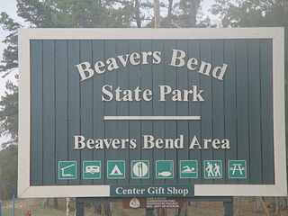
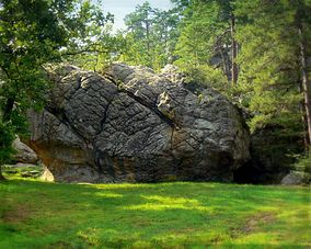
Beavers Bend State Park is a 1,300 acres (5.3 km2) Oklahoma state park located in McCurtain County. It is approximately 10.5 miles (16.9 km) north of Broken Bow on SH-259A. It was established in 1937 and contains Broken Bow Lake.

Boiling Springs State Park is a park built 6 miles (9.7 km) northeast of Woodward, Oklahoma, USA. It was built by the Civilian Conservation Corps in the 1930s.
Greenleaf State Park is located near Braggs, Oklahoma, and is situated around the 930-acre (3.8 km2) Greenleaf Lake. Greenleaf Lake was built in 1939. There is an 18-mile (29 km) hiking trail that begins inside the park and weaves its way around Greenleaf lake and into the adjacent government land of Camp Gruber.

Keystone State Park is an Oklahoma state park near Sand Springs, Tulsa County, Oklahoma, in the United States. Located on Keystone Lake, the park covers 714 acres (289 ha) and provides recreational opportunities for fishing, swimming, water skiing and boating. Cabins are available to rent. Keystone State Park is on State Highway 151 near Mannford.

Backbone State Park is Iowa's oldest state park, dedicated in 1919. Located in the valley of the Maquoketa River, it is approximately three miles (5 km) south of Strawberry Point in Delaware County. It is named for a narrow and steep ridge of bedrock carved by a loop of the Maquoketa River originally known as the Devil's Backbone. The initial 1,200 acres (490 ha) were donated by E.M. Carr of Lamont, Iowa. Backbone Lake Dam, a relatively low dam built by the Civilian Conservation Corps (CCC) in the 1930s, created Backbone Lake. The CCC constructed a majority of trails and buildings which make up the park.
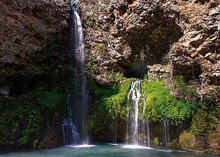
Natural Falls State Park is a 120 acres (0.49 km2) state-owned park in the Ozarks, in Delaware County, Oklahoma. It lies along U.S. Highway 412, near the Arkansas-Oklahoma state line. The property was privately-owned and known as Dripping Springs until 1990, when the state bought it. The previous owners had also used the property as an attraction and rest stop for travelers on the highway, featuring a swimming pool and gardens. The site was used in the production of the 1974 film "Where the Red Fern Grows".

The former Arrowhead State Park, now known as the Arrowhead Area at Lake Eufaula State Park is a 2,200-acre (8.9 km2) Oklahoma state park area located in northern Pittsburg County, Oklahoma on a peninsula of Eufaula Lake. It is located near the city of Canadian, Oklahoma. Eufaula is one of the largest man-made lakes in the southwest. Arrowhead State Park features 100 tent sites and 91 total RV sites. The park also offers picnic shelters, a marina, playgrounds, trails, miniature golf course, swimming area, mountain biking, equestrian campground, stables, and 25 miles (40 km) of equestrian trails. Group camps with a kitchen and bunkhouses are available and can sleep up to 144 people. Area 51 Marina, which also offers a restaurant, is also located at the park in the Echo Ridge area.
Cherokee Landing State Park is a 146-acre (0.59 km2) Oklahoma state park located in Cherokee County, Oklahoma. It is located near Park Hill, Oklahoma on a peninsula jutting into Lake Tenkiller in the Cookson Hills, south of Tahlequah. The park features 93 RV campsites with electric power and water hookups, dump station, 45 primitive campsites, covered picnic shelters, restrooms with hot showers, boating, lighted boat ramp, water skiing, swimming beach, fishing, handicapped fishing dock, playgrounds and a softball field.
Fort Cobb State Park is a 1,872-acre (7.58 km2) Oklahoma state park located in Caddo County, Oklahoma, USA. It is located near the city of Fort Cobb. The park offers recreational activities and facilities including camping, fishing, boating, water sports, golf, hunting and swimming. A visitors' center is located on site, as well as a gift shop, bait and tackle shop, RV sites with water and electric hook-ups, primitive camping areas, scenic views of the lake, comfort stations, showers, picnic sites, group shelters, a playground, swimming beach and marina. Equipment rentals are available. The park also has an 18-hole golf course with practice range, putting green and pro shop. The park has 299 RV sites and 300 tent campsites.
Foss State Park is a 1,749-acre (708 ha) Oklahoma state park located on Foss Lake, in southwestern Custer County, Oklahoma, near the city of Foss.

Great Plains State Park is a 487-acre (1.97 km2) Oklahoma state park located in Kiowa County, Oklahoma. It is located near the city of Mountain Park, Oklahoma. Located south of Hobart off Hwy 183, Great Plains State Park is nestled between the Wichita Mountains and the Tom Steed Reservoir. The area offers water sports, boating, boat ramps, camping, RV parking, swimming beach, playground, picnic areas, cycling, mountain biking and hiking trails. The campground spans approximately 460 acres (1.9 km2) of park land with 56 RV hookups and 30 tent sites. RV sites consist of 14 modern water, sewer, and electric sites and 42 semi-modern sites with water and electric. Located on the shores of Tom Steed Reservoir, a large lake with 31 miles (50 km) of shoreline.
Great Salt Plains State Park is a 840-acre (3.4 km2) Oklahoma state park located in Alfalfa County, Oklahoma. It is located 8 miles (13 km) north of Jet, Oklahoma on SH-38 and 12 miles (19 km) east of Cherokee. Recreational opportunities at Great Salt Plains State Park include boating, camping, picnicking, swimming, hiking, mountain biking and exploring. The Great Salt Plains Lake is located at the park and covers 9,300 acres (38 km2) with 41 miles (66 km) of shoreline and is a shallow, salty lake with fishing opportunities for catfish, saugeye, sandbass and hybrid striper. The average depth is reportedly 4 feet (1.2 m) and the impoundment capacity is 31,420 acre-feet. Salinity of the water in the reservoir is one-fourth that of sea water. Personal watercraft are not recommended. The park has RV and tent sites, comfort stations with showers, cabins, picnic sites, group shelters, swimming beach, playgrounds, boat ramps, fishing dock and equestrian trails. Horse rental is not available.
The Honey Creek Area at Grand Lake State Park, previously Honey Creek State Park, is a 30-acre (120,000 m2) Oklahoma state park located on Grand Lake, near the city of Grove, Oklahoma in Delaware County, Oklahoma

Lake Eufaula State Park is a 2,853-acre (11.55 km2) Oklahoma state park located in McIntosh County, Oklahoma on Lake Eufaula. It is 14 miles (23 km) southwest of Checotah. The park was formerly known as Fountainhead State Park. Fountainhead, together with the neighboring Arrowhead State Park, were created in 1965. Fountainhead's name was changed to Lake Eufaula State Park effective November 1, 2002. Arrowhead is now known as the Arrowhead Area at Lake Eufaula State Park.
Tenkiller State Park is a 1,190-acre (4.8 km2) Oklahoma state park located in northwestern Sequoyah County, Oklahoma, near the city of Vian, Oklahoma. Larger cities nearby include Sallisaw, Muskogee and Webbers Falls, Oklahoma.

Lake Wister State Park is a 3,428-acre (13.87 km2) Oklahoma state park located in Le Flore County, Oklahoma. It is located near the city of Wister, Oklahoma.

Osage Hills State Park is a 1,100-acre (4.5 km2) Oklahoma state park It is located in eastern Osage County, Oklahoma. The nearest cities are Pawhuska and Bartlesville. The park offers outdoor recreation opportunities including camping, hiking, fishing and wildlife watching. Park facilities include picnic tables and shelters, 20 semi-modern RV campsites, 16 tent sites and 8 cabins. Several of the park's structures are historic parkitecture built by the Civilian Conservation Corps during the 1930s and 1940s.

Sequoyah State Park, one of Oklahoma State Park's 32 parks, is a 2,200 acre peninsular recreation space on the eastern shore of Fort Gibson Lake in Cherokee County, Oklahoma. It is 8 miles (13 km) east of Wagoner, Oklahoma and 18 miles (29 km) west of Tahlequah, Oklahoma on State Highway 51. A shortleaf pine-lined drive leads you to the many amenities of the park including camping loops, Paradise Cove Marina, a golf course, Three Forks Nature Center, Sequoyah Riding Stables, and the state's largest state park lodge. The park office is in the town of Hulbert, Oklahoma. There are 12 miles of hiking trails free and open to the public including the Fossil Trail, Bluebird Trail, and Scissortail Paved Trial.

Lake Thunderbird State Park is a 1,874 acres (7.58 km2) Oklahoma state park located in Cleveland County, Oklahoma. It is 12 miles (19 km) east of Norman, Oklahoma on State Highway 9.