Alberta Provincial Highway No. 16, commonly referred to as Highway 16, is a major east–west highway in central Alberta, Canada, connecting Jasper to Lloydminster via Edmonton. It forms a portion of the Yellowhead Highway, a major interprovincial route of the Trans-Canada Highway system that stretches from Masset, British Columbia to Portage la Prairie, Manitoba, near Winnipeg. Highway 16 spans approximately 634 km (394 mi) from Alberta's border with British Columbia in the west to its border with Saskatchewan in the east. As of 2010, all but less than 96 km (60 mi) of the route was divided, with a minimum of two lanes in each direction. It is designated a core route in Canada's National Highway System.

The Rural Municipality of Dundurn No. 314 is a rural municipality (RM) in the Canadian province of Saskatchewan within Census Division No. 11 and SARM Division No. 5. It is located in the north-central portion of the province along the South Saskatchewan River and surrounds the Town of Dundurn.
The Rural Municipality of Montmartre No. 126 is a rural municipality (RM) in the Canadian province of Saskatchewan within Census Division No. 6 and SARM Division No. 1. It is located in the southeast portion of the province along Highway 48.
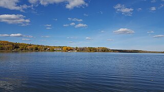
Missinipe, meaning "big water" or "difficult river", is a northern settlement in northern Saskatchewan located in Treaty 10 territory and along the western shore of Otter Lake. The hamlet is situated 80 km (50 mi) north of La Ronge along Saskatchewan Highway 102. As of the 2016 census, Missinipe had a population of 5, an 87% decrease from 2011. The hamlet is located within the Northern Saskatchewan Administration District and the provincial Census Division No. 18.

Highway 13 is a highway in the Canadian province of Saskatchewan. It runs from the Alberta border until it transitions into Highway 2 at the Manitoba border near Antler. Highway 13 is about 676 km (420 mi.) long. Highway 13 passes through Shaunavon, Assiniboia, Weyburn, Redvers and Carlyle. It is also referred to as the Red Coat Trail, as much of its length follows the route of the original historic path. A majority of the route between Wauchope and Govenlock going through the Palliser's Triangle is also referred to as the Ghost Town Trail.

Clavet is a village in the Canadian province of Saskatchewan within the Rural Municipality of Blucher No. 343 and Census Division No. 11. The village is located along an old section of the Yellowhead Highway, about 15 kilometres southeast of the City of Saskatoon.

The Rural Municipality of Caron No. 162 is a rural municipality (RM) in the Canadian province of Saskatchewan within Census Division No. 7 and SARM Division No. 2. It is located in the southwest portion of the province.
The Rural Municipality of Wallace No. 243 is a rural municipality (RM) in the Canadian province of Saskatchewan within Census Division No. 9 and SARM Division No. 4. It is located in the east-central portion of the province.

St. Boswells is a hamlet in Glen Bain Rural Municipality No. 105, Saskatchewan, Canada. The hamlet is about 8 km east of Highway 19, about 25 km northwest of the town of Gravelbourg. Very little remains of the former village except a well known as the best water around, and sidewalks which mark the once prosperous business section of St. Boswells.

Duvernay is a hamlet in central Alberta, Canada within the County of Two Hills No. 21. It is located 1.6 km (1.0 mi) north of the intersection of Highway 36 and Highway 29 along the south bank of the North Saskatchewan River, approximately 53 km (33 mi) southwest of St. Paul. The hamlet of Brosseau is located immediately across the river along the north bank.

The Rural Municipality of Moose Mountain No. 63 is a rural municipality (RM) in the Canadian province of Saskatchewan within Census Division No. 1 and SARM Division No. 1. It is located in the south-east portion of the province.

The Rural Municipality of Coteau No. 255 is a rural municipality (RM) in the Canadian province of Saskatchewan within Census Division No. 7 and SARM Division No. 3.
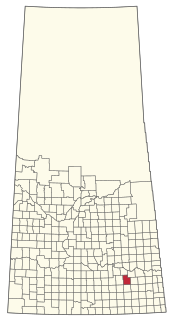
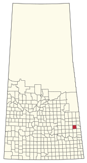
Handsworth is a hamlet in Golden West Rural Municipality 95, Saskatchewan, Canada. The hamlet is located about 20 km east of the town of Creelman on Highway 701, along a former Canadian Pacific Railway branch line.
Madison is an unincorporated community in Newcombe Rural Municipality No. 260, Saskatchewan, Canada. The community had a population of 10 in 2001. It previously held the status of village until February 1, 1998. The hamlet is located 20 km west of the Town of Eston on highway 44 along the Canadian National Railway subdivision.
Salvador is a hamlet in Grass Lake Rural Municipality No. 381, Saskatchewan, Canada. The community had a population of 35 at the 2001 Census. It previously held the status of village until February 1, 1998. The hamlet is located 38 km north-west of the Towns of Luseland & Kerrobert on highway 31 along the Canadian Pacific Railway subdivision.
Lawson is a hamlet in Maple Bush Rural Municipality No. 224, Saskatchewan, Canada. It previously held the status of village until December 31, 1985. The hamlet is located 12 km north-west of the Town of Central Butte on highway 42 along the now defunct Canadian Pacific Railway subdivision.

Forward is a hamlet in Norton Rural Municipality No. 69, Saskatchewan, Canada. It previously held the status of a village until December 31, 1947.

Sanctuary is an Unincorporated community in Lacadena Rural Municipality No. 228, Saskatchewan, Canada. The hamlet is located approximately 4.5 miles (7.2 km) west of highway 4 on highway 647, about 58 miles (93 km) north of Swift Current and is situated along the remains of the historic Swift Current-Battleford Trail.
