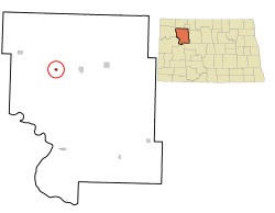
Ross, North Dakota | |
---|---|
Coordinates: 48°18′46″N102°32′37″W / 48.31278°N 102.54361°W | |
Country | United States |
State | North Dakota |
County | Mountrail |
Founded | 1902 |
Established | 1929 |
Government | |
• Mayor | Wyatt Seibel |
Area | |
• Total | 0.29 sq mi (0.75 km2) |
• Land | 0.29 sq mi (0.75 km2) |
• Water | 0.00 sq mi (0.00 km2) |
Elevation | 2,297 ft (700 m) |
Population | |
• Total | 95 |
88 | |
• Density | 329.86/sq mi (127.51/km2) |
Time zone | UTC-6 (Central (CST)) |
• Summer (DST) | UTC-5 (CDT) |
ZIP code | 58776 |
Area code | 701 |
FIPS code | 38-68540 |
GNIS feature ID | 1036245 [2] |
Website | cityofross.com |
Ross is a city in Mountrail County, North Dakota, United States. The population was 95 at the 2020 census. [3]
Ross was founded in 1902. It was the site of one of the oldest mosques in the United States . [5] Established in 1929, the mosque fell into disrepair and was dismantled. [5] In 2005, the edifice was rebuilt by the family of one of the last remaining Muslims in the area. [5] [6] The community that built the mosque were Syrian-Lebanese immigrants who settled the region starting in the late 19th century to take advantage of the Homestead Act. [5] The mosque was featured on NPR's Weekend Edition on September 12, 2010.
According to the United States Census Bureau, the city has a total area of 0.28 square miles (0.73 km2), all land. [7]
Census | Pop. | Note | %± |
---|---|---|---|
1960 | 167 | — | |
1970 | 125 | −25.1% | |
1980 | 104 | −16.8% | |
1990 | 61 | −41.3% | |
2000 | 48 | −21.3% | |
2010 | 97 | 102.1% | |
2020 | 95 | −2.1% | |
2022 (est.) | 88 | [4] | −7.4% |
U.S. Decennial Census [8] 2020 Census [3] |
As of the census of 2010, there were 97 people, 46 households, and 23 families residing in the city. The population density was 346.4 inhabitants per square mile (133.7/km2). There were 54 housing units at an average density of 192.9 per square mile (74.5/km2). The racial makeup of the city was 94.8% White, 4.1% Native American, and 1.0% from two or more races. Hispanic or Latino of any race were 2.1% of the population.
There were 46 households, of which 17.4% had children under the age of 18 living with them, 43.5% were married couples living together, 6.5% had a male householder with no wife present, and 50.0% were non-families. 34.8% of all households were made up of individuals, and 4.3% had someone living alone who was 65 years of age or older. The average household size was 2.11 and the average family size was 2.57.
The median age in the city was 36.5 years. 15.5% of residents were under the age of 18; 13.3% were between the ages of 18 and 24; 30.9% were from 25 to 44; 34.1% were from 45 to 64; and 6.2% were 65 years of age or older. The gender makeup of the city was 59.8% male and 40.2% female.
As of the census of 2000, there were 48 people, 24 households, and 13 families residing in the city. The population density was 169.6 inhabitants per square mile (65.5/km2). There were 29 housing units at an average density of 102.5 per square mile (39.6/km2). The racial makeup of the city was 97.92% White and 2.08% Native American.
There were 24 households, out of which 20.8% had children under the age of 18 living with them, 50.0% were married couples living together, 4.2% had a female householder with no husband present, and 45.8% were non-families. 41.7% of all households were made up of individuals, and 12.5% had someone living alone who was 65 years of age or older. The average household size was 2.00 and the average family size was 2.62.
In the city, the population was spread out, with 14.6% under the age of 18, 14.6% from 18 to 24, 22.9% from 25 to 44, 27.1% from 45 to 64, and 20.8% who were 65 years of age or older. The median age was 44 years. For every 100 females, there were 92.0 males. For every 100 females age 18 and over, there were 105.0 males.
The median income for a household in the city was $18,750, and the median income for a family was $28,750. Males had a median income of $16,875 versus $14,250 for females. The per capita income for the city was $15,025. There were no families and 5.3% of the population living below the poverty line, including no under eighteens and none of those over 64.
Amtrak's Empire Builder, which operates between Seattle/Portland and Chicago, passes through the town on BNSF tracks, but makes no stop. The nearest station is located in Stanley, 7 miles (11 km) to the east.
The school district is Stanley Public School District 2. [9]
Kathryn is a city in Barnes County, North Dakota, United States. The population was 66 at the 2020 census. Kathryn was founded in 1900. It was named after the daughter of a railroad man.
Powers Lake is a city in Burke County, North Dakota, United States. The population was 385 at the 2020 census. Powers Lake was founded in 1909.
North River is a city in Cass County, North Dakota, United States. The population was 55 at the 2020 census. North River was founded in 1973. It is a suburb/bedroom community directly adjacent to the city of Fargo.
Munich is a city in Cavalier County, North Dakota, United States. The population was 190 at the 2020 census. The city was named after Munich, Germany.
Halliday is a city in Dunn County, North Dakota, United States. The population was 241 at the 2020 census. Halliday was founded in 1914.
Inkster is a small city in Grand Forks County, North Dakota, United States, with a population of 38 as of the 2020 census. Inkster was founded in 1884, in an area that had been settled by George T. Inkster in 1878.
Elgin is a city in Grant County, North Dakota, United States. The population was 543 at the 2020 census.
Gackle is a city in Logan County, North Dakota, United States. The population was 281 at the 2020 census.
Mercer is a city in McLean County, North Dakota, United States. The population was 88 at the 2020 census.
New Town is a city in Mountrail County, North Dakota. The population was 2,764 at the time of the 2020 census, making it the 18th largest city in North Dakota. New Town was platted in 1950 as a replacement site for the residents of Sanish and Van Hook, as these towns were scheduled to be flooded by the creation of Lake Sakakawea, a reservoir to provide water for irrigation.
Palermo is a city in Mountrail County, North Dakota, United States. The population was 125 at the 2020 census.
Parshall is a city lying within the jurisdictional boundaries of the Mandan, Hidatsa, and Arikara Nation. It is located on the Fort Berthold Indian Reservation in Mountrail County, North Dakota, United States. The population was 949 at the 2020 census. Parshall was founded in 1914 by George Parshall, and is the home of the Paul Broste Rock Museum.
Plaza is a city in Mountrail County, North Dakota, United States. The population was 211 at the 2020 census. Plaza was founded in 1906. The business district is built around a central town square, city park or "plaza". A key feature of the plaza is a recently completed large covered gazebo.
Stanley is a city in Mountrail County, North Dakota, United States. It is the county seat of Mountrail County. The population was 2,321 at the 2020 census, making it the 22nd largest city in North Dakota. Stanley was founded in 1902. The town's economy is heavily connected to the nearby oil-rich Bakken Formation.
White Earth is a small City in Mountrail County, North Dakota, United States. It is one of the oldest communities in Mountrail County, having been founded in 1887. The population was 100 at the 2020 census. There is a City Hall at White Earth, community center, two churches and a granary; and no other businesses or services.
Pekin is a city in Nelson County, North Dakota, United States. The population was 75 at the 2020 census. The first European settlers immigrated to the area in the mid-19th century and Pekin was founded in 1906.
Hankinson is a city in Richland County, North Dakota, United States. The population was 921 at the 2020 census. Hankinson was founded in 1886. It is part of the Wahpeton, ND–MN Micropolitan Statistical Area.
Alamo is a city in Williams County, North Dakota, United States. The population was 53 at the 2020 census. Alamo was founded in 1916.
Tea is a city in Lincoln County, South Dakota, United States and is a suburb of Sioux Falls. The population was 5,598 at the 2020 census, and was estimated to be 7,381 in 2023.
Iroquois is a city on the border of Beadle and Kingsbury counties in South Dakota, United States. The population was 292 at the 2020 census. The school building is located in Kingsbury County, while the school parking lot is located in Beadle County. Highway 14 runs directly through Iroquois.