Rutland Township, Kane County, Illinois

Last updated

Rutland Township
Map highlighting Rutland Township, Kane County, Illinois.svg
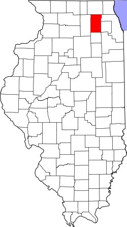
Location in Kane County
Map of Illinois highlighting Kane County.svg
Kane County's location in Illinois
Coordinates: 42°06′33″N88°25′18″W / 42.10917°N 88.42167°W / 42.10917; -88.42167
Country Flag of the United States (23px).png  United States
State Flag of Illinois.svg  Illinois
County Kane
EstablishedNovember 6, 1849
Area
  Total36.3 sq mi (94 km2)
  Land36.22 sq mi (93.8 km2)
  Water0.08 sq mi (0.2 km2)  0.22%
Elevation
902 ft (275 m)
Population
 (2010)
  Estimate 
(2016) [1]
22,713
  Density519.2/sq mi (200.5/km2)
Time zone UTC-6 (CST)
  Summer (DST) UTC-5 (CDT)
ZIP codes
60118, 60123, 60136, 60140, 60142
FIPS code 17-089-66430
Website www.rutlandtownship.com

Rutland Township is one of sixteen townships in Kane County, Illinois. As of the 2010 census, its population was 18,806 and it contained 8,004 housing units. [2] It was originally called Jackson Township; the name was changed to Rutland on July 2, 1850.

Contents

Geography

According to the 2010 census, the township has a total area of 36.3 square miles (94 km2), of which 36.22 square miles (93.8 km2) (or 99.78%) is land and 0.08 square miles (0.21 km2) (or 0.22%) is water. [2]

Cities, towns, villages

Unincorporated towns

(This list is based on USGS data and may include former settlements.)

Airports and landing strips

Cemeteries

The township contains these two cemeteries: Buena Vista and Saint Mary's Catholic.

Major highways

Demographics

Historical population
CensusPop.Note
2016 (est.)22,713 [1]
U.S. Decennial Census [3]

School districts

Political districts

Related Research Articles

<span class="mw-page-title-main">Kane County, Illinois</span> County in Illinois, United States

Kane County is a county in the U.S. state of Illinois. According to the 2020 census, it has a population of 516,522, making it the fifth-most populous county in Illinois. Its county seat is Geneva, and its largest city is Aurora. Kane County is one of the collar counties of the metropolitan statistical area designated "Chicago–Naperville–Elgin, IL–IN–WI" by the US census.

<span class="mw-page-title-main">Afton Township, DeKalb County, Illinois</span> Township in Illinois, United States

Afton Township is one of nineteen townships in DeKalb County, Illinois, USA. As of the 2020 census, its population was 901 and it contained 384 housing units.

<span class="mw-page-title-main">Aurora Township, Illinois</span> Township in Illinois, United States

Aurora Township is located in Kane County, Illinois. It is divided by the Fox River. As of the 2010 census, its population was 146,149 and it contained 49,127 housing units.

<span class="mw-page-title-main">Batavia Township, Illinois</span> Township in Illinois, United States

Batavia Township is in Kane County, Illinois. It is divided by the Fox River. As of the 2010 census, its population was 35,221 and it contained 12,892 housing units. The western part of the United States Department of Energy's Fermilab is at the township's eastern edge, although most of the facility is in neighboring Winfield Township in DuPage County.

<span class="mw-page-title-main">Elgin Township, Illinois</span> Township in Illinois, United States

Elgin Township is located in Kane County, Illinois. It is divided by the Fox River. As of the 2010 census, its population was 100,922 and it contained 35,690 housing units.

<span class="mw-page-title-main">Kaneville Township, Illinois</span> Township in Illinois, United States

Kaneville Township is one of sixteen townships in Kane County, Illinois, USA. As of the 2010 census, its population was 1,264 and it contained 508 housing units.

<span class="mw-page-title-main">Plato Township, Illinois</span> Township in Illinois, United States

Plato Township is one of sixteen townships in Kane County, Illinois, USA. As of the 2010 census, its population was 6,166 and it contained 2,182 housing units. It was originally named Homer Township; the name was changed to Plato on July 2, 1850.

<span class="mw-page-title-main">St. Charles Township, Illinois</span> Township in Illinois, United States

St. Charles Township is one of sixteen townships in Kane County, Illinois, USA. As of the 2010 census, its population was 50,854 and it contained 19,043 housing units.

<span class="mw-page-title-main">Sugar Grove Township, Illinois</span> Township in Illinois, United States

Sugar Grove Township is one of sixteen townships in Kane County, Illinois, USA. As of the 2010 census, its population was 19,618 and it contained 6,963 housing units. The Sugar Grove campus of Waubonsee Community College is within this township.

<span class="mw-page-title-main">Virgil Township, Kane County, Illinois</span> Township in Illinois, United States

Virgil Township is one of sixteen townships in Kane County, Illinois, USA. As of the 2010 census, its population was 1,937 and it contained 766 housing units. The land is primarily used for agriculture.

<span class="mw-page-title-main">Barrington Township, Illinois</span> Township in Illinois, United States

Barrington Township is one of 29 townships in Cook County, Illinois, USA. As of the 2020 census, its population was 16,514 and it contained 6,172 housing units. The northwestern corner of the Cook County panhandle, it is the county's northwesternmost township. It is also by far the least densely populated township in the county, with less than half the population density of the next least Lemont Township.

<span class="mw-page-title-main">Mayfield Township, DeKalb County, Illinois</span> Township in Illinois, United States

Mayfield Township is one of nineteen townships in DeKalb County, Illinois, USA. As of the 2020 census, its population was 872 and it contained 409 housing units. Mayfield Township was renamed from Liberty Township on November 20, 1850.

<span class="mw-page-title-main">Somonauk Township, DeKalb County, Illinois</span> Township in Illinois, United States

Somonauk Township is one of nineteen townships in DeKalb County, Illinois, USA. As of the 2020 census, its population was 2,006 and it contained 823 housing units.

<span class="mw-page-title-main">Bourbonnais Township, Kankakee County, Illinois</span> Township in Illinois, United States

Bourbonnais Township is one of seventeen townships in Kankakee County, Illinois, USA. As of the 2010 census, its population was 40,137 and it contained 15,153 housing units.

<span class="mw-page-title-main">Lisle Township, Illinois</span> Township in Illinois, United States

Lisle Township is one of nine townships in DuPage County, Illinois, USA. As of the 2020 census, its population was 119,040 and it contained 48,875 housing units.

<span class="mw-page-title-main">Naperville Township, Illinois</span> Township in Illinois, United States

Naperville Township is one of nine townships in DuPage County, Illinois, USA. As of the 2020 census, its population was 104,765 and it contained 41,338 housing units.

<span class="mw-page-title-main">Wayne Township, Illinois</span> Township in Illinois, United States

Wayne Township is one of nine townships in DuPage County, Illinois, USA. As of the 2020 census, its population was 64,427 and it contained 21,788 housing units.

<span class="mw-page-title-main">Winfield Township, Illinois</span> Township in Illinois, United States

Winfield Township is one of nine townships in DuPage County, Illinois, USA. As of the 2020 census, its population was 45,836 and it contained 16,445 housing units. It is the least populous of the DuPage County Townships.

<span class="mw-page-title-main">Bloomingdale Township, Illinois</span> Township in Illinois, United States

Bloomingdale Township is one of nine townships in DuPage County, Illinois, USA. As of the 2020 census, its population was 111,875 and it contained 42,488 housing units.

<span class="mw-page-title-main">Grafton Township, Illinois</span> Township in Illinois, United States

Grafton Township is located in McHenry County, Illinois. As of the 2010 census, its population was 53,137 and it contained 17,922 housing units. Grafton Township includes portions of Huntley, Lake in the Hills, Algonquin, Crystal Lake, and Lakewood.

References

  1. 1 2 "Population and Housing Unit Estimates" . Retrieved June 9, 2017.
  2. 1 2 "Population, Housing Units, Area, and Density: 2010 - County -- County Subdivision and Place -- 2010 Census Summary File 1". United States Census. Archived from the original on February 12, 2020. Retrieved May 28, 2013.
  3. "Census of Population and Housing". Census.gov. Retrieved June 4, 2016.