You can help expand this article with text translated from the corresponding article in French. (December 2008)Click [show] for important translation instructions.
|
Saales | |
|---|---|
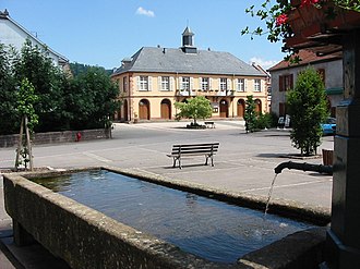 Town hall | |
 Coat of arms | |
Location of Saales  | |
 Saales  Saales | |
| Coordinates: 48°20′57″N7°06′23″E / 48.3492°N 7.1064°E | |
| Country | France |
| Region | Grand Est |
| Department | Bas-Rhin |
| Arrondissement | Molsheim |
| Canton | Mutzig |
| Intercommunality | Vallée de la Bruche |
| Government | |
| • Mayor (2020–2026) | Romain Mangenet [1] |
Area 1 | 9.88 km2 (3.81 sq mi) |
| Population (2022) [2] | 827 |
| • Density | 84/km2 (220/sq mi) |
| Time zone | UTC+01:00 (CET) |
| • Summer (DST) | UTC+02:00 (CEST) |
| INSEE/Postal code | 67421 /67420 |
| Elevation | 517–831 m (1,696–2,726 ft) (avg. 555 m or 1,821 ft) |
| 1 French Land Register data, which excludes lakes, ponds, glaciers > 1 km2 (0.386 sq mi or 247 acres) and river estuaries. | |
Saales (French pronunciation: [sal] ; German : Saal) is a commune in the Bas-Rhin department in Grand Est in north-eastern France. [3]