Waltenheim-sur-Zorn | |
|---|---|
 Waltenheim-sur-Zorn's center, featuring several half-timbered houses and a courtyard, common features of alsatian architecture | |
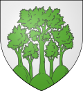 Coat of arms | |
Location of Waltenheim-sur-Zorn  | |
  Waltenheim-sur-Zorn  Waltenheim-sur-Zorn | |
| Coordinates: 48°44′50″N7°37′48″E / 48.7472°N 7.63°E | |
| Country | France |
| Region | Grand Est |
| Department | Bas-Rhin |
| Arrondissement | Saverne |
| Canton | Bouxwiller |
| Intercommunality | Pays de la Zorn |
| Government | |
| • Mayor (2020–2026) | Jeannot Krebs [1] |
Area 1 | 5.04 km2 (1.95 sq mi) |
| Population (2022) [2] | 659 |
| • Density | 130/km2 (340/sq mi) |
| Time zone | UTC+01:00 (CET) |
| • Summer (DST) | UTC+02:00 (CEST) |
| INSEE/Postal code | 67516 /67670 |
| Elevation | 147–258 m (482–846 ft) |
| 1 French Land Register data, which excludes lakes, ponds, glaciers > 1 km2 (0.386 sq mi or 247 acres) and river estuaries. | |
Waltenheim-sur-Zorn (German : Waltenheim an der Zorn) is a commune in the Bas-Rhin department in Grand Est in north-eastern France. [3]
Contents
It lies on the road D332 next to the Marne-Rhine Canal.


