Erckartswiller

Last updated
Erckartswiller
Ercketswiller.JPG
Houses in Erckartswiller
Blason ville fr Erckartswiller Bas-Rhin.svg
Location of Erckartswiller
Erckartswiller
France location map-Regions and departements-2016.svg
Red pog.svg
Erckartswiller
Grand Est region location map.svg
Red pog.svg
Erckartswiller
Coordinates: 48°52′37″N7°22′07″E / 48.8769°N 7.3686°E / 48.8769; 7.3686 Coordinates: 48°52′37″N7°22′07″E / 48.8769°N 7.3686°E / 48.8769; 7.3686
Country France
Region Grand Est
Department Bas-Rhin
Arrondissement Saverne
Canton Ingwiller
Government
  Mayor (20202026) Jean Adam [1]
Area
1
10.46 km2 (4.04 sq mi)
Population
 (Jan. 2019) [2]
299
  Density29/km2 (74/sq mi)
Time zone UTC+01:00 (CET)
  Summer (DST) UTC+02:00 (CEST)
INSEE/Postal code
67126 /67290
Elevation217–392 m (712–1,286 ft)
1 French Land Register data, which excludes lakes, ponds, glaciers > 1 km2 (0.386 sq mi or 247 acres) and river estuaries.

Erckartswiller (German : Erkartsweiler) is a commune, in the Bas-Rhin department in Grand Est in north-eastern France. It is part of the arrondissement of Saverne and the canton of Ingwiller. [3]

Contents

History

In 1176, the Holy Roman Emperor donated the Ekengeriswilre monastic grange [lower-alpha 1] to Neubourg Abbey in nearby Dauendorf. The fiefdom of Erkartswyler was sold by the Burn family to the lord of Lichtenberg in 1345. Following the end of the lordship of Lichtenberg, the town was transferred to the lord of Oberbronn in 1480 and to the count of Linange (fr) in 1541. Like several cities in the vicinity, many of the inhabitants left during the Thirty Years War and the town was uninhabited from 1649–1651. [4] During the Franco-Prussian War, a brigade of the retreating French army passed through the town on 7 August 1870, during which they quickly mobilized to fight what turned out to be a false alert before slowly advancing to La Petite-Pierre. [5]

Since Erckartswiller lacks significant arable land, the inhabitants have historically lived off of the surrounding forests, with a sizeable number of cobblers. [4] The town also has a windmill, located along the Mittelbach River, which was built before 1630 and continued to function until the early 20th century. [6]

Religion

Saint Apollonia Chapel (French: Chapelle Sainte-Apollonie), dedicated to Saint Apollonia, is the town's Protestant church. The church's bell tower dates to the 14th century and the church is mentioned for the first time in 1371. Alterations and expansions were made in 1613, 1669, and 1739 and the church was restored in 1994. [6] [7]

The sisters of Neuenberg built a house in Erckartswiller in 1973. It houses a small permanent team that manages a reception center and spiritual retreat for visitors from not only Alsace, but Germany and Switzerland as well. A chapel was built on the same property in 1994. [8]

Geography

Erckartswiller lies entirely within the Northern Vosges Regional Nature Park. [9]

Demographics

The inhabitants of Erckartswiller are known as Erckartswillerois (males) and Erckartswilleroises (females). [10] Its population was 299 in 2017. [11]

See also

Notes

  1. The term used by the source is "la grangia Ekengeriswilre". Grangia cannot be found in any French dictionary, but it is used in Italian for the English term monastic grange. This also matches the context of the source (translated): "In 1176, Pope Alexander III acknowledged the possession of the Ekengeriswilre [monastic grange] to the cistern abbey of Neubourg, which was undoubtedly received as a donation by the emperor." [4] (The village was within the Holy Roman Empire at the time.)

Related Research Articles

<span class="mw-page-title-main">Bas-Rhin</span> Department of France

Bas-Rhin is a department in Alsace which is a part of the Grand Est super-region of France. The name means 'Lower Rhine', referring to its lower altitude among the two French Rhine departments: it is downstream of the Haut-Rhin department. Note that both belong to the European Upper Rhine region. It is, with the Haut-Rhin, one of the two departments of the traditional Alsace region which until 1871, also included the area now known as the Territoire de Belfort. The more populous and densely populated of the pair, it had 1,140,057 inhabitants in 2019. The prefecture is based in Strasbourg. The INSEE and Post Code is 67.

<span class="mw-page-title-main">Haut-Rhin</span> Department of France

Haut-Rhin is a department in the Grand Est region of France, bordering both Germany and Switzerland. It is named after the river Rhine. Its name means Upper Rhine. Haut-Rhin is the smaller and less populated of the two departments of the former administrative Alsace region, the other being the Bas-Rhin. Especially after the 1871 cession of the southern territory known since 1922 as Territoire de Belfort, although it is still densely populated compared to the rest of metropolitan France. It had a population of 767,086 in 2019.

<span class="mw-page-title-main">Haguenau</span> Subprefecture and commune in Grand Est, France

Haguenau is a commune in the Bas-Rhin department of France, of which it is a sub-prefecture.

<span class="mw-page-title-main">Brumath</span> Commune in Grand Est, France

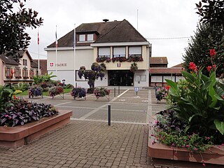
Brumath is a commune in the Bas-Rhin department in Grand Est in north-eastern France.

<span class="mw-page-title-main">Arrondissement of Saverne</span> Arrondissement in Grand Est, France

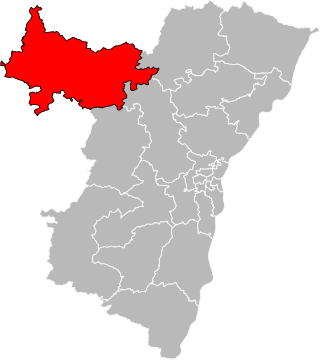
The arrondissement of Saverne is an arrondissement of France in the Bas-Rhin department in the Grand Est region. It has 162 communes. Its population is 128,960 (2016), and its area is 1,241.0 km2 (479.2 sq mi).

<span class="mw-page-title-main">Bischheim, Bas-Rhin</span> Commune in Grand Est, France

Bischheim is a commune in the Bas-Rhin department and Grand Est region of north-eastern France.

<span class="mw-page-title-main">Soultz-Haut-Rhin</span> Commune in Grand Est, France

Soultz-Haut-Rhin is a commune in the Haut-Rhin département in Grand Est in north-eastern France.

<span class="mw-page-title-main">Asswiller</span> Commune in Grand Est, France

Asswiller is a commune in the Bas-Rhin department in the Grand Est region of north-eastern France.

<span class="mw-page-title-main">Adamswiller</span> Commune in Grand Est, France

Adamswiller is a commune in the Bas-Rhin department in the Grand Est region of northeastern France.

<span class="mw-page-title-main">Wimille</span> Commune in Hauts-de-France, France

Wimille[vimij] is a commune in the Pas-de-Calais department in the Hauts-de-France region of France.

<span class="mw-page-title-main">Ingwiller</span> Commune in Grand Est, France

Ingwiller is a commune in the Bas-Rhin department in Grand Est in north-eastern France.

<span class="mw-page-title-main">Wimmenau</span> Commune in Grand Est, France

Wimmenau is a commune in the Bas-Rhin department in Grand Est in north-eastern France.

<span class="mw-page-title-main">Bouxwiller, Bas-Rhin</span> Commune in Grand Est, France

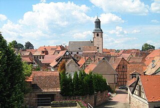
Bouxwiller is a commune in the Bas-Rhin department in Grand Est in north-eastern France. Likely meaning "Bucco's land", Bouxwiller is the capital of the Bouxwiller canton and is located within the Saverne arrondissement about 34 kilometres (21 mi) northwest of Strasbourg.

<span class="mw-page-title-main">Dauendorf</span> Commune in Grand Est, France

Dauendorf is a commune in the Bas-Rhin department in Grand Est in north-eastern France.

<span class="mw-page-title-main">Gries, Bas-Rhin</span> Commune in Grand Est, France

Gries is a commune in the Bas-Rhin département in Grand Est in north-eastern France. It lies 7 km to the south-southeast of Haguenau.
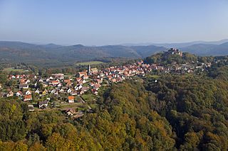
<span class="mw-page-title-main">Reipertswiller</span> Commune in Grand Est, France

Reipertswiller is a commune in the Bas-Rhin department in Grand Est in north-eastern France.

<span class="mw-page-title-main">Schillersdorf</span> Commune in Grand Est, France

Schillersdorf is a commune in the Bas-Rhin department in Grand Est in north-eastern France.

<span class="mw-page-title-main">Westhoffen</span> Commune in Grand Est, France

Westhoffen is a commune in the Bas-Rhin department and Grand Est region of north-eastern France.
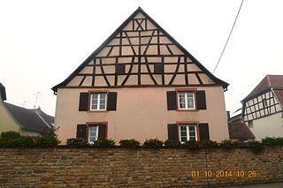
<span class="mw-page-title-main">Northern Vosges Regional Nature Park</span>

The Northern Vosges Regional Natural Park is a protected area of woodland, wetland, farmland and historical sites in the region Grand Est in northeastern France. The area was officially designated as a regional natural park in 1976.

The canton of Ingwiller is an administrative division of the Bas-Rhin department, northeastern France. It was created at the French canton reorganisation which came into effect in March 2015. Its seat is in Ingwiller.

References

  1. "Répertoire national des élus: les maires" (in French). data.gouv.fr, Plateforme ouverte des données publiques françaises. 13 September 2022.
  2. "Populations légales 2019". The National Institute of Statistics and Economic Studies. 29 December 2021.
  3. "Commune d'Erckartswiller (67126)". insee.fr (in French). Institut national de la statistique et des études économiques (INSEE). Retrieved 20 May 2022.
  4. 1 2 3 "Histoire de Erckartswiller". Le Pays de la Petit Pierre (in French). Archived from the original on 14 November 2008. Retrieved 9 May 2015.
  5. "21: La Guerre de 1870–1871". Revue d'histoire rédigée à l'État-major de l'armée: Section historique (Volume 3) (in French). L' armée de France: Service historique. 1902. pp. 679–680. Retrieved 10 May 2015.
  6. 1 2 "Erckartswiller". Le Pays de la Petit Pierre (in French). Archived from the original on 27 March 2009. Retrieved 9 May 2015.
  7. "Erckartswiller: Monuments historiques et bâtiments protégés d'Erckartswiller". Actuacity (in French). Retrieved 10 May 2015.
  8. "Maison Gustave Herrmann". ingwiller.com (in French). Retrieved 10 May 2015.
  9. Google (9 May 2015). "Erckartswiller" (Map). Google Maps . Google. Retrieved 9 May 2015.
  10. "Erckartswiller". habitants.fr (in French). Retrieved 9 May 2015.
  11. Téléchargement du fichier d'ensemble des populations légales en 2017, INSEE

Commons-logo.svg Media related to Erckartswiller at Wikimedia Commons