You can help expand this article with text translated from the corresponding article in French. (December 2008)Click [show] for important translation instructions.
|
Waldhambach | |
|---|---|
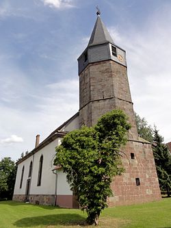 The Protestant church in Waldhambach | |
 Coat of arms | |
Location of Waldhambach  | |
 Waldhambach  Waldhambach | |
| Coordinates: 48°55′40″N7°13′04″E / 48.9278°N 7.2178°E | |
| Country | France |
| Region | Grand Est |
| Department | Bas-Rhin |
| Arrondissement | Saverne |
| Canton | Ingwiller |
| Intercommunality | Alsace Bossue |
| Government | |
| • Mayor (2020–2026) | Frédéric Bruppacher [1] |
Area 1 | 12.59 km2 (4.86 sq mi) |
| Population (2022) [2] | 611 |
| • Density | 49/km2 (130/sq mi) |
| Time zone | UTC+01:00 (CET) |
| • Summer (DST) | UTC+02:00 (CEST) |
| INSEE/Postal code | 67514 /67430 |
| Elevation | 225–374 m (738–1,227 ft) (avg. 300 m or 980 ft) |
| 1 French Land Register data, which excludes lakes, ponds, glaciers > 1 km2 (0.386 sq mi or 247 acres) and river estuaries. | |
Waldhambach is a commune in the Bas-Rhin department in Grand Est in north-eastern France. [3]