Saint-Alphonse-de-Granby

Last updated

Saint-Alphonse-de-Granby
Restaurant La Grillade, Saint-Alphonse-de-Granby.jpg
Saint-Alphonse-de-Granby Quebec location diagram.PNG
Location within La Haute-Yamaska RCM.
Canada Southern Quebec location map.png
Red pog.svg
Saint-Alphonse-de-Granby
Location in southern Quebec.
Coordinates: 45°20′N72°49′W / 45.333°N 72.817°W / 45.333; -72.817
CountryCanada
Province Quebec
Region Estrie
RCM La Haute-Yamaska
ConstitutedDecember 30, 1890
Government
  MayorMarcel Gaudreau
   Federal riding Shefford
   Prov. riding Brome-Missisquoi
Area
  Total50.20 km2 (19.38 sq mi)
  Land49.93 km2 (19.28 sq mi)
Population
 (2011) [3]
  Total3,125
  Density62.6/km2 (162/sq mi)
  Pop 2006-2011
Increase2.svg 7.1%
  Dwellings
1,124
Time zone UTC−05:00 (EST)
  Summer (DST) UTC−04:00 (EDT)
Postal code(s)
Area code(s) 450 and 579
Highways
Quebec Autoroute 10.svg A-10

Qc139.svg R-139
Website www.st-alphonse.qc.ca

Saint-Alphonse-de-Granby is a municipality in the Canadian province of Quebec, located within La Haute-Yamaska Regional County Municipality. The population as of the 2011 Canadian Census was 3,125.

Contents

Before October 25, 2008 it was known simply as Saint-Alphonse. [4]

Geography

Approximately halfway between Montreal and Sherbrooke, Saint-Alphonse-de-Granby's geography is mainly flat and its great fields have been exploited for agricultural ends (maize is most popularly grown) and for grazing for centuries now; this region distinguishes itself by the presence of rocky zones that form outcrops scattered randomly (some of this rock is exploited in the municipality's large private quarry, owned by Groupe Sintra), mixed forests are also found but are threatened by deforestation serving for residential and commercial expansion. The Yamaska River flows through Saint-Alphonse-de-Granby, many creeks and ditches empty themselves in it there and a bridge allows autoroute 10 to pass over its waters. The crossing of autoroute 10 (at exit 68) and route 139 happens on this territory near its border with the town of Granby.

Neighbouring municipalities

The neighbouring towns are Ange-Gardien, Granby, Bromont, Brigham, Cowansville, Farnham and East Farnham, there is also access to Saint-Paul-d'Abbotsford. The regional cycling network La route des champs traverses St-Alphonse, connecting it to many more towns via bike.

Ecology

Pileated woodpecker is known to inhabit the forests of Saint-Alphonse-de-Granby. Pileated Woodpecker-St-Alphonse-de-Granby.jpg
Pileated woodpecker is known to inhabit the forests of Saint-Alphonse-de-Granby.

Since it is a rural area with many fields, mixed forests, and marshlands, it harbours a great number of animals and plant] that are active year-round such as coniferous trees, certain types of birds, fish, and mammals; many species are also present and active in a seasonal fashion because of their migratory or hibernation habits, others still, are flora that remain dormant during the cold seasons; in this group are several thousands of invertebrates, mammals, amphibians, birds, reptiles, grass, bushes, trees and fungi. Among the most imposing creatures encountered here are great blue heron and moose. Fruit-bearing plants are abundant in the forested regions and alongside roads; the richness of variety make it a coveted place for practices such as hunting, trapping, herbalism, and the collecting of sap in the spring.

A great cohabitation is noticed among humans and animals in this municipality in regards to wild species and domestic species; this is due to wildlife becoming accustomed to human presence, raising of cattle and poultry has much importance, many ranches are also established, and the keeping of domestic cats make it a common lurker. Long has man and nature cohabited at this location before the arrival of Columbus in the Americas; the most important exploitation and the most damaging has happened from the arrival of the first French colonists that decided to farm the fields, up until the most recent development, seeing itself accelerated by modern residential, commercial and industrial growth. Many species of birds come to bird feeders and will live in residential neighbourhoods all year. Many residents upkeep and cultivate flora that is alien to Quebec, this results in the presence of exotic species growing in many neighbourhoods and natural spaces. The most tragic consequence for animals from the town is the construction of roads, which cost the lives of thousands of animals yearly.

Although its surface area is mostly reserved to the agricultural sector, the municipal council of St-Alphonse-de-Granby knows the importance of its green spaces and has inaugurated, circa 2000, a trail in a forest. For a long time municipal and private lands have held a network of dirt roads dedicate to ATV and snowmobiles transport.

History

Saint-Alphonse-de-Granby c. 1900 Saint-Alphonse-de-Granby.jpg
Saint-Alphonse-de-Granby c. 1900

In the 1800s, the region that would become Saint-Alphonse-de-Granby was colonized, but it would not known by that name until 1890. A one-room school was inaugurated on a land held by Georges D. Fuller in 1950 to educate the children of the area. In about 1855, Hungerford Mills, a sawmill, was constructed by Stephen Léonard Hungerford before it was sold to Joseph B. Hungerford, an American relative, who operated it for 15 years, until Thomas Ferguson took over; the mill was part of the Township of Granby.

Another mill (for flour) appeared before 1870, and it was around these two mills that the village of Saint-Alphonse slowly developed. Houses began to be built; the space was divided in four zones and many workers were hired to run roads across its territory.

Many of the workmen who built Saint-Alphonse also worked for the township of Granby.

The parish of Saint-Alphonse was decreed by Bishop Charles La Rocque of the Diocese of Saint-Hyacinthe, February 6, 1875. At the request of citizens from the area that a parson was present on Sundays for Mass. Abbot Charbonneau became the parson of Adamsville and Saint-Alphonse and lived three months under a locals roof while his clergy house near the church, which would be expanded in 1881. On December 30, 1890, the municipality of Saint-Alphonse became a distinct and independent municipality after a petition by the residents of the Saint-Alphonse du Canton de Granby parish. It was in the town's school that the first municipal council was elected on March 16, 1891, with six councillors and a mayor. Before the construction of the town hall in 1985, the council rented a room in the town school to hold its sessions.

The town's church was hit by lightning in 1897 and a fire began while the parson was Pierre A. Saint-Pierre. He limited damages with the help of twelve parishioners; and decided not to save the statue of Saint Anne on its altar. Although the fire left traces, the church was not entirely demolished. Bishop Moreau wrote in a letter that Saint Anne saved the building.

Around 1905, the town grew around a railroad and a train station (built by Onéisme Boisvert on rang Saint-Georges, the three floors having a general store, hotel, and the living quarters of the owner's family. Farmers brought their livestock on foot and got them on railroad cars. Local merchandise such as milk and lumber were all transported by train to be sold in Montreal. Later, the station was sold and moved and also served as a warehouse for products that arrived or left the town.

Between 1925 and 1929, bridges were restored in Saint-Alphonse, and the municipal council constructed a new bridge on 6e rang. Improvements were brought to the bridges on 3e rang (now rang Parent) and the town's bridge (a central pillar was added).

In the 1940s, Maurice Duplessis, the premier of Quebec implemented rural electrification, a teamwork of electricity co-operatives of Roxton Pond, Sainte-Cécile-de-Milton, Ange-Gardien, Saint-Alphonse, and Saint-Valérien implemented the project in the region. The co-ops created the Coopérative d'électricité de Saint-Valérien de Shefford, inaugurated in 1947, instead of competing. An airport was established on the land had belonged to Albert Lecours; it is sold to Granby three years later. It ceased with the arrival of Autoroute des Cantons, in 1962.

A new general store, which sold fresh meat, was opened in 1951, when Omer Bédard bought a three-floor building in the heart of the village. It was a popular place and provided access to all essential household items. It also had three apartments by 1957.

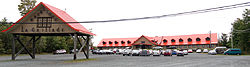
In 1963, the municipal council received the preliminary plans to Route 139, which would link the municipality to the highway at exit 38 (now 68), with a toll booth; construction lasted two years. The toll booth was converted after the tolls abolition in 1988; it was transformed in La maison du tourisme de l'Estrie.

The town hall was finally opened in 1986 at the intersection of Rue Principale and Route 139; the first public session was held in the new building that year May 16. [5]

Demographics

Population

Population trend: [6]

CensusPopulationChange (%)
20113,125Increase2.svg 7.1%
20062,918Increase2.svg 4.0%
20012,805Decrease2.svg 2.9%
19962,889Increase2.svg 12.2%
19912,575N/A

Language

Mother tongue language (2006) [7]

LanguagePopulationPct (%)
French only2,72093.31%
English only1103.77%
Both English and French150.52%
Other languages702.40%

Notable people

From 1971 to 2012, Clément Choinière was mayor of Saint-Alphonse-de-Granby. He held the position 41 years (until his death) because he was the only mayoral candidate.

See also

Related Research Articles

<span class="mw-page-title-main">Granby, Quebec</span> Town in Quebec, Canada

Granby is a town in southwestern Quebec, located east of Montreal. The population as of the Canada 2021 Census was 69,025. Granby is the seat of La Haute-Yamaska Regional County Municipality. It is the second most populated city in Estrie after Sherbrooke. The town is named after John Manners, Marquess of Granby; today it is most famous for the Granby Zoo and its landmark fountain of Lac Boivin.

<span class="mw-page-title-main">Shefford (federal electoral district)</span> Federal electoral district in Quebec, Canada

Shefford is a federal electoral district in Quebec, Canada, that has been represented in the House of Commons of Canada since 1867. Its population in 2006 was 100,000.

Shefford County is an historical county in southern Québec, Canada. It is named after Shefford, a small town in Bedfordshire county, England of the same name and is in the Eastern Townships region of Québec.

Autoroute 10 (A-10) is an Autoroute of Quebec in Canada that links greater Montreal to key population centres in Montérégie and Estrie, including Brossard, Saint-Jean-sur-Richelieu, Granby, and Sherbrooke.

The Township of Granby was a township municipality in south-central Quebec, Canada in the La Haute-Yamaska Regional County Municipality. Its territory comprised the northern and western sections of the present-day City of Granby.

<span class="mw-page-title-main">Area codes 450, 579, and 354</span> Telephone area codes for the suburbs of Montreal

Area codes 450, 579, and 354 are telephone area codes in the North American Numbering Plan in the Canadian province of Quebec, encompassing the off-island suburbs of Montreal, as well as the rest of the Montérégie region southward to the border with New York state. Among the cities in the numbering plan area are Laval, Longueuil, Terrebonne, Saint-Jean-sur-Richelieu, Brossard, Repentigny, Saint-Jérôme, Granby, Blainville and Saint-Hyacinthe.

<span class="mw-page-title-main">Quebec Route 112</span> Highway in Quebec

Route 112 is a busy east–west highway on the south shore of the Saint Lawrence River in Quebec, Canada. Its eastern terminus is in Frampton at the junction of Route 275, and the western terminus is in Downtown Montreal, after crossing the Victoria Bridge. The stretch between Vallée-Jonction and Sherbrooke is a very busy highway as it is the main link between the southern regions of Quebec, in particular the Beauce region and the Eastern Townships. Between Sherbrooke and Marieville there is less traffic, since Autoroute 10 is in close proximity to the highway. From Marieville to Montreal it is a very busy highway, in most parts a four-lane separated highway, upgraded to freeway standards in certain places.

<span class="mw-page-title-main">Bromont</span> City in Quebec, Canada

Bromont is a city in southern Quebec, Canada, at the base of Mont Brome; it is in the Brome-Missisquoi Regional County Municipality. The Bromont area and its resort, Ski Bromont, is well known as a tourist destination for its downhill skiing, mountain biking, BMX-riding and water slides. It also features golf and equestrian events in moderate weather. Bromont also boasts a high-tech industrial park, which includes IBM, General Electric, and Teledyne DALSA. Bromont Airport serves the region.

<span class="mw-page-title-main">Yamaska River</span> River in Quebec, Canada

The Yamaska River is a river in southern Quebec, Canada.

<span class="mw-page-title-main">Saint-Wenceslas, Quebec</span> Municipality in Quebec, Canada

Saint-Wenceslas, Quebec is a municipality in Nicolet-Yamaska Regional County Municipality, Quebec, Canada. The town is situated at a bend in the Bécancour River. The northern branch of Autoroute 55 terminated at the 9e rang of Saint-Wenceslas until its completion in October 2006. Route 161 also goes through the town.

<span class="mw-page-title-main">Saint-Léonard-d'Aston, Quebec</span> Municipality in Quebec, Canada

Saint-Léonard-d'Aston is a municipality in Nicolet-Yamaska RCM in the Centre-du-Québec region of Quebec, Canada. The population as of the Canada 2011 Census was 2,271. The municipality is situated along Route 155, partway between Drummondville and Trois-Rivières. Autoroute 20 and a major intercity railway line, part of Canadian National Railway over which VIA Rail Canada passenger trains also operate, cross through the town. Until the completion of the northern branch of Autoroute 55 in October 2006, Saint-Léonard-d'Aston was a common waypoint for those who travelled between Trois-Rivières and Sherbrooke.

<span class="mw-page-title-main">Saint-Cyrille-de-Wendover</span> Municipality in Quebec, Canada

Saint-Cyrille-de-Wendover is a Quebec municipality located in the Drummond Regional County Municipality just east of Drummondville in the Centre-du-Quebec region. The population as of the Canada 2011 Census was 4,389. The town is located alongside the Rivière des Saults.

<span class="mw-page-title-main">Ange-Gardien</span> Municipality in Quebec, Canada

Ange-Gardien is a municipality in the Canadian province of Quebec, located within the Rouville Regional County Municipality in the province's Montérégie region. The population as of the 2016 Canadian Census was 2,699.

<span class="mw-page-title-main">Quebec Route 211</span> Highway in Quebec

Quebec Route 211 is a provincial highway in the Canadian province of Quebec. Located in the Montérégie and Estrie regions in the southern part of the province, the highway's southern terminus is at Route 137 north of Granby and its northern terminus is at Quebec Autoroute 20 in Saint-Simon, east of Saint-Hyacinthe.

<span class="mw-page-title-main">Saint-Joachim-de-Shefford</span> Municipality in Quebec, Canada

Saint-Joachim-de-Shefford is a municipality in the Canadian province of Quebec, located within La Haute-Yamaska Regional County Municipality. The population as of the 2021 Canadian census was 1,476.

<span class="mw-page-title-main">Yamaska National Park</span>

Yamaska National Park is a provincial park centered on the man-made Choinière Reservoir. It is located in the municipalities of Roxton Pond and Saint-Joachim-de-Shefford in La Haute-Yamaska Regional County Municipality, just northeast of Granby, Quebec.

<span class="mw-page-title-main">North Yamaska River</span> River in Montérégie, Quebec, Canada

The North Yamaska river is a tributary of the Yamaska river. It flows over 47.8 kilometres (29.7 mi) on the south shore of the Saint Lawrence river in Quebec, Canada and passes through five municipalities, some of them sourcing their fresh water from it.

<span class="mw-page-title-main">Noire River (Yamaska River tributary)</span> River in Montérégie, Quebec (Canada)

The Noire River is the most important tributary of the Yamaska River. The Black River flows on the South Shore of the Saint Lawrence River, in Quebec, Canada, passing through the municipalities of:

The rivière aux Vaches is a tributary of the Saint-François River. It flows northwest in the administrative region of Centre-du-Québec, on the South Shore of the Saint Lawrence River, in Quebec, Canada, crossing the municipalities of:

<span class="mw-page-title-main">Blanche River (Bécancour River tributary, Daveluyville)</span> River in Centre-du-Québec, Quebec (Canada)

The rivière Blanche is a watercourse on the South shore of St. Lawrence River, in the administrative region of Centre-du-Québec, in the province of Quebec, in Canada. This river flows in the regional county municipalities of:

References

  1. 1 2 "Ministère des Affaires municipales, des Régions et de l'Occupation du territoire: Saint-Alphonse-de-Granby". Archived from the original on 2013-09-29. Retrieved 2012-03-11.
  2. "Parliament of Canada Federal Riding History: SHEFFORD (Quebec)". Archived from the original on 2009-06-05. Retrieved 2009-04-20.
  3. 1 2 "2011 Statistics Canada Census Profile: Saint-Alphonse-de-Granby, Quebec". Archived from the original on 2016-03-04. Retrieved 2012-05-18.
  4. http://www.stat.gouv.qc.ca/publications/referenc/pdf2008/Modif_oct08.pdf%5B%5D
  5. Laflamme, Cynthia. "Un peu d'histoire". pdf.lavoixdelest.ca. LA VOIX DE L'EST. Archived from the original on 3 March 2016. Retrieved 2 November 2015.
  6. Statistics Canada: 1996, 2001, 2006, 2011 census
  7. "2006 Statistics Canada Community Profile: Saint-Alphonse-de-Granby, Quebec". Archived from the original on 2016-03-04. Retrieved 2012-05-18.