Saint-André-d'Argenteuil, Quebec

Last updated • 3 min readFrom Wikipedia, The Free Encyclopedia
Saint-André-d'Argenteuil
Carillon QC 1.JPG
Saint-Andre-d'Argenteuil Quebec location diagram.png
Location within Argenteuil RCM.
Canada Central Quebec location map.png
Red pog.svg
Saint-André-d'Argenteuil
Location in central Quebec.
Coordinates: 45°34′N74°20′W / 45.567°N 74.333°W / 45.567; -74.333 Coordinates: 45°34′N74°20′W / 45.567°N 74.333°W / 45.567; -74.333 [1]
CountryFlag of Canada (Pantone).svg  Canada
Province Flag of Quebec.svg  Quebec
Region Laurentides
RCM Argenteuil
Settled1800
ConstitutedDecember 29, 1999
Government
[2]
  MayorStephen Matthews
   Federal riding Argenteuil—La Petite-Nation
   Prov. riding Argenteuil
Area
  Total101.90 km2 (39.34 sq mi)
  Land97.78 km2 (37.75 sq mi)
Population
 (2011) [3]
  Total3,275
  Density33.5/km2 (87/sq mi)
  Pop 2006-2011
Increase2.svg 5.7%
  Dwellings
1,551
Time zone UTC−5 (EST)
  Summer (DST) UTC−4 (EDT)
Postal code(s)
Area code(s) 450 and 579
Highways
Quebec Autoroute 50.svg A-50

Qc327.svg Route 327
Qc344.svg Route 344
Website www.stada.ca
Saint-Andre-d'Argenteuil Saint-Andre-d'Argenteuil.jpg
Saint-André-d'Argenteuil
Carillon Carillon QC 2.JPG
Carillon

Saint-André-d'Argenteuil (French pronunciation:  [sɛ̃ nɑ̃dʁe daʁʒɑ̃tœj] ) is a municipality in the Laurentides region of Quebec, Canada, part of the Argenteuil Regional County Municipality. It is located along the Ottawa River, just south of Lachute.

Contents

History

Carillon, being located at the foot of the Long-Sault rapids on the Ottawa River, has a long history. It started out as a trading post at the beginning of the seventeenth century, and then a relay station for voyageurs. Here in 1660, Adam Dollard des Ormeaux and his companions saved New France from attack by the Iroquois during the Battle of Long Sault, according to tradition. However, evidence was found of a burnt palisade in the vicinity of the earthworks of the present dam constructed on the opposite side in present day Ontario. In 1671, an officer of the Carignan Regiment, Philippe Carion (Carrion), obtained the area as a concession in the Montreal Island Seigneury from Dollier de Casson and established a trading post. But the name Carillon was reported in 1686 in the journal of Chevalier de Troyes. [4]

Around 1800, settlers of Scottish origin settled at the confluence of the North River ( Rivière du Nord ) and Rouge River near the Ottawa River. In 1819, the post office with the English name of St. Andrews East (Frenchified to Saint-André-Est in 1978) was established here, having adopted the name of the patron saint of the Scottish settlers. Also here two years later in 1821, John Joseph Caldwell Abbott, Prime Minister of Canada from 1891 to 1892, was born. In 1845, the Argenteuil Municipality was founded, but was abolished two years later. In 1855, the Parish Municipality of Saint-André-d'Argenteuil was formed. [5]

In the nineteenth century, the timber industry was very active in this section of the Laurentian Mountains and the first paper mill in Canada was built on this land in 1803. [5] From the 1830s onward, Carillon became the site of the Carillon Canal, built to facilitate military transport up the Ottawa River. It was enlarged in the 1870s to accommodate commercial boat traffic. Today it is a National Historic Site of Canada. [6] In 1959, construction began on the Carillon Generating Station and dam, raising the Ottawa River water level by over 62 feet (19 m) at Carillon, flooding the rapids of Long-Sault and transforming them into calm water. [7]

Carillon and Saint-André-Est became independent municipalities in 1887 and 1958 respectively, their territories being separated from the Parish Municipality of Saint-André-d'Argenteuil. But on December 29, 1999, the Village Municipality of Saint-André-Est, the Village Municipality of Carillon, and the Parish Municipality of Saint-André-d'Argenteuil were rejoined into the new Municipality of Saint-André–Carillon, which was renamed on November 25, 2000, to Saint-André-d'Argenteuil. [8]

Demographics

Population trend: [9]

Private dwellings occupied by usual residents: 1318 (total dwellings: 1551)

Mother tongue: [10]

Education

The Commission scolaire de la Rivière-du-Nord operates French-language public schools. [11]

The Sir Wilfrid Laurier School Board operates English-language public schools:

Notable natives and residents

See also

Related Research Articles

Mirabel, Quebec City in Quebec, Canada

Mirabel is an off-island suburb of Montreal, located in southern Quebec.

Argenteuil Regional County Municipality Regional county municipality in Quebec, Canada

Argenteuil is a regional county municipality located in the Laurentides region of Quebec, Canada. Its seat is Lachute.
Lachute City in Quebec, Canada

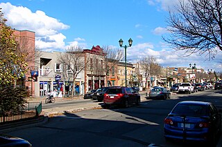
Lachute is a town in southwest Quebec, Canada, 62 km (39 mi) northwest of Montreal, on the Rivière du Nord, a tributary of the Ottawa River, and west of Mirabel International Airport. It is located on Autoroute 50, at the junctions of Quebec Provincial Highways Route 148, Route 158, and Secondary Highways 327 and 329.

Morin-Heights Municipality in Quebec, Canada

Morin-Heights is a town in the Laurentian Mountains region of Quebec, Canada. It is west of Saint-Sauveur and north of Lachute; municipally, it is within the Regional County Municipality of Les Pays-d'en-Haut.
Brownsburg-Chatham City in Quebec, Canada

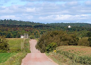
Brownsburg-Chatham is a municipality in the Laurentides region of Quebec, Canada, part of the Argenteuil Regional County Municipality. It is located along the Ottawa River, just west of Lachute, and includes the communities of Brownsburg, Cushing, Dalesville, Greece's Point, Pine Hill, and Saint-Philippe. Economic activities include agriculture, tourism and the manufacture of explosives.
Prévost, Quebec City in Quebec, Canada

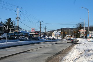
Prévost is a town within the La Rivière-du-Nord Regional County Municipality, Quebec, Canada, and the administrative region of Laurentides in the Laurentian Mountains, north of Montreal. It was created in 1973 from the amalgamation of the former villages of Shawbridge and Lesage with old Prévost on the other side of the Rivière du Nord. Shawbridge was named after William Shaw (1805-1894) who settled in the township of Abercromby in 1847 and built the first bridge over the Rivière du Nord.

Piedmont, Quebec Municipality in Quebec, Canada

Piedmont is a small municipality within the Les Pays-d'en-Haut Regional County Municipality, Quebec, Canada, in the Laurentian Mountains of the administrative region of Laurentides. It is located along the North River and Autoroute 15 and Route 117, north of Montreal.

Saint-Hippolyte, Quebec Municipality in Quebec, Canada

Saint-Hippolyte is a municipality within La Rivière-du-Nord Regional County Municipality in the Laurentides region of Quebec, Canada, in the Laurentian mountains about 45 km north of Montreal. The name comes from Saint Hippolytus.

Grenville-sur-la-Rouge, Quebec Municipality in Quebec, Canada

Grenville-sur-la-Rouge is a municipality in the Argenteuil Regional County Municipality in the Laurentides region of Quebec, Canada. It is a predominantly Francophone community situated along the southern border of Quebec between Montreal and Ottawa.

Grenville, Quebec Village municipality in Quebec, Canada

Grenville is a village municipality in the Argenteuil Regional County Municipality of the Laurentides region of Quebec, Canada. It is located opposite Hawkesbury, Ontario, on the Ottawa River.
Gore, Quebec Township municipality in Quebec, Canada

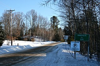
Gore is a township municipality in the Canadian province of Quebec, located within the Argenteuil Regional County Municipality. Its main community is Lakefield.
Harrington, Quebec Township municipality in Quebec, Canada

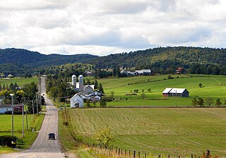
Harrington is a township municipality in the Laurentides region of Quebec, Canada, part of the Argenteuil Regional County Municipality. It is located in the Laurentian Mountains, about 40 kilometres (25 mi) north-west of Lachute.

Wentworth, Quebec Township municipality in Quebec, Canada

Wentworth is a township municipality in the Laurentides region of Quebec, Canada, part of the Argenteuil Regional County Municipality, north-west of Lachute.

Notre-Dame-de-la-Paix, Quebec Municipality in Quebec, Canada

Notre-Dame-de-la-Paix is a town and municipality in the Outaouais region of Quebec, Canada, part of the Papineau Regional County Municipality.

Saint-Émile-de-Suffolk, Quebec Municipality in Quebec, Canada

Saint-Émile-de-Suffolk is a municipality in the Outaouais region of Quebec, Canada, part of the Papineau Regional County Municipality. Until 1994 it was known as United Township Municipality of Suffolk-et-Addington.

Saint-Colomban, Quebec City in Quebec, Canada

Saint-Colomban is a city in the regional county municipality of La Rivière-du-Nord in Québec, Canada. It is situated in the Laurentides region of Québec and was named in honour of Saint Columbanus.

Mille-Isles, Quebec Municipality in Quebec, Canada

Mille-Isles is a municipality in the Laurentides region of Quebec, Canada, part of the Argenteuil Regional County Municipality, west of Saint-Jérôme.

Wentworth-Nord, Quebec Municipality in Quebec, Canada

Wentworth-Nord is a municipality in the Laurentides region of Quebec, Canada, part of the Les Pays-d'en-Haut Regional County Municipality.
Lac-des-Seize-Îles, Quebec Municipality in Quebec, Canada

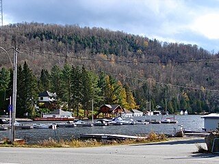
Lac-des-Seize-Îles is a village and municipality in the Laurentides region of Quebec, Canada, part of the Les Pays-d'en-Haut Regional County Municipality. The municipality surrounds and is named after Sixteen Island Lake with the village situated at the northern end of this lake.

Sainte-Sophie, Quebec Municipality in Quebec, Canada

Sainte-Sophie is a municipality in the Laurentides region of Quebec, Canada, part of the La Rivière-du-Nord Regional County Municipality.

References

  1. Reference number 362818 of the Commission de toponymie du Québec (in French)
  2. 1 2 "Saint-André-d'Argenteuil". Répertoire des municipalités (in French). Ministère des Affaires municipales, des Régions et de l'Occupation du territoire. Retrieved 2011-08-13.
  3. 1 2 "Saint-André-d'Argenteuil census profile". 2011 Census data . Statistics Canada. Retrieved 2011-08-13.
  4. "Carillon (Municipalité de village)" (in French). Commission de toponymie du Québec. Retrieved 2009-02-23.
  5. 1 2 "Saint-André-d'Argenteuil (Municipalité)" (in French). Commission de toponymie du Québec. Retrieved 2009-02-23.
  6. "Carillon Canal National Historic Site of Canada, Cultural Heritage". Parks Canada. Archived from the original on 2007-05-06. Retrieved 2009-02-09.
  7. "Canal" (in French). Village de Grenville. Retrieved 2009-02-09.
  8. "Saint-André-d'Argenteuil (Municipalité de paroisse)" (in French). Commission de toponymie du Québec. Retrieved 2009-02-23.
  9. Statistics Canada: 1996, 2001, 2006, 2011 census
  10. "Saint-André-d'Argenteuil community profile". 2006 Census data . Statistics Canada. Retrieved 2011-08-13.
  11. "Trouver une école ou un centre." Commission scolaire de la Rivière-du-Nord. Retrieved on September 24, 2017. For attendance boundary information, click "Par bassin d'école"
  12. "LAURENTIAN ELEMENTARY ZONE." Sir Wilfrid Laurier School Board. Retrieved on September 16, 2017.
  13. "LAURENTIAN REGIONAL HS ZONE." Sir Wilfrid Laurier School Board. Retrieved on September 4, 2017.