Saint-Marc Arrondissement

Last updated

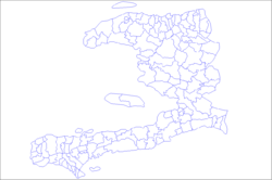
Saint-Marc (Haitian Creole : Sen Mak) is an arrondissement in Artibonite department of Haiti. It has 268,499 inhabitants. [1] Postal codes in the Saint-Marc Arrondissement start with the number 43.

Arrondissements of Haiti Wikimedia list article

An arrondissement is a level of administrative division in Haiti.

Artibonite (department) department in Gonaïves, Haiti

Artibonite is one of the ten departments of Haiti. With an area of 4,887 km2 it is Haiti's largest department. As of 2015, its estimated population was 1,727,524. The region is the country's main rice-growing area. The main cities are Gonaïves and Saint-Marc. In February 2004 an insurgency tried unsuccessfully to declare Artibonite's independence.

Departments of Haiti first-level administrative territorial entity of Haiti

In the administrative divisions of Haiti, the department is the first of four levels of government. Haiti is divided administratively into ten departments, which are further subdivided into 42 arrondissements, 145 communes, and 571 communal sections.

The arrondissement consists of the following municipalities:

Saint-Marc Commune in Artibonite, Haiti

Saint-Marc is a commune in western Haiti in Artibonite. Its geographic coordinates are 19°7′N72°42′W. At the 2003 Census the commune had 160,181 inhabitants. It is one of the biggest cities, second to Gonaïve, between Port-au-Prince and Cap-Haïtien.

La Chapelle, Artibonite Place in Artibonite, Haiti

La Chapelle is a commune in the Saint-Marc Arrondissement, in the Artibonite department of Haiti. It has around 50,000 inhabitants as of 2018.

Verrettes Commune in Artibonite, Haiti

Verrettes is a commune in the Saint-Marc Arrondissement, in the Artibonite department of Haiti. It is located approximately 58 km north of the capital, Port-au-Prince, and has 48,724 inhabitants.

Related Research Articles

Centre (department) department in Hinche, Haiti

Centre is one of the ten departments of Haiti, located in the center of the country along the border with the Dominican Republic. As of 2015, its estimated population was 746,236. Its capital is Hinche. It borders the Dominican Republic to the east and is the only landlocked department in Haiti.

Nord (Haitian department) Department in Cap-Haïtien, Haiti

Nord is one of the ten departments of Haiti. It has an area of 2,114.91 km² and a population of 1,067,177 (2015). Its capital is Cap-Haïtien.

Nord-Ouest (department) Department in Port-de-Paix, Haiti

Nord-Ouest is one of the ten departments of Haiti as well as the northernmost one. It has an area of 2,102.88 km² and a population of 728,807. Its capital is Port-de-Paix.

Sud-Est (department) department in Jacmel, Haiti

Sud-Est is one of the ten departments of Haiti. It has an area of 2,034.10 km² and a population of 632,601 (2015). Its capital is Jacmel.

GrandAnse (department) Department in Jérémie, Haiti

Grand'Anse is one of the ten departments of Haiti. Its capital is Jérémie.

Dessalines Arrondissement arrondissement of Haiti

Dessalines is an arrondissement in the Artibonite department of Haiti. The arrondissement is named after its main city, Dessalines. The city, in turn, is named after the Haitian Revolution leader Jean-Jacques Dessalines. The arrondissement contains four communes: the city of Dessalines, Desdunes, Grande Saline, and Petite Rivière de l'Artibonite.

Battle of Crête-à-Pierrot major battle of the Haitian Revolution

The Battle of Crête-à-Pierrot was a major battle of the Haitian Revolution taking place from 4 March until 24 March 1802.

Acul-du-Nord is an arrondissement of the Nord department of Haiti. As of 2015, the population was 129,155 inhabitants. Postal codes in the Acul-du-Nord Arrondissement start with the number 12.

Gonaïves is an arrondissement in the Artibonite department of Haiti. It has 263,858 inhabitants. Postal codes in the Gonaïves Arrondissement start with the number 41.

Hinche is an arrondissement in the Centre department of Haiti. As of 2015, the population was 264,943 inhabitants. Postal codes in the Hinche Arrondissement start with the number 51.

Jacmel is an arrondissement in the Sud-Est department of Haiti. As of 2015, the population was 338,728 inhabitants.

Marmelade is an arrondissement in the Artibonite department of Haiti. It has 120,193 inhabitants. Postal codes in the Marmelade Arrondissement start with the number 45.

Môle-Saint-Nicolas is an arrondissement in the Nord-Ouest Department of Haiti. As of 2015, the population was 245,590 inhabitants. Postal codes in the Môle-Saint-Nicolas Arrondissement start with the number 33.

Plaisance is an arrondissement in the Nord Department of Haiti. As of 2015, the population was 123,633 inhabitants. Postal codes in the Plaisance Arrondissement start with the number 17.

Port-de-Paix is an arrondissement in the Nord-Ouest department of Haiti. As of 2015, the population was 336,650 inhabitants. Postal codes in the Port-de-Paix Arrondissement start with the number 31.

Saint-Louis-du-Nord is an arrondissement in the Nord-Ouest department of Haiti. As of 2015, the population was 146,567 inhabitants. Postal codes in the Saint-Louis-du-Nord Arrondissement start with the number 32.

Saint-Raphaël is an arrondissement in the Nord department of Haiti. As of 2015, the population was 169,867 inhabitants. Postal codes in the Saint-Raphaël Arrondissement start with the number 14.

Trou-du-Nord is an arrondissement in the Nord-Est department of Haiti. As of 2015, the population was 115,000 inhabitants. Postal codes in the Trou-du-Nord Arrondissement start with the number 23.

Liancourt, Artibonite Commune in Artibonite, Haiti

Liancourt is a commune in the Saint-Marc Arrondissement, in the Artibonite department of Haiti. Once a communal section, a presidential decree on 22 July 2015 made it a commune.

References

  1. Institut Haïtien de Statistique et d'Informatique (IHSI), 7 August 2003.

Coordinates: 19°07′00″N72°42′00″W / 19.1167°N 72.7°W / 19.1167; -72.7

Geographic coordinate system Coordinate system

A geographic coordinate system is a coordinate system that enables every location on Earth to be specified by a set of numbers, letters or symbols. The coordinates are often chosen such that one of the numbers represents a vertical position and two or three of the numbers represent a horizontal position; alternatively, a geographic position may be expressed in a combined three-dimensional Cartesian vector. A common choice of coordinates is latitude, longitude and elevation. To specify a location on a plane requires a map projection.