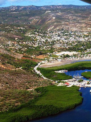
Marmelade is a commune and former duchy in the Artibonite department of Haiti. It is the chief town of the Marmelade Arrondissement, which also includes the commune of Saint Michel de l'Attalaye.

Dessalines usually referred to as Marchand-Dessalines, is a commune in the Artibonite department of Haiti. It is named after Jean-Jacques Dessalines, a leader of the Haitian Revolution and the first ruler and emperor of independent Haiti.
Bombardopolis is a commune located in the hilly country of the Môle-Saint-Nicolas Arrondissement, in the Nord-Ouest department of Haiti.

An arrondissement is a level of administrative division in Haiti.

In the administrative divisions of Haiti, the department is the first of four levels of government. Haiti is divided administratively into ten departments, which are further subdivided into 42 arrondissements, 145 communes, and 571 communal sections.
Belladère is a commune in the Lascahobas Arrondissement, inside the Centre department of Haiti. Its border crossing to the Dominican town Comendador is one of the four chief land crossings to the Dominican Republic.

The administrative divisions of Haiti are concerned with the institutional and territorial organization of Haitian territory. There are many administrative divisions which may have political, electoral (districts), or administrative objectives.

Jérémie is an arrondissement in the Grand'Anse Department of Haiti. As of 2015, the population was 238,218 inhabitants. Postal codes in the Anse d'Hainault Arrondissement start with the number 71.

Anse-à-Galets is a commune and city in the La Gonâve Arrondissement, in the Ouest department on Gonâve Island in Haiti, located to the west-northwest of Port-au-Prince in the Gulf of Gonâve. It is the largest commune on the island and has 62,559 inhabitants.
Arcahaie is a commune in the Arcahaie Arrondissement, in the Ouest department of Haiti. In 2015, the commune had 130,306 inhabitants.
Beaumont is a commune in the Corail Arrondissement, in the Grand'Anse department of Haiti. It has 31,580 inhabitants in 2015.
Bonbon is a commune in the Jérémie Arrondissement, in the Grand'Anse department of Haiti. The non-profit organization Sant Demen is establishing a learning center for the Haitian community in the area. It has 8,610 inhabitants in 2015.
Chambellan is a commune in the Jérémie Arrondissement, in the Grand'Anse department of Haiti. It has 26,459 inhabitants in 2015.

Corail is a commune in the Corail Arrondissement, in the Grand'Anse department of Haiti. It has 19,566 inhabitants in 2015.

Les Irois is a commune in the Anse-d'Hainault Arrondissement, in the Grand'Anse department of Haiti.

Pestel is a commune in the Corail Arrondissement, in the Grand'Anse department of Haiti. It has 44,659 inhabitants in 2015. The commune also includes the Cayemite Islands.
Acul-du-Nord is a commune in the Acul-du-Nord Arrondissement, in the Nord department of Haiti.
Ferrier is a commune in the Fort-Liberté Arrondissement, in the Nord-Est department of Haiti. It had 14,642 inhabitants as of 2015.
Jean-Rabel is a commune located west of the city of Port-de-Paix and east of the city of the Môle-Saint-Nicolas Arrondissement, in the Nord-Ouest department of Haiti. As of 2015, the estimated adult population was 148,416.
Arniquet is a commune in the Port-Salut Arrondissement, in the Sud department of Haiti. In 2015, the commune had 29,180 inhabitants.


