Hinche Arrondissement

Last updated
Hinche Arrondissement

Ench Awondisman
Country Flag of Haiti.svg  Haiti
Department Centre
Area
[1]
   Arrondissement 1,393.33 km2 (537.97 sq mi)
  Urban
19.09 km2 (7.37 sq mi)
  Rural
1,374.24 km2 (530.60 sq mi)
Population
 (2015) [1]
   Arrondissement 264,943
  Density190/km2 (490/sq mi)
   Urban
70,558
   Rural
194,385
Time zone UTC-5 (Eastern)
Postal code
HT51
Communes 4
Communal Sections 12
IHSI Code061

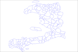
Hinche (Haitian Creole : Ench) is an arrondissement in the Centre department of Haiti. As of 2015, the population was 264,943 inhabitants. [1] Postal codes in the Hinche Arrondissement start with the number 51.

Arrondissements of Haiti Wikimedia list article

An arrondissement is a level of administrative division in Haiti.

Centre (department) department in Hinche, Haiti

Centre is one of the ten departments of Haiti, located in the center of the country along the border with the Dominican Republic. As of 2015, its estimated population was 746,236. Its capital is Hinche. It borders the Dominican Republic to the east and is the only landlocked department in Haiti.

Departments of Haiti first-level administrative territorial entity of Haiti

In the administrative divisions of Haiti, the department is the first of four levels of government. Haiti is divided administratively into ten departments, which are further subdivided into 42 arrondissements, 145 communes, and 571 communal sections.

The arondissement consists of the following communes:
Related Research Articles

Artibonite (department) department in Gonaïves, Haiti

Artibonite is one of the ten departments of Haiti. With an area of 4,887 km2 it is Haiti's largest department. As of 2015, its estimated population was 1,727,524. The region is the country's main rice-growing area. The main cities are Gonaïves and Saint-Marc. In February 2004 an insurgency tried unsuccessfully to declare Artibonite's independence.

Thomonde Commune in Centre, Haiti

Thomonde is a commune in the Hinche Arrondissement, in the Centre department of Haiti. It is located in the Centre or "Plateau Central", arrondissement Hinche. The geo-coordinates are 19.02N and 71.97W. The population was about 2,381 in 1982 and about 3,784 in 2007 - as reported by the government of Haiti.

Acul-du-Nord is an arrondissement of the Nord department of Haiti. As of 2015, the population was 129,155 inhabitants. Postal codes in the Acul-du-Nord Arrondissement start with the number 12.

Bainet is an arrondissement in the Sud-Est department of Haiti. As of 2015, the population was 135,792 inhabitants. Postal codes in the Bainet Arrondissement start with the number 92.

Borgne is an arrondissement in the Nord department of Haiti. As of 2015, the population was 116,800 inhabitants. Postal codes in the Borgne Arrondissement start with the number 15.

Cap-Haïtien is an arrondissement in the Nord department of Haiti and is the second important city of the country. Known as the historical and touristic capital of the country. Cap-Haïtien was founded in 1670 by the French settler Bertrand d'Ogeron de La Bouëre. As of 2015, the population was 356,908 inhabitants. The city is governed by three mayors elected by popular vote every 5 years and also represented in the National Assembly of Haiti with one member elected every 4 years. Postal codes in Cap-Haïtien Arrondissement start with the number 11.

Fort-Liberté is an arrondissement in the Nord-Est department of Haiti. As of 2015, the population was 60,632 inhabitants. Postal codes in the Fort-Liberté Arrondissement start with the number 21.

Grande-Rivière-du-Nord is an arrondissement in the Nord Department of Haiti. As of 2015, the population was 64,613 inhabitants. Postal codes in the Grande-Rivière-du-Nord Arrondissement start with the number 13.

Jacmel is an arrondissement in the Sud-Est department of Haiti. As of 2015, the population was 338,728 inhabitants.

Limbé is an arrondissement in the Nord department of Haiti. As of 2015, the population was 106,201 inhabitants. Postal codes in the Limbé Arrondissement start with the number 16.

Mirebalais is an arrondissement in the Centre department of Haiti. As of 2015, the population was 192,852 inhabitants. Postal codes in the Mirebalais Arrondissement start with the number 52.

Plaisance is an arrondissement in the Nord Department of Haiti. As of 2015, the population was 123,633 inhabitants. Postal codes in the Plaisance Arrondissement start with the number 17.

Port-au-Prince Arrondissement Arrondissement in Ouest, Haiti

Port-au-Prince is an arrondissement in the Ouest department of Haiti. It had 2,109,516 inhabitants at the 2003 Census which was estimated to have risen to 2,759,991 in 2015 in an area of 735.78 sq km. Postal codes in the Port-au-Prince Arrondissement start with the number 61.

Port-de-Paix is an arrondissement in the Nord-Ouest department of Haiti. As of 2015, the population was 336,650 inhabitants. Postal codes in the Port-de-Paix Arrondissement start with the number 31.

Saint-Louis-du-Nord is an arrondissement in the Nord-Ouest department of Haiti. As of 2015, the population was 146,567 inhabitants. Postal codes in the Saint-Louis-du-Nord Arrondissement start with the number 32.

Trou-du-Nord is an arrondissement in the Nord-Est department of Haiti. As of 2015, the population was 115,000 inhabitants. Postal codes in the Trou-du-Nord Arrondissement start with the number 23.

Vallières is an arrondissement in the Nord-Est department of Haiti. As of 2015, the population was 71,851 inhabitants. Postal codes in the Vallières Arrondissement start with the number 24.

Liancourt, Artibonite Commune in Artibonite, Haiti

Liancourt is a commune in the Saint-Marc Arrondissement, in the Artibonite department of Haiti. Once a communal section, a presidential decree on 22 July 2015 made it a commune.

References

  1. 1 2 3 "Population totale, population de 18 ans et plus ménages et densités estimés en 2015" [Total Population, Population of 18 and over, Households and Densities Estimated in 2015](PDF). IHSI (in French). March 2015. Retrieved 8 May 2017.

Coordinates: 19°09′00″N72°01′00″W / 19.15°N 72.0167°W / 19.15; -72.0167

Geographic coordinate system Coordinate system

A geographic coordinate system is a coordinate system that enables every location on Earth to be specified by a set of numbers, letters or symbols. The coordinates are often chosen such that one of the numbers represents a vertical position and two or three of the numbers represent a horizontal position; alternatively, a geographic position may be expressed in a combined three-dimensional Cartesian vector. A common choice of coordinates is latitude, longitude and elevation. To specify a location on a plane requires a map projection.