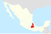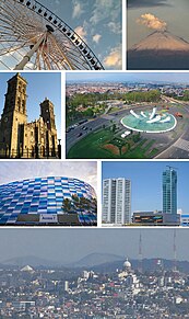
Puebla, formally Heroica Puebla de Zaragoza and also known as Puebla de los Ángeles, is the seat of Puebla Municipality, the capital and largest city of the state of Puebla, and one of the five most important Spanish colonial cities in Mexico. A colonial era-planned city, it is located in (southern) Central Mexico on the main route between the capital, Mexico City, and Mexico's main Atlantic port, Veracruz—about 100km east southeast of Mexico City and about 220 km west of Veracruz.

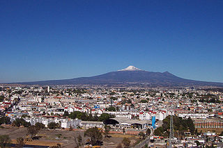
Cholula is a city and district located in the center west of the state of Puebla, near Puebla City, in central Mexico. Cholula is best known for its Great Pyramid, with the Iglesia de Nuestra Señora de los Remedios sanctuary on top, as well as its numerous churches. The city and district are divided into two, San Pedro Cholula and San Andrés Cholula, which together are officially called the Distrito Cholula de Rivadavia. Surrounding the city proper is a number of more rural communities which belong to the municipalities of San Andrés and San Pedro. The city itself is divided into eighteen neighborhoods or barrios, each with a patron saint. This division has pre-Hispanic origins as does the division into two municipalities. The city is unified by a complicated system of shared religious responsibilities, called cargas, which function mostly to support a very busy calendar of saints' days and other festivals which occur in one part or another almost all year round. The most important of these festivals is that dedicated to the Virgin of the Remedies, the patron of the city in its entirety, which occurs at the beginning of September.

Axochiapan is a city in the Mexican state of Morelos. It stands at 18°30′N98°45′W, at a mean height of 1,030 metres (3,380 ft) above sea level. It is surrounded by the State of Puebla to the east and south, Jonacatepec to the north, and Tepelcingo to the west.
Zacualpan de Amilpas is a town in the Mexican state of Morelos. The town serves as the municipal seat for the surrounding municipality, with which it shares a name. To the north is the municipality of Tetela del Volcán, to the south is the municipality of Temoac, to the east is the State of Puebla, and to the west are the municipalities of Ocuituco and Yecapixtla.

Puebla International Airport, officially Hermanos Serdán International Airport is an international airport located in the municipalities of Tlaltenango, Huejotzingo and Juan C. Bonilla near Puebla, Puebla, Mexico. It handles national and international air traffic for the city of Puebla.

Hérculez Gómez Hurtado is a retired American soccer player. He currently works as a commentator in both English and Spanish for ESPN.
The Metropolitan area of Puebla or Greater Puebla is the fourth largest agglomeration in Mexico with a population of 2.109 million. This agglomeration includes 10 municipalities of the state of Puebla, and 13 municipalities of the state of Tlaxcala. It does not include the city of Tlaxcala.

Juan Manuel Asensi Ripoll is a Spanish retired footballer who played as an attacking midfielder.
Organización Editorial Mexicana, also known as OEM, is the largest Mexican print media company and the largest newspaper company in Latin America. The company owns a large newswire service, it includes 70 Mexican daily newspapers, 24 radio stations and 44 websites.
Juan Carlos de la Barrera Lara is a former Mexican football player who last played for Tampico Madero in the Ascenso MX.
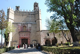
Huejotzingo (modern Nahuatl pronunciation is a small city and municipality located just northwest of the city of Puebla, in central Mexico. The settlement’s history dates back to the pre-Hispanic period, when it was a dominion, with its capital a short distance from where the modern settlement is today. Modern Huejotzingo is located where a Franciscan monastery was founded in 1525, and in 1529, the monks moved the indigenous population of Huejotzingo to live around the monastery. Today, Huejotzingo is known for the production of alcoholic apple cider and fruit preserves, as well as its annual carnival. This carnival is distinct as it centers on the re-enactment of several historical and legendary events related to the area. The largest of these is related to the Battle of Puebla, with about 2,000 residents representing French and Mexican forces that engage in mock battles over four days.
San Andrés Cholula Municipality is a municipality in Puebla in south-eastern Mexico. It forms part of the Metropolitan area of Puebla, and as of 2011, it is the fastest-growing municipality that conforms the Metropolitan Area, partly because the presence of universities and the wealthiest neighborhoods are located on San Andres Cholula. Along with San Pedro Cholula and Santa Isabel Cholula, it conforms the most ancient still inhabited city in the Americas, Cholula de Rivadabia.
Carlos Antonio Salom Zulema is an Argentine-born Palestinian footballer who currently plays for Chennaiyin FC on loan from Bangkok United.

The 1999 Tehuacán earthquake, or the 1999 Central Mexico earthquake, occurred on June 15 at 15:42 local time near Tehuacán, Puebla, Mexico, close to the state of Oaxaca. The earthquake measured 7.0 on the moment magnitude scale.
The 2012 Guerrero–Oaxaca earthquake struck southern Mexico with a moment magnitude of 7.4 at 12:02 local time on Tuesday, 20 March. Its epicenter was near Ometepec, in the border between the states of Guerrero and Oaxaca. With a shallow focus of 15 to 20 km, the earthquake caused strong shaking over a large area along the Oaxaca–Guerrero border and the adjacent Pacific coastline. Significant tremors were felt in areas up to several hundred kilometers away, including Mexico City and also in Guatemala. Two people were killed and over 30,000 houses were damaged or destroyed.

The 2017 Puebla earthquake struck at 13:14 CDT on 19 September 2017 with an estimated magnitude of Mw 7.1 and strong shaking for about 20 seconds. Its epicenter was about 55 km (34 mi) south of the city of Puebla. The earthquake caused damage in the Mexican states of Puebla and Morelos and in the Greater Mexico City area, including the collapse of more than 40 buildings. 370 people were killed by the earthquake and related building collapses, including 228 in Mexico City, and more than 6,000 were injured.
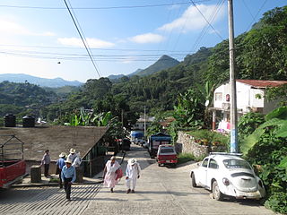
Huehuetla is a rural municipality in Puebla, Mexico.

Frida the rescue dog is a Golden Labrador Retriever in the Mexican Navy (SEMAR) who is deployed in the event of natural disasters to help the rescue efforts. Frida has helped save the lives of people buried under the rubble of buildings that collapsed in the 2010 Haiti earthquake, victims of a landslide in Guatemala in 2012, after the explosion of the Torre Ejecutiva Pemex in Mexico City in 2013, the 2016 Ecuador earthquake and the 2017 Puebla earthquake in Mexico. Reports have suggested that she has located more than 52 people.