San Salvador Huixcolotla is a town and municipality in the Mexican state of Puebla that may be best known as the birthplace of papel picado.[6][7]San Salvador is of Spanish origin and translates to "Holy Savior" and Huixcolotla is Nahuatl for "place of the curved spines".[8]
The original inhabitants were Popoloca speakers, under the Aztec Triple Alliance.[8] Friar Juan de Rivas founded a small congregation in 1539 as part of the Spanish colonization and in 1750, construction began on Iglesia del Divino Salvador (Church of the Divine Savior).[8] In 1779 it became a town, and on 15 April 1930, it was declared a municipality under the governorship of Leonides Andrew Almazán.[8][9]
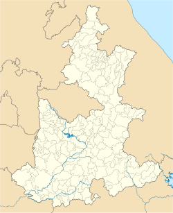
Geography
The total area of San Salvador Huixcolotla is 23.909 square kilometres (9.231sqmi), of which 79% is devoted to agriculture and the remaining is 21% developed.[4][2]:2 The four barrios are El Calvario, San Antonio, San Martín, and La Candelaria, and the three colonias are San Isidro, Dolores, and Benito Juárez.[4] It is surrounded to the north by the municipalities of Los Reyes de Juárez and Acatzingo; to the east by Acatzingo and Tecamachalco; to the south by Tecamachalco, Tochtepec, and Cuapiaxtla de Madero; and to the west by Cuapiaxtla de Madero and Los Reyes de Juárez.[2]
Climate
The typical range of temperatures is 12–18°C (54–64°F).[2]:2 Typical annual rainfall is 1,100–1,300 millimetres (43–51in).[2]:2
Demographics
78.12% of the population lives in poverty.[4]:15 As of 2015, electricity and sanitary systems are universal, but only 50.10% of households have piped water inside their homes.[4]:17 90.25% of the population between age 6 and 14 can read and write.[4]:18
Papel Picado ("perforated paper," "pecked paper") is a decorative Mexican folk art made by cutting elaborate designs into sheets of tissue paper that were popularized in San Salvador Huixcolotla. It is thought to have originated from the pre-Hispanic practice of making religious offerings with amate bark paper.[10] Among the first makers were Juan Hernandez, Cristóbal Flores, Santiago Vivanco R., and Lauro Pérez Macías.[9] By the late 1920s, it had spread outside Puebla to Tlaxcala and is now used around the world in observations of Día de Muertos (Day of the Dead).[11][7] In addition to Día de Muertos, known locally as Todos Santos, papel picado is also commonly made to celebrate Semana Santa (the Holy Week of Easter), Mexican independence, and Christmas.[12][10]
In 1998 the governor of Puebla declared the town, in which 35% of the residents participate in this craft, a cultural heritage of the state.[10][13] Papel Picado from Huixcolotla is exported around the world via the Museo Nacional de Arte.[12]
Other culture
An annual fair celebrates the town's patron of San Salvador and runs from 6–14 August.[9] A typical dish is the eponymous mole poblana of the region.[9]
1 2 3 4 "San Salvador Huixcolotla". Enciclopedia de los Municipios y Delegaciones de México (Mexican Encyclopedia of Municipalities and Delegations) (in Spanish). Retrieved 31 May 2021.
↑ Álvarez Cordero, María del Carmen (2008). El arte de jugar y crear Tijereteando(PDF). LXIII Legislatura de la H. Cámara de Diputados. p.82. Retrieved 31 May 2021.
↑ Palacios, Karina (25 October 2015). "Pueblo de papel picado". milenio.com (in Mexican Spanish). Retrieved 31 May 2021.
Further reading
Manjarrez Rosas, Josefina (2013). Huixcolotla: el lugar de las espinas encorvadas: sus orígenes, tradiciones y costumbres ("Huixcolotla: the place of curved spines: its origins, traditions, and costumes") (1sted.). Puebla, Pue, México: Benmérita Universidad de Puebla, Facultad de Filosofía y Letras. ISBN9786074876604.
This page is based on this Wikipedia article Text is available under the CC BY-SA 4.0 license; additional terms may apply. Images, videos and audio are available under their respective licenses.