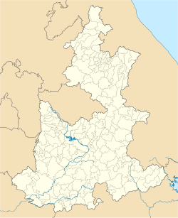
Honey, Puebla

Last updated
Honey
Municipality and town
Chila honey - panoramio.jpg
Escudo Honey.svg
Mexico Puebla Honey location map.svg
Location of the municipality in Puebla
CountryFlag of Mexico.svg  Mexico
State Puebla
Population
 (2015)
  Total7,857 [1]
Time zone UTC-6 (Central Standard Time)

Honey is a town and municipality in the Sierra Norte region of the Mexican state of Puebla, on the border with the state of Hidalgo. [2] It serves as the seat of the surrounding municipality of the same name.

The municipality was established in April 1919 as Chila Honey, honouring Richard Honey (c. 1829–1913), a 19th-century English immigrant who invested heavily in mining, metallurgy and railways in the area and established a paint factory in the town. In 1993 the name was officially shortened to its present form. [3] [4]

Related Research Articles

Jantetelco, officially Jantetelco de Matamoros, is a city in the Mexican state of Morelos. . The city serves as the municipal seat for the surrounding municipality of the same name. The municipality reported 17,238 inhabitants in the year 2015 census.

Jiutepec is a city and its surrounding municipality in the Mexican state of Morelos.

Jonacatepec de Leondro Valle is a city in the Mexican state of Morelos. The city serves as the municipal seat for the surrounding municipality of the same name. The municipality reported 15,690 inhabitants in the year 2015 census.

<span class="mw-page-title-main">Miacatlán</span> City in Morelos, Mexico

Miacatlán is a city and municipal seat of the municipality of Miacatlán in the Mexican state of Morelos. It stands at 18°46′20″N99°21′17″W.

<span class="mw-page-title-main">Puente de Ixtla</span>

Puente de Ixtla is a city in the Mexican state of Morelos. It stands at 18°37′01″N99°19′23″W. The city serves as the municipal seat for the surrounding municipality of the same name. The municipality reported 66,435 inhabitants in the year 2015 census.

Temoac is a town in the Mexican state of Morelos..

Tepalcingo is a town in the Mexican state of Morelos. It at 18°26′N98°18′W. The name Nahuatl root tekpa-tl (flint), tzintli, tzinco, so in sum it means tekpatzinko "down or behind the flints".

<span class="mw-page-title-main">Tetela del Volcán</span>

Tetela del Volcán or simply Tetela, is a town and municipal seat of the municipality of Tetela del Volcán in the Mexican state of Morelos. It is located on the slopes of the volcano Popocatépetl. 18°57′48″N99°15′12″W. The city serves as the municipal seat for the surrounding municipality of the same name. It is notable for its sixteenth century Dominican ex-convent which together with a number of other early monasteries nearby in the area has been declared a UNESCO World Heritage Site. The municipality reported 20,698 inhabitants in the year 2015 census. Other towns in the municipality of Tetela del Volcán include Hueyapan, Xochicalco and Tlamimilulpan.

<span class="mw-page-title-main">Yautepec, Morelos</span> Municipality in Morelos, Mexico

Yautepec is a municipality located in the north-central part of the Mexican state of Morelos. The municipal seat is the city of Yautepec de Zaragoza. It stands at 18°53′N99°04′W.

<span class="mw-page-title-main">Asientos</span> Municipality in Aguascalientes, Mexico

Asientos is a municipality in the Mexican state of Aguascalientes. It stands at 22°14′N102°05′W. The town of Real de Asientos serves as the municipal seat for the surrounding municipality of Asientos.

<span class="mw-page-title-main">Gómez Farías Municipality, Tamaulipas</span> Municipality in Tamaulipas, Mexico

Gómez Farías Municipality is a municipality located in the Mexican state of Tamaulipas. The seat of government for the municipality is the town Gómez Farías. Gómez Farías Municipality has an area of 433 square kilometres (167 sq mi) and a population in 2010 of 8,786. The town of Gómez Farías had a population of 883 in 2010. 23,124 hectares of the municipal area is included in the El Cielo Biosphere Reserve.

San Andrés Larráinzar is a town in the Mexican state of Chiapas. It serves as the municipal seat for the surrounding municipality of Larráinzar.

<span class="mw-page-title-main">Ciudad Serdán</span> Locality in Puebla, Mexico

Ciudad Serdán is the municipal seat of Chalchicomula de Sesma Municipality in the Mexican state of Puebla.

<span class="mw-page-title-main">Chila (municipality)</span> Municipality in Puebla, Mexico

Chila Municipality is a municipality in Puebla in south-eastern Mexico.

<span class="mw-page-title-main">Huitzilan de Serdán</span> Municipality in Puebla, Mexico

Huitzilan de Serdán Municipality is a municipality in the Mexican state of Puebla in south-eastern Mexico.

Lafragua Municipality is a municipality in the Mexican state of Puebla. According to the National Statistics Institute (INEGI), it had a population of 10,551 inhabitants in the 2005 census. By the 2010 census it had dropped to 7,767 inhabitants, 761 of whom lived in Saltillo, the municipal seat. Its total area is 128.85 km². The Saltillo name comes from the Nahuatl words Atlcholoa in atl, which means water, and Choloa, meaning drip. Therefore, means water that drips. The name Lafragua is in honor of José María Lafragua.

<span class="mw-page-title-main">Cañada Morelos Municipality</span> Municipality in Puebla, Mexico

Cañada Morelos Municipality is a municipality in Puebla in south-eastern Mexico.

San Matías Tlalancaleca is a town and municipality in Puebla in south-eastern Mexico. The population of San Matias Tlalancaleca was 20,974 inhabitants in 2015.

<span class="mw-page-title-main">San Miguel Ixitlán</span> Municipality in Puebla, Mexico

San Miguel Ixitlán Municipality is a municipality in Puebla in south-eastern Mexico. It is one of 217 municipalities in the Mexican state of Puebla. It was founded on October 4th, 1926.

Santo Tomás Hueyotlipan Municipality is a municipality in Puebla in south-eastern Mexico.

References

  1. "Ficha Municipales". Archived from the original on 2017-12-07.
  2. Enciclopedia de los Municipios de México. Instituto Nacional para el Federalismo y el Desarrollo Municipal https://web.archive.org/web/20070405081753/http://www.e-local.gob.mx/work/templates/enciclo/puebla/. Archived from the original on April 5, 2007. Retrieved January 4, 2010.{{cite web}}: Missing or empty |title= (help)
  3. Burton, Tony (14 March 2008). "Did you know? A village named "Honey"". MexConnect.
  4. "Honey". INAFED. Archived from the original on 7 August 2020.