Calpan | |
|---|---|
Municipality and town | |
 | |
 Coat of arms | |
 Location of the municipality in Puebla | |
| Country | |
| State | Puebla |
| Time zone | UTC-6 (Zona Centro) |
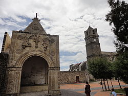
Calpan is a municipality in the Mexican state of Puebla. [1]
Calpan | |
|---|---|
Municipality and town | |
| | |
| Coat of arms | |
| Location of the municipality in Puebla | |
| Country | |
| State | Puebla |
| Time zone | UTC-6 (Zona Centro) |
Calpan is a municipality in the Mexican state of Puebla. [1]
Calpan was a Nahuatl-speaking community prior to the Spanish incursion, and it had close dynastic ties to Huejotzingo. [2] During the era of New Spain it was Corregidor of Atrisco. [3]
| International | |
|---|---|
| National | |
19°06′N98°27′W / 19.100°N 98.450°W
| | This article about a location in the Mexican state of Puebla is a stub. You can help Wikipedia by adding missing information. |
