Cantabria is an autonomous community and province in northern Spain with Santander as its capital city. It is called a comunidad histórica, a historic community, in its current Statute of Autonomy. It is bordered on the east by the Basque autonomous community, on the south by Castile and León, on the west by the Principality of Asturias, and on the north by the Cantabrian Sea.
San Miguel, Spanish for Saint Michael, may refer to:

The Spanish Missions in Texas comprise a series of religious outposts established by Spanish Catholic Dominicans, Jesuits, and Franciscans to spread the Catholic doctrine among area Native Americans, but with the added benefit of giving Spain a toehold in the frontier land. The missions introduced European livestock, fruits, vegetables, and industry into the Texas area. In addition to the presidio and pueblo (town), the misión was one of the three major agencies employed by the Spanish crown to extend its borders and consolidate its colonial territories. In all, twenty-six missions were maintained for different lengths of time within the future boundaries of the state of Texas.

Mission San José y San Miguel de Aguayo is an historic Catholic mission in San Antonio, Texas, United States. The mission was named in part for the Marquis de San Miguel de Aguayo, José de Azlor y Virto de Vera. Many buildings on the campus of Texas Tech University in Lubbock, Texas, borrow architectural elements from those found at Mission San José.
San Miguel de Aguayo can refer to:

The Battle of Santander was a battle fought in the War in the North campaign of the Spanish Civil War during the summer of 1937. Santander's fall on 26 August assured the Nationalist conquest of the province of Santander, now Cantabria. The battle devastated the Republic's "Army of the North"; 60,000 soldiers were captured by the Nationalists.

The designation artede (la) repoblación was first proposed by José Camón Aznar in 1949 to replace the term Mozarabic as applied to certain works of architecture from the Christian kingdoms of northern Spain between the end of the 9th and beginning of the 11th centuries. Camón argued that these buildings were related stylistically to the architecture of Asturias and owed little to Andalusian styles. Moreover, since they were built by Christians living under Christian rule, neither were they Mozarabic.

Aurora Matilde Gómez Camus was a Spanish poet from Cantabria who also wrote non-fiction.

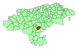
Campoo is a comarca (district) of Cantabria (Spain) located in the High Ebro. With an area of slightly more than 1,000 km2, it includes the municipalities of Hermandad de Campoo de Suso, Campoo de Enmedio, Campoo de Yuso, Valdeolea, Valdeprado del Río, Valderredible, Reinosa, Las Rozas de Valdearroyo, Santiurde de Reinosa, Pesquera, and San Miguel de Aguayo. The local inhabitants are called Campurrians . Its highest elevation is the Cuchillón peak, and the lowest is Pesquera, with the capital, Reinosa at 850 m.

Mozarabic art refers to art of Mozarabs, Iberian Christians living in Al-Andalus, the Muslim conquered territories in the period that comprises from the Arab invasion of the Iberian Peninsula (711) to the end of the 11th century, adopted some Arab customs without converting to Islam, preserving their religion and some ecclesiastical and judicial autonomy.
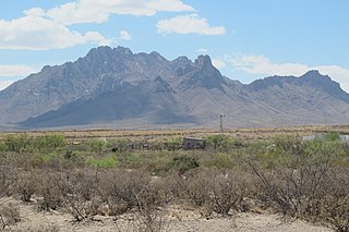
José de Azlor y Virto de Vera, second Marquis of San Miguel de Aguayo by marriage, commonly known as the Marqués de Aguayo, was the governor of the provinces of Coahuila and of the New Philippines in New Spain between 1719 and 1722. During his tenure, Aguayo retook eastern Texas from New France without firing a shot. He established or reestablished seven missions and three presidios, and quadrupled the number of Spanish soldiers stationed in Texas. Aguayo and his wife were also owners of a very large estate, or latifundio, in Coahuila. His descendants inherited and expanded the landholdings. The Aguayo dynasty continued until 1825.

Franciscan Friars established Mission Nuestra Señora de la Purísima Concepción de Acuña in 1711 as Nuestra Señora de la Purísima Concepción de los Hainais in East Texas. The mission was by the Domingo Ramón-St. Denis expedition and was originally meant to be a base for converting the Hasinai to Catholicism and teaching them what they needed to know to become Mexican citizens. The friars moved the mission in 1731 to San Antonio. After its relocation most of the people in the mission were Pajalats who spoke a Coahuiltecan language. Catholic Mass is still held at the mission every Sunday.
Medellín Municipality is a municipality in the Mexican state of Veracruz. The municipal seat is the town of Medellín.

Los Tojos is a municipality located in the autonomous community of Cantabria, Spain.

Molledo is a municipality located in the autonomous community of Cantabria, Spain.

Valdeprado del Río is a municipality located in the autonomous community of Cantabria, Spain.

Pesaguero is a municipality located in the autonomous community of Cantabria, Spain.

Santiurde de Reinosa is a municipality located in the autonomous community of Cantabria, Spain.
The Sánchez Navarro latifundio (1765-1866) in Mexico was the largest privately owned estate or latifundio in all of Latin America. At its maximum extent, the Sánchez Navarro family owned more than 67,000 square kilometres of land, an area almost as large as the Republic of Ireland and larger than the American state of West Virginia. The Sánchez Navarro latifundio was more than five times the size of the largest ranch, the XIT, in the United States and extended 350 kilometres (220 mi) from north to south. The latifundio was located in the Chihuahuan Desert, mostly in Coahuila, but also in Nuevo Leon, Durango, and Zacatecas.